
Waitangi Day (6 Feb): 15 images from Aotearoa
Above/featured: The kea is the world’s only alpine parrot and on the endangered list; on Milford Road near Homer Tunnel.
On the 6th of February, I’ll be humming “E Ihowa Atua” and “Pokarekare Ana”.
Waitangi Day is a national holiday in New Zealand to commemorate the signing of the Treaty of Waitangi on 6 February 1840. As the founding document of the country, the Treaty of Waitangi (Te Tiriti o Waitangi) is an accord agreed upon by representatives of the Crown (British Empire) and of indigenous Māori iwi (tribes) and hapū (sub-tribes). The agreement is named after the name of the location in the Bay of Islands where the Treaty was first signed. Despite continuing disagreements between the two parties about contemporary extent and redress, I think the conversation and interactions between the communities are at a more advanced stage of integration within the nation’s fabric by comparison with Australia and Canada.
For Aotearoa, the New Zealand government approved in October 2013 formal names of the two main islands in Māori and English:
• Te Ika a Māui (“the fish of Māui”) for the North Island, and
• Te Wai Pounamu (“the waters of greenstone”) for the South Island.
I highlight Aotearoa with 15 images of the following locations:
- Akaroa
- Auckland
- Dunedin
- Franz Josef Glacier *
- Greymouth
- Hapuku (Seaward Kaikouras)
- Homer Tunnel *
- Lake Matheson *
- Milford Sound *
- Queen Charlotte Sound
- Queenstown
- Southern Alps *
- Waimakariri River
- Wellington City
- Wellington Harbour
Asterisks identify locations within the Te Wāhipounamu area in South West New Zealand which was inscribed in 1990 as UNESCO World Heritage Site that includes four national parks: Aoraki/Mount Cook, Fiordland, Mount Aspiring, and Westland Tai Poutini.
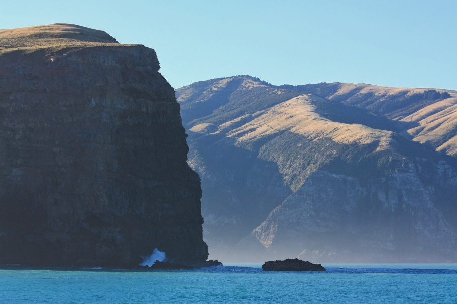
1. Akaroa
2. Auckland

City skyline, from Rangitoto Island
3. Dunedin

University of Otago is also known as Te Whare Wānanga o Otāgo; Māori is 1 of 3 official languages in New Zealand.
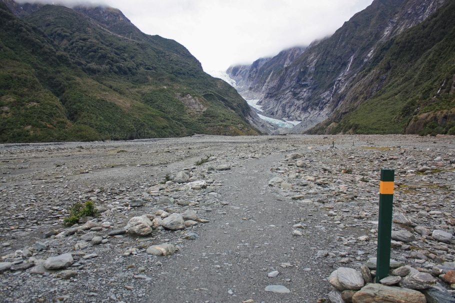
4. Franz Josef Glacier
5. Greymouth

“A New Land” in Greymouth: Flood Wall, Left Bank Art Gallery.
6. Hapuku (Seaward Kaikouras)
7. Homer Tunnel

Northwest from Homer Tunnel on Milford Road with Odyssey Peak at centre in background.
8. Lake Matheson

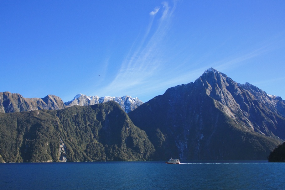
9. Milford Sound
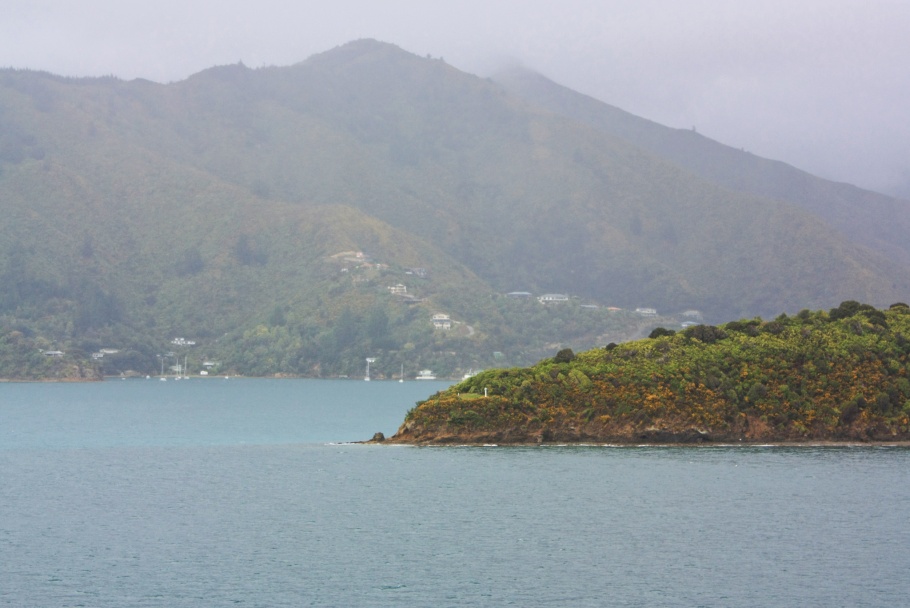
10. Queen Charlotte Sound
11. Queenstown
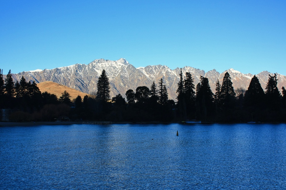
The Remarkables (and Double Cone) over Lake Wakatipu.
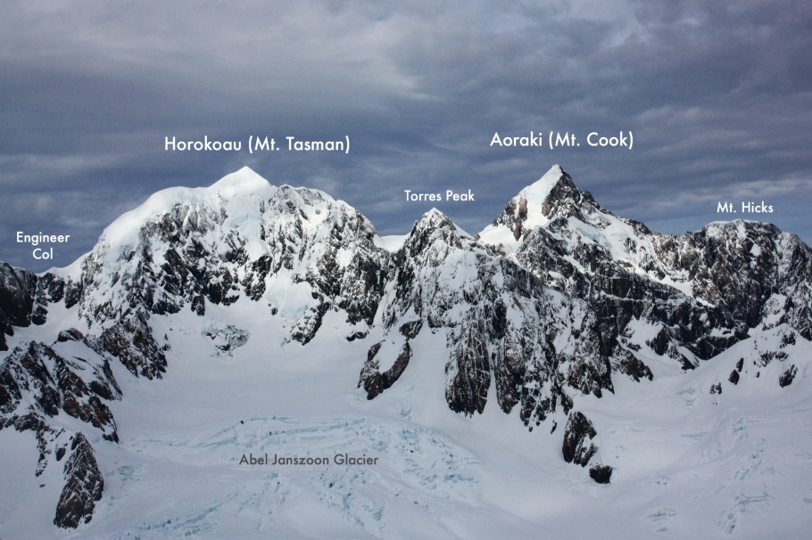
12. Southern Alps, by plane
13. Waimakariri River

14. Wellington: the national capital

At the national parliament: “Kaiwhakatere The Navigator” sculpture in the foreground and The Beehive at right.
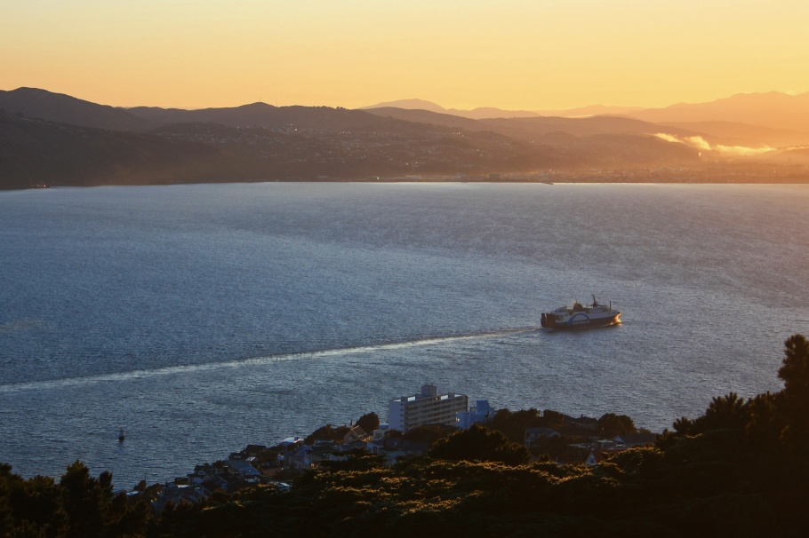
15. Wellington Harbour
Click on the arrow-window icon at the upper-left corner of the map for the legend.
More
• “Getting familiar with Treaty of Waitangi“, by Hinemoa Elder, for Stuff NZ, 10 Feb 2019.
• Treaty of Waitangi, in brief and FAQs: from NZ History
• Treaty of Waitangi, Nation & Government: Te Ara New Zealand Archives
• Celebrating Waitangi Day
• Waitangi Treaty Grounds: Stuff NZ, 28 Jun 2019.
• How New Zealand’s Waitangi Day differs from Australia Day: ABC, 25 January 2018
How much love for Te Waipounamu?
• Akaroa: Akaroa’s Long Harbour with special guests
• Akaroa: La petite ville française de Akaroa
• Christchurch: Christchurch’s changing Red Zone
• Christchurch: Christchurch’s Art Gallery: glass and light
• Dunedin: Baldwin Street, steepest in the world
• Fiordland: Cruising up and down Milford Sound
• Fox Glacier: The slow forest walk up to Fox Glacier
• Franz Josef Glacier: The slow approach to Franz Josef Glacier
• Interislander Ferry: On the ferry between the North and South Islands
• Lake Matheson: What are the sounds of a New Zealand sunset?
• Southern Alps: Flying over the South Island’s Southern Alps
• Southern Alps: The Southern Alps at sunset, from Lake Matheson
• Train: Coastal Pacific train, from Picton to Christchurch
• Train: TranzAlpine train, from Christchurch to Greymouth
• “Oh noae, I’m beached, bru. I’m beached az …”
I made the photos above in 2010 and 2012. This post appears on Fotoeins Fotografie at fotoeins DOT com as https://wp.me/p1BIdT-bjo.

5 Responses to “Waitangi Day (6 Feb): 15 images from Aotearoa”
Such a beautiful country. Your photos brought back many happy memories.
LikeLiked by 1 person
Hi and thanks for your comment, Ursula. I would very much like to go back to New Zealand and explore more of the North Island 🇳🇿😊
LikeLike
[…] Acknowledgements to Amy’s LAPC no.31 for 2-8 February 2019 in time for Waitangi Day, New Zealand’s national day on 6 […]
LikeLike
[…] “The Beehive”, executive wing of New Zealand’s national parliament – 10 July 2012 with 450D (more here). […]
LikeLike
[…] “Kaiwhakatere The Navigator” sculpture in the foreground and the National Parliament bui… – 10 Jul 2012 (450D). […]
LikeLike