1-day drive, US: Tucson to Santa Fe
Above/featured: Northeast on US-60/AZ-77, through the Apache-Sitgreaves National Forests, just outside of Show Low, AZ.
The following takes place entirely on travel day 16 in the American Southwest. Departing Tucson, Arizona, we headed north and east on AZ-77, US-60, and I-25 into New Mexico for Santa Fe, New Mexico. We drove through a variety of landscapes in east-central Arizona and west-central New Mexico for a total of 856 kilometres (532 miles).
Highlights
- Pinal Pass (El Capitan Pass), AZ
- Salt River Canyon, AZ
- Show Low, AZ
- Springerville Volcano Field
- Springerville, AZ
- AZ-NM State Line
- Quemado, NM
- Pie Town, NM
- Crossing the divide
- Plains of Agustin, NM
- Magdalena, NM
Pinal Pass (El Capitan Pass), AZ
Located 146 kilometres (91 miles) north from Tucson, AZ is Pinal Pass or El Capitan Pass. The mountain crossing is at elevation 1519 metres (4983 feet) above sea level, and is located at the southeast corner of the Tonto National Forest. With the view from the pass, I can’t help but wonder how indigenous and colonizers trekked this land west from what is now New Mexico through Arizona and onwards to California. The inscription for the historical marker at the roadside stop reads:
This pass was used by Stephen W. Kearny’s Army of the West in a march to California in 1846. Guided by Kit Carson it was described in a journal of the trip as “Carson’s Old Trail”. The pass led around the impassable canyon on the Gila River where Coolidge Dam has been constructed.

Northeast view from Pinal Pass: 33.263 degrees North latitude, 110.772 degrees West longitude.
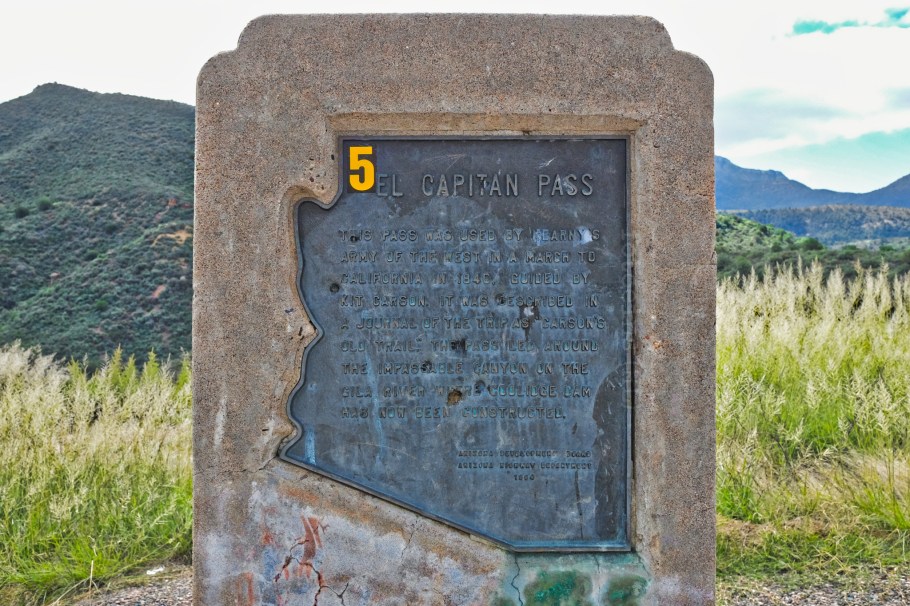
Historical marker, next to highway AZ-77.
Salt River Canyon, AZ
About halfway between Globe and Show Low is the very scenic Salt River Canyon Rest Area. It’s a great place to stretch the legs, descend to the river canyon below, or walk across the 1934 bridge which is now only for pedestrian use. The replacement New Salt River Canyon Bridge (Apache Bridge) opened in 1996. The river and rest area lie on the territorial lands of the San Carlos Apache and the White Mountain Apache peoples. The Salt River flows west and converges downstream with the Gila river in southwest Phoenix.

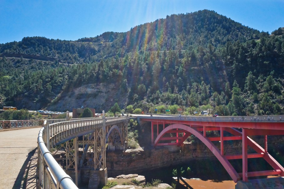
Facing south: left, 1934 pedestrian and former vehicular bridge; right, 1996 replacement bridge.
Show Low, AZ
We’d already seen highway signs marking down the distance on our approach to the town of Show Low (founded 1870). As we drive through, we stop at a traffic light and discover we’re on “Deuce of Clubs Avenue.” That’s not exactly coincidence: the town’s name and the name of the “main street” are derived from a high-stakes game of cards. In a game of the “lowest card”, the deuce of clubs is said to have won the game. We don’t have time to stop in town to explore the story some more; we’ll have to come back. It’s also here in Show Low where shared highway AZ-77 and US-60 part ways. With AZ-77 continuing north to Holbrook, we turn east on US-60 to Springerville.
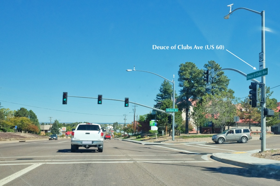
Deuce of Clubs Avenue at McNeil Street, in Show Low, AZ.
Springerville Volcano Field
Driving east on US route 60, extinct cinder cones begin to pop up on the landscape in an area known as the Springerville Volcano Field containing over 400 cones and volcanic activity with ages between 3 million years and about 300-thousand years ago. The volcano field is situated between Show Low, AZ and Springerville, AZ; is one of the largest volcanic fields on the Colorado Plateau; and is the youngest volcanic fields in the United States. The cinder cone shown below is Cerro Quemado.
In the distance at centre-right is Cerro Quemado.
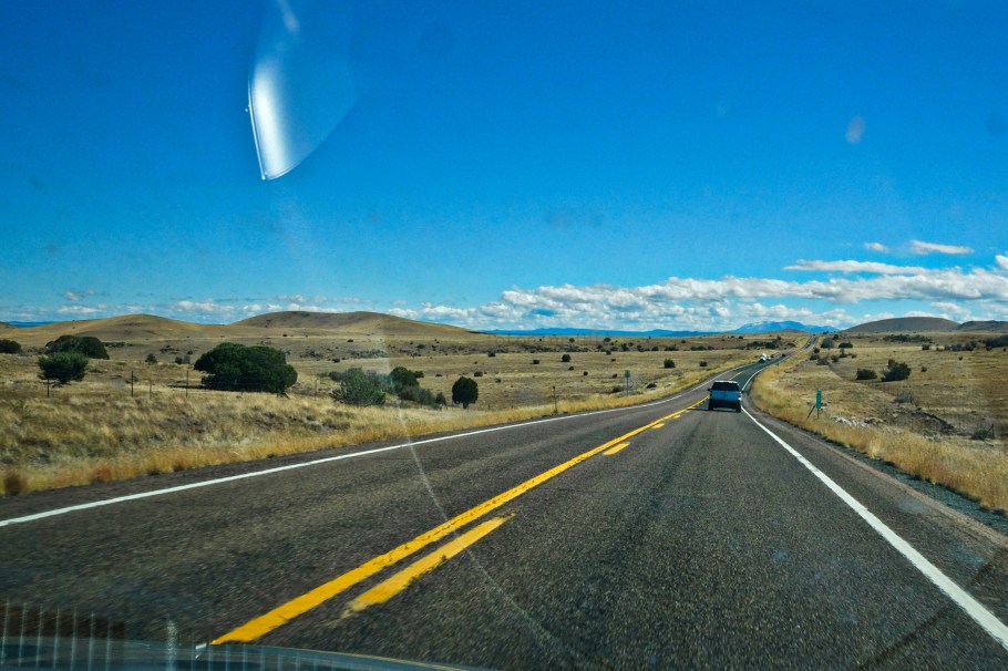
Facing east on US-60 at mile marker 373, other smaller extinct cinder cones in the Springerville Volcano Field dot the landscape.
Springerville, AZ
Passing through the Volcano Field, we continue southeast and slightly downhill to Springerville: a town founded in 1870 with present-day population about 7000. At the location in the image below, the road is shared by three highway designations: US-60, US-181, and US-190. Escudilla Mountain in the distance has already been topped with fresh snow for the new season. For us, snow is no worry, but the low fuel gauge is a worry, and we’ve set aside time to stop in town to tank up.
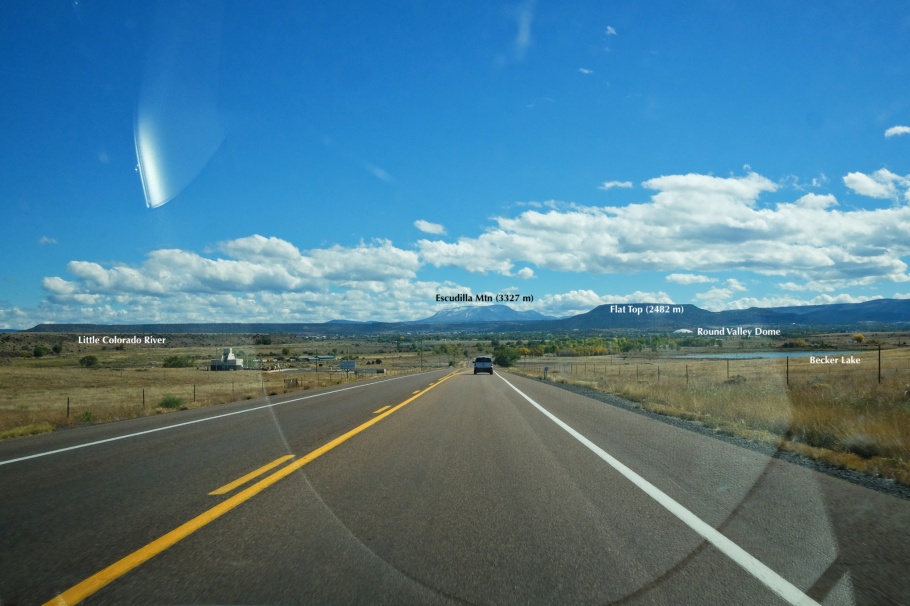
At 34.163931, -109.307187: approaching Springerville, AZ.
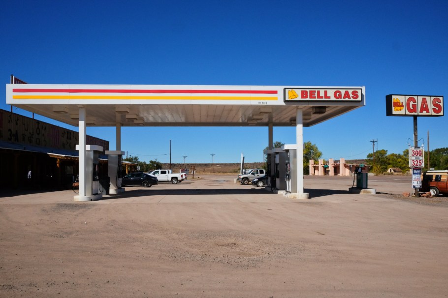
Gas station in town, near the crossing with the Little Colorado River.
AZ-NM State Line
It’s early-afternoon when we cross state lines, and we see a sign at mile 0: “Welcome to New Mexico: Land of Enchantment.” We are in fact enchanted. We’ve crossed the state border with “the road’s end” at Arizona (AZ mile “401.97”) and “the beginning” in New Mexico at mile 0. The latter milepost marker from NMDOT is at latitude 34.167 degrees north and longitude 109.047 degrees west at an elevation of over 2240 metres (7360 feet). We’ve put on a few hours on the road since leaving Tucson, but we’re closer to reaching a key destination: Pie Town.

Crossing the state line: “Welcome to New Mexico: Land of Enchantment”.
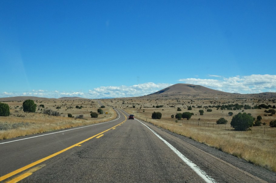
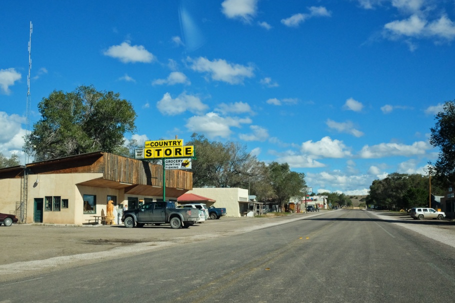
Quemado, NM
Beyond the state line on US-60, the first town of any significance is Quemado, about 56 km (35 mi) from the AZ-NM border. It’s too bad we’re not planning on making stops (except fuel) in small towns along the way. I can only imagine the practical delights to be seen in shops like the Country Store: grocery, hunting, fishing; everything one might need for supplies.
Pie Town, NM
“Pie Town, New Mexico” never left my mind after seeing the town’s name the first time. We ensured we found our way through central New Mexico, given two important constraints: we had to visit Tucson, and we had to drive back to Santa Fe for our return flights home. Our stay in Pie Town lasted only one memorable hour. A future return here is not out of the question.
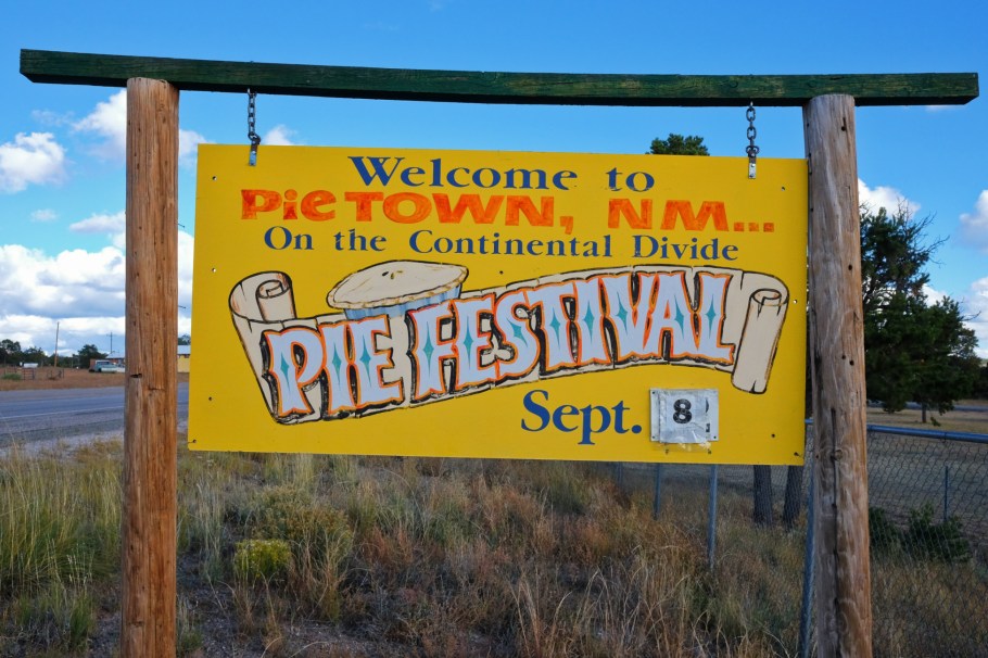
Welcome sign.
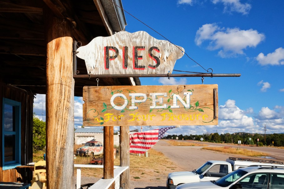
Pie-O-Neer in Pie Town; much more here.
Crossing the divide
Continuing east on US 60, a sign appears two miles outside of Pie Town. The sign reveals the highest elevation reached over the entire length of the highway. Here at an elevation of 7796 feet (2376 metres), we pass by the geographic feature known as the “continental divide” which separates rivers flowing east to the Atlantic from rivers flowing west to the Pacific. This crossing of the Divide is about 72 miles east from Springerville, AZ, and 81 miles west from Socorro, NM.
Our west-east crossing of the Divide on US-60 complements our east-west crossing of the Divide on I-40 one week earlier (on day 8) when we stopped in the town of Continental Divide, NM.

Eastbound on US-60, the “continental divide” sign (near 34.291 degrees north, 108.101 degrees west) is just before mile marker 58.
Plains of Agustin, NM
We’ve descended after crossing the continental divide or the spine of North America. Leaving behind the Datil mountains and the town of Datil, the next “landmark” will be Magdalena. Before us is the flat expanse of the Plains of Agustin, once the bed of Lake San Agustin (up to 20-thousand years ago, Pleistocene epoch). Fact is we’re still up at over 2100 metres (7000+ feet) above sea level.
The sun pokes out from behind the clouds, and lights up the white dishes of the Very Large Array (VLA) radio observatory in the distance. Today, the VLA is in a compact “engineering” configuration which is useful to see all of the dishes together, but it would’ve been nice to see the dishes spread out miles apart in an observing configuration. I should come back to this place.

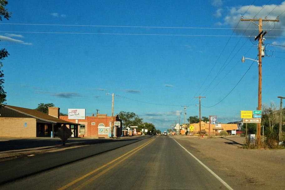
Magdalena, NM
It’s a small town with at least one of everything: gas station (Steer Stop), school, bank, library, museum, cemetery. We’re passing through town, as we’re chasing the end of daylight in a hurry to Albuquerque. Traffic is stopped for about 20 minutes with road construction, and while thinking about the terms and conditions for living in south-central New Mexico, I wonder what the day-to-day might be like. Quiet, with a rush of the 60? Clearing the obstruction, we make haste to Socorro and merge onto I-25 north to the Duke City in time for an important repeat meal at Mary & Tito’s.
We arrive in Santa Fe at night, bringing our time in the American Southwest to a close.
I made all pictures above on 19 Oct 2018 with a Fujifilm X70 fixed-lens prime. Thanks to AB for making this memorable trip possible. This post appears on Fotoeins Fotografie at fotoeins DOT com as https://wp.me/p1BIdT-eG8.

8 Responses to “1-day drive, US: Tucson to Santa Fe”
[…] Tucson to Santa Fe […]
LikeLike
[…] Tucson to Santa Fe […]
LikeLike
[…] Tucson to Santa Fe […]
LikeLike
[…] Tucson to Santa Fe […]
LikeLike
[…] Tucson to Santa Fe […]
LikeLike
[…] Tucson to Santa Fe, including a stop in Pie Town, NM (19 Oct) […]
LikeLike
[…] Tucson to Santa Fe […]
LikeLike
[…] garnish. One sopapilla is satisfying, but a one time experience isn’t enough. On our return drive from Tucson to Santa Fe, we race against the clock to make that one last mandatory stop in Albuquerque. Exit the Interstate […]
LikeLike