Fotoeins Fotografie

location bifurcation, place vs. home

Posts tagged ‘coast’

Interislander ferry, Kaitaki, Cook Strait, Raukawa Moana, New Zealand, Aotearoa, fotoeins.com

Seescape seascapes

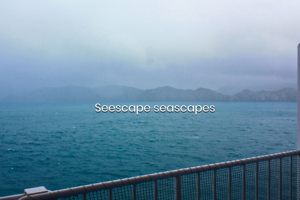
Above/featured: Crossing Cook Strait in winter mist and fog, catching first sight of New Zealand’s South Island – 14 July 2012 (450D).

Some time ago, the challenge was people’s take on cityscapes. The present challenge looks out to the water, and while lakes are nice, I like the opportunities afforded by the ocean or the sea. The word “seascape” is a noun whose definition is “a view of an expanse of sea.” I’m pleased to present the following “seescapes” with the allure of open waters in mind:

  1. Australia: HMAS Sydney I memorial, Sydney
  2. Australia: Port Arthur, Sydney
  3. Canada: Strait of Georgia, Salish Sea
  4. England: Dover Cliffs from English Channel
  5. Germany: Bodensee (Lake Constance)
  6. Germany: Wadden Sea mud flats
  7. Hong Kong: outlying islands in South China Sea
  8. Italy: Ligurian Sea from Cinque Terre
  9. New Zealand: Akaroa Harbour and the Pacific
  10. New Zealand: Milford Sound and the Pacific
  11. South Africa: where the Indian and Atlantic Oceans meet
  12. Sweden: Stockholm archipelago, Baltic Sea
  13. USA: Puget Sound, Salish Sea

Meere Seen – mehre Seen – mehr sehen1.

( Click here for images and more )

New Zealand: Coastal Pacific train from Picton to Christchurch

Previously: on board the Interislander ferry to cross New Zealand’s Cook Strait from Wellington on the North Island to Picton on the South Island.

There are cheaper or faster ways to travel between Wellington and Christchurch. But I love boats, and I love trains. So, an alternative is a trip with KiwiRail Scenic Journeys, combining boat and train. After 3.5 hours, the ferry across Cook Strait arrives in Picton at 1140am. I make my way out of the ferry terminal, and walk the short path to the train station nearby. My luggage on the ferry is automatically transferred onto the train, as I’ve paid for both legs of the trip in its entirety.

( Click here for more )

Hawaii Big Island: along the northeast Hāmākua Coast

While visiting friends in Hilo on the Big Island of Hawaii this past January (2012), my friend MK and I hop into a rental car, and we drive out on separate days along the northeast Hamakua coast and along the south Ka’u coast. Even though I’d made a number of prior visits for astronomy-related work on the Big Island, I had yet to see much of the northeast or the southern coastlines.

On today’s drive along the northeast Hāmākua coast on the Big Island, I seek out three locations: Laupahoehoe, Waipio Lookout, and Akaka Falls. Why these three?

  1. They’re easy to reach from Hilo.
  2. They’re all related in one way or another to Mauna Kea, that massive and dormant shield-volcano, dominating the south the entire drive along the Hamakua Coast.
  3. They’re beautiful: what else is there?

( Click here for images and more )