Fotoeins Fotografie

location bifurcation, place vs. home

Posts from the ‘Architecture’ category

Vienna Steinhof Church: city- & Wagner-landmark

Above/featured: East side of the church, in afternoon light. Photo on 28 May 2023, X70 with wide-field WCL-X70 lens attachment, image corrected for geometric distortion.

Building: Steinhof church, also St. Leopold Church, 1907 // Kirche am Steinhof, Kirche zum heiligen Leopold.
Address: Baumgartner Höhe 1, in Penzing, the city’s 14th district.

Up on the city’s Baumgartner Heights is an example of Europe’s first modernist church at Steinhof. Dedicated to St. Leopold, the structure is one of the city’s finest examples of turn-of-the-century architecture, and one of the world’s most important churches in the Jugendstil or Art Nouveau architectural style. The church was designed and built by architect Otto Wagner, inaugurated in 1907 for patients and staff within the surrounding hospital complex the Lower Austria state, sanatorium, and nursing home for the mentally ill (Niederösterreichische Landes-, Heil-, und Pflegeanstalt für Geistes- und Nervenkranke) which included over 30 buildings and room for over 2000 beds. The bright, airy, and spacious modern design was met at that time with skepticism and criticism by local church officials. Of utmost importance on Wagner’s mind were the hospital patients: his church design was about gentle solitude, not fire and damnation.

The church was a collaborative effort with other Viennese artists, including mosaics and stained glass by Koloman Moser, angel sculptures by Othmar Schimkowitz, and exterior tower sculptures by Richard Luksch. The church roof is topped with a dome covered in gold-plated copper plates, whose bright yellow appearance in daylight merits the nickname “Limoniberg” (lemon hill) that’s visible in different parts of the city. The Steinhof church is an example of a “Gesamtkunstwerk“, where every detail and fixture contributed to a “total and functional work of art”; an architectural masterpiece of the period; and one of Otto Wagner’s most important creations.

I included this building as part of my description of Otto Wagner’s architectural legacy in Vienna and of the recent centenary celebration in Vienna of the city’s 19th- to 20th-century architectural transition from historicism to modernism.


( Click here for images and more )

Berlin U5-Museumsinsel: Mozart, Schinkel, & Dudler

Above: Museumsinsel U-Bahn station entry-exit ‘A’. Photo, 17 May 2025 (P15).

The Berlin U-Bahn metro station Museumsinsel adjacent to the world renowned Museum Island is located on the U5 line which connects the city’s central station (Hauptbahnhof) with Alexanderplatz and the city’s eastern neighbourhoods. Construction for the station began in 2012 and lasted over 8 years. For the station interior at track level, architect Max Dudler was inspired by Karl Friedrich Schinkel’s 1815–1816 design of the stage for the Mozart opera “Die Sauberflöte” (The Magic Flute). For the appearance of the Queen of the Night, Schinkel imagined a large dome-like space like the overhead starry night sky. Over each of the two tracks in the U-Bahn station, Dudler designed a dark blue barrel-shaped vault embedded with thousands of white point-sources of light.

The fully-completed U5 extension from Hauptbahnhof to Alexanderplatz opened to the public on 4 December 2020, which at long last connected the Hauptbahnhof with Berlin’s U-Bahn city transport system. The Museumsinsel station on the U5 line opened on 9 July 2021. In addition to the city’s bus network, the station now allowed visitors to use the U-Bahn metro to reach the Museum Island complex, inscribed by UNESCO as World Heritage Site in 1999.

Artist and architect Karl Friedrich Schinkel (1781–1841) has his “fingerprints” on many of the city’s early- to middle 19th-century architecture, including in the immediate vicinity of the station the Neue Wache (New Guard House), Schlossbrücke (Castle Bridge), Friedrichswerder Church, Bauakademie (Building Academy), and the Altes Museum (Old Museum).


( Click here for images )

My Berlin: Wrapped Reichstag after 30 years

Above: “Wrapped Reichstag 1995–2025” light show.

In 1995, the artist duo Christo & Jeanne-Claude carried out a bold but contentious project by covering Berlin’s landmark Reichstag parliament building. Plans for the project had taken over 20 years, even though the artwork had always meant to be temporary and all expenses had been covered without corporate sponsors. Over 5 million visited in a period of 12 days in the summer of 1995 to look at the undulating “silver dream” in the German capital city. The timing was ideal. After reunification of the two Germanys in 1990, the new home of the federal parliament would be Berlin’s Reichstag. Renovations to the building began in the autumn of 1995 with the federal parliament opening in the spring of 1999.

From 9 to 22 June 2025, the Reichstag building was illuminated nightly with a light show in a 30-year anniversary tribute to the famous 1995 artwork. In a 20- to 30-minute cycle, the light-show appeared to first envelop the building in silver fabric. The fabric cover flapped in artificial breeze, before the cover lost its shape and fell onto the ground at the base of the building. The free-of-charge light show began shortly after sunset at about 930pm and continued until 1am. Whatever Christo and Jeanne-Claude chose to cover and transform, their art works posed questions of perception, origins, shape, functionality, and permanence.

•   DW: Germany Arts
•   Visit Berlin


( Click here for images )

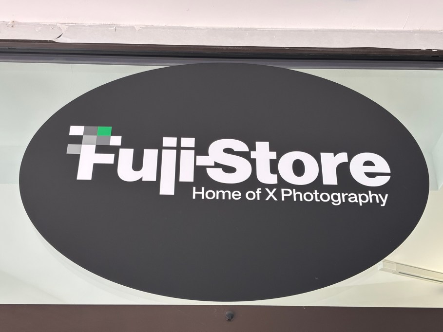
Nuremberg: Fuji(film)-Store

“Home of X Photography”

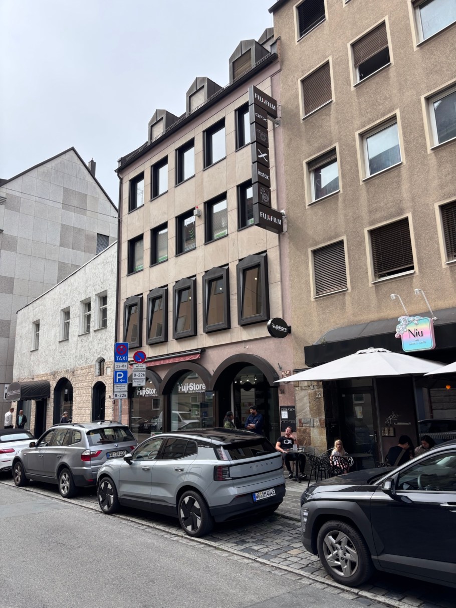
It’s a busy active crowded Saturday in Nuremberg’s city centre. There’s a big music festival with acts ranging in size from solo artists to 3-piece bands. But as I walk across town, I see a big Fujifilm sign, and as I approach, I can see this is no ordinary camera shop.

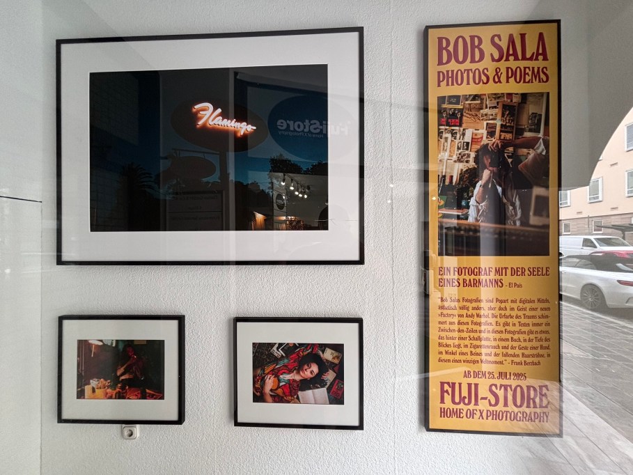
I learn there’s been a Fuji shop in the city for a number of years, and only this past February did they move to this new location. Judging by layout and the upstairs gallery, the Fuji shop has a feel similar to aLeica shop. That’s because the owner of Nuremberg’s Fuji-Store created the shop based on their experience operating the city’s Leica shop nearby. I chat with Peter, the gentleman in the shop about what’s out now and what else might be expected. We agree to a common wish: to have Fuji fill a current niche with a compact portable point-and-shoot at the right price point. How about an X80 product variant?

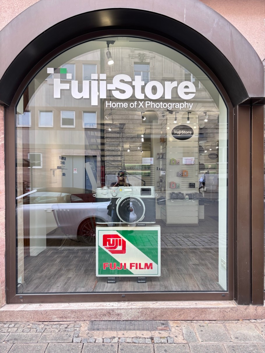
I’ve done my fair share of drooling (but no buying) at Leica shops in Frankfurt and Vienna, and I enjoyed doing the same to available X-models on display at Nuremberg’s Fuji-Store. Did I buy? No. Am I thinking about life after the X70? Yes.

I can also see Fuji X Weekly having some fun here in the shop.


I received neither support nor compensation for this piece. I made all images above with an iPhone15 on 2 August 2025. This post composed within Jetpack for iOS appears on Fotoeins Fotografie at fotoeins DOT com.

San Francisco: that golden bridge again

Above/featured: In San Francisco Bay on board Golden Gate Ferry westbound to Sausalito, the Golden Gate Bridge traverses over the deep narrow strait called Golden Gate, and connects San Francisco County (left) with Marin County (right). Photo, 18 Mar 2025 (X70).

It’s easy to mistake the association of the bright “international orange” colour of the Golden Gate Bridge with the Golden Gate. The name given to the deep narrow strip of water has much more to do with the Golden Horn in Istanbul. As part of his expeditions and geographic surveys in northern California in the mid-1840s, John Charles Frémont wrote the following for 27 April 1846 (Frémont 1848, pp. 31–33):

… The bay of San Francisco is separated from the sea by low mountain ranges. Looking from the peaks of the Sierra Nevada, the coast mountains present an apparently continuous line, with only a single gap, resembling a mountain pass. This is the entrance to the great bay, and is the only water communication from the coast to the interior country. Approaching from the sea, the coast presents a bold outline. On the south, the bordering mountains come down in a narrow ridge of broken hills, terminating in a precipitous point, against which the sea breaks heavily. On the northern side, the mountain presents a bold promontory, rising in a few miles to a height of two or three thousand feet. Between these points is the strait — about one mile broad, in the narrowest part, and five miles long from the sea to the bay. Passing through this gate,* the bay opens to the right and left, extending in each direction about 35 miles, having a total length of more than 70, and a coast of about 275 miles. It is divided, by straits and projecting points, into three separate bays, of which the northern two are called San Pablo and Suisoon bays.

* Called Chrysopylae (Golden gate) on the map, on the same principle that the harbor of Byzantium (Constantinople afterwards) was called Chrysoceras (golden horn). The form of the harbor, and its advantages for commerce, (and that before it became an entrepot of eastern commerce,) suggested the name to the Greek founders of Byzantium. The form of the entrance into the bay of San Francisco, and its advantages for commerce, (Asiatic inclusive,) suggest the name which is given to this entrance.

Frémont’s description in 1848 is most likely the first documented mention, as San Francisco’s Chrysopylae (golden gate) reminded him of Constantinople’s Chrysoceras (golden horn). Today, the Greek noun has been dropped, and the world recognizes the narrow water entrance into San Francisco Bay simply as “Golden Gate”.


Around the Bay & City

Over a number of months in the Bay Area, I examined many lines of sight to the Golden Gate Bridge. My favourite has to be the Bay ferry between San Francisco and Sausalito.


Crissy Field, Crissy Field Marsh, The Presidio, Golden Gate, Golden Gate Bridge, San Francisco, Bay Area, California, USA, fotoeins.com

Crissy Field Marsh – 31 Oct 2024 (P15).

Fort Mason, Golden Gate, Golden Gate Bridge, San Francisco, Bay Area, California, USA, fotoeins.com

Fort Mason, next to the Great Meadow – 2 Dec 2024 (P15).

Lands End, Golden Gate, Golden Gate Bridge, San Francisco, Bay Area, California, USA, fotoeins.com

Lands End – 3 Dec 2024 (P15).

Treasure Island, Golden Gate Bridge, San Francisco, Bay Area, California, USA, fotoeins.com

In morning light, facing west from Treasure Island – 6 Dec 2024 (P15).

China Beach, Golden Gate, Golden Gate Bridge, San Francisco, Bay Area, California, USA, fotoeins.com

Midday light at China Beach – 6 Dec 2024 (P15).

Golden Gate Bridge Welcome Center, The Presidio, Golden Gate, Golden Gate Bridge, San Francisco, Bay Area, California, USA, fotoeins.com

Dusk from the Golden Gate Bridge Welcome Center – 9 Dec 2024 (P15).

Torpedo Wharf, The Presidio, Golden Gate, Golden Gate Bridge, San Francisco, Bay Area, California, USA, fotoeins.com

Torpedo Wharf – 26 Dec 2024 (P15).

San Francisco National Cemetery, The Presidio, Golden Gate Bridge, San Francisco, Bay Area, California, USA, fotoeins.com

San Francisco National Cemetery, facing northwest – 28 Dec 2024 (P15).

Powell-Hyde cable car turntable, Maritime Park, Aquatic Cove, Golden Gate Bridge, San Francisco, Bay Area, California, USA, fotoeins.com

Powell-Hyde cable car turntable at dawn – 31 Dec 2024 (P15).

Coastal Trail, Lands End, GGNRA, Golden Gate, Golden Gate Bridge, San Francisco, Bay Area, California, USA, fotoeins.com

From the Coastal Trail, east to Lands End. Photo, 5 Jan 2025 (X70).

Hamon Tower, De Young Museum, Golden Gate Park, Golden Gate Bridge, San Francisco, Bay Area, California, USA, fotoeins.com

At upper right, the tops of the bridge towers appear over The Presidio, from de Young Museum’s Hamon Tower – 7 Jan 2025 (P15).

Battery Godfrey, The Presidio, Golden Gate, Golden Gate Bridge, San Francisco, Bay Area, California, USA, fotoeins.com

From Battery Godfrey in The Presidio. Access is from the Coastal Trail or the Golden Gate Bridge Visitor Center. Photo, 13 Jan 2025 (X70).

Twin Peaks, Christmas Tree Point, Golden Gate Bridge, San Francisco, Bay Area, California, USA, fotoeins.com

From Twin Peaks’ Christmas Tree Point, the Golden Gate bridge appears at top-centre; at right are St. Ignatius church and the University of San Francisco campus. Photo, 28 Jan 2025 (P15).

Marina Promenade, The Marina, Golden Gate Bridge, San Francisco, Bay Area, California, USA, fotoeins.com

Marina Promenade – 5 Feb 2025 (P15).

Aquatic Cove, Golden Gate Bridge, San Francisco, Bay Area, California, USA, fotoeins.com

Aquatic Cove: the bridge is almost fully covered in fog. Photo, 16 Feb 2025 (P15).

Emeryville Marina Park, Emeryville, Golden Gate Bridge, San Francisco, Bay Area, California, USA, fotoeins.com

From Emeryville Marina Park: sunset intercepts one of the bridge’s towers – 25 Feb 2025 (P15).

Fort Point, The Presidio, Golden Gate, Golden Gate Bridge, San Francisco, Bay Area, California, USA, fotoeins.com

Underneath the bridge at Fort Point – 28 Feb 2025 (P15).

Fort Point, The Presidio, Golden Gate, Golden Gate Bridge, San Francisco, Bay Area, California, USA, fotoeins.com

Next to the entrance for Fort Point and in front of Golden Gate strait – 28 Feb 2025 (P15).

Baker Beach, Golden Gate, Golden Gate Bridge, San Francisco, Bay Area, California, USA, fotoeins.com

Baker Beach – 11 Mar 2025 (P15).

Richardson Bay, Golden Gate Ferry, Golden Gate, Golden Gate Bridge, San Francisco, Bay Area, California, USA, fotoeins.com

In Richardson Bay, on Golden Gate Ferry westbound to Sausalito. The Sutro Tower also makes an appearance at left. Photo, 18 Mar 2025 (P15).

Battery Marcus Miller, The Presidio, Golden Gate, Golden Gate Bridge, San Francisco, Bay Area, California, USA, fotoeins.com

The Presidio, over Battery Marcus Miller – 26 Mar 2025 (P15).

UCSF Parnassus Heights, Parnassus Heights, Golden Gate Bridge, San Francisco, Bay Area, California, USA, fotoeins.com

From UCSF Parnassus Heights: at left-centre is The Landmark at Presidio (former military hospital), and at upper-right are the towers of the Golden Gate Bridge. Photo, 29 Mar 2025 (P15).

Presidio Tunnel Tops, The Presidio, Golden Gate, Golden Gate Bridge, San Francisco, Bay Area, California, USA, fotoeins.com

From the Tunnel Tops at the Presidio – 31 Mar 2025 (X70).


Sources

•   Fremont, J.C., “Geographical memoir upon upper California, addressed to the Senate of the United States in 1848“, 30th United States Congress, no. 148 (Philadelphia: William McCarty, 1848). Digitized in 2015 by and online access at Internet Archive, via San Francisco Public Library: https://archive.org/stream/geographicalmemo00frmo_0/geographicalmemo00frmo_0_djvu.txt [last accessed May 2025].
•   Fremont, J.C., “Map of Oregon and upper California from the surveys of John Charles Frémont and other authorities“, U.S. Library of Congress online: https://www.loc.gov/item/79692905/ [last accessed May 2025].

Golden Gate, Charles Preuss, John Charles Frémont, Northern California, San Francisco, Bay Area

Section from Charles Preuss’ 1848 map included with John Charles Frémont’s 1848 memoir of his expeditions into Northern California. Reminding him of the Golden horn in Constantinople, Frémont named the narrow strait into San Francisco Bay as Chrysopylae or “Golden Gate”.


I made all photos above between 31 October 2024 and 31 March 2025 with a Fujifilm X70 fixed-lens prime (X70) and an iPhone15 (P15). I received neither request nor compensation for the content described here. This post appears on Fotoeins Fotografie at fotoeins DOT com as https://wp.me/p1BIdT-uS3.