New Zealand: slow bound to Franz Josef Glacier
To a person, from the InterCity coach driver to the proprietors of motels along the South Island’s west coast, everyone spoke about how the Franz Josef and Fox Glaciers are two of the most accessible glaciers in the world. All things being equal, reaching the glaciers is definitely easier with a vehicle.
But I’m on New Zealand’s South Island, in the middle of a rainforest, and within the Westland National Park which is part of a UNESCO Heritage Site. I’m in no rush; so I think I’ll spare the trees from the expelled products of a combustible engine.
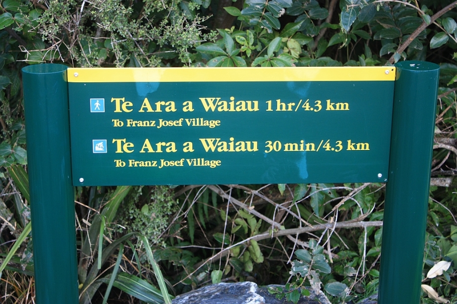
I decide on the following course of action: awake at the crack of dawn, have a solid breakfast, and walk out from town to the glacier. The distance from town to the parking lot at the glacier is about six kilometres, which is 90 minutes one-way. From the parking lot, there is another 45-minute walk to the glacier’s terminus.
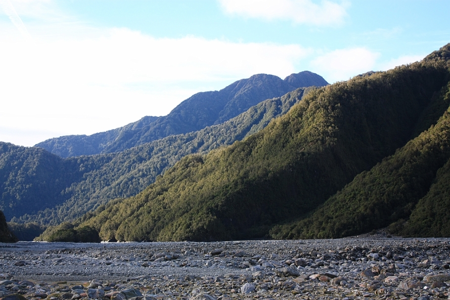
The first thing is a walk through the thick lush rainforest, all part of the catchment basin for the Waiho river. The Waiho river begins mostly as meltwater at the terminal face of the Franz Josef Glacier, runs west and joins the Callery River near the Franz Josef Glacier township, and drains into the Tasman Sea.
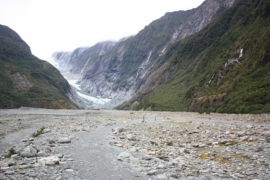
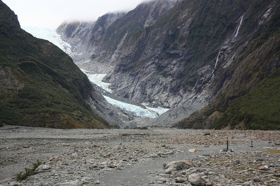
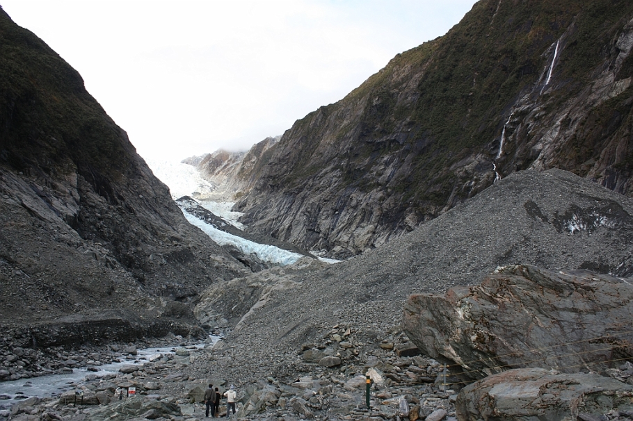
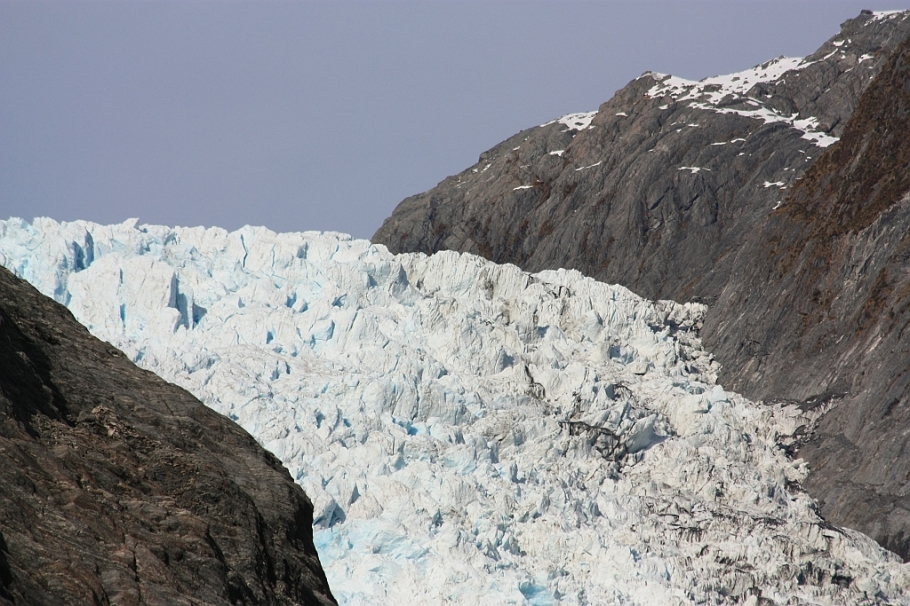
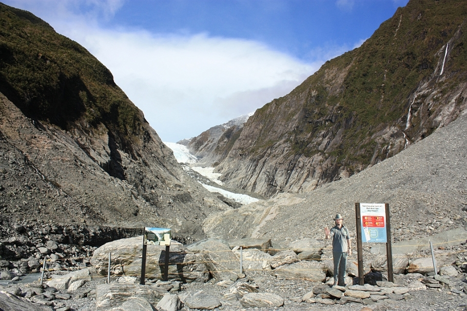
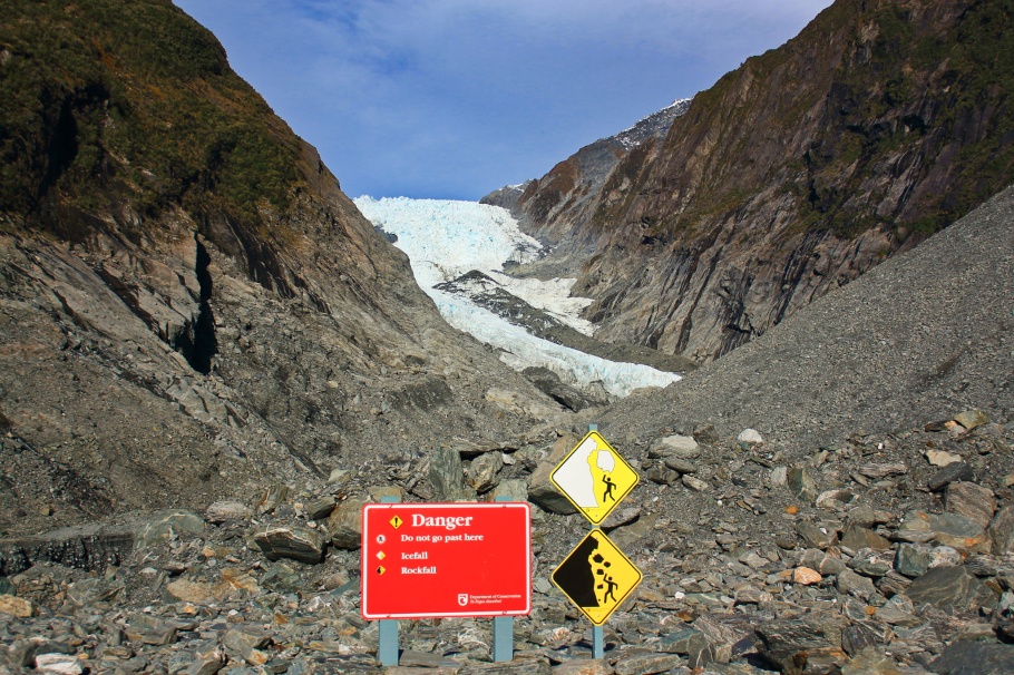
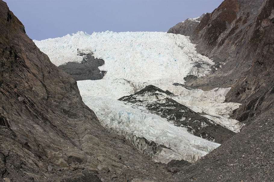
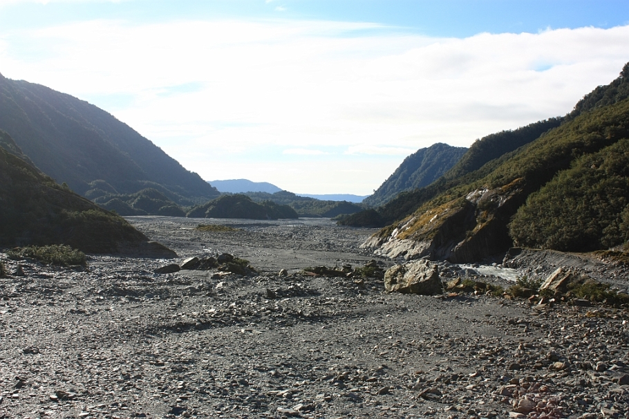
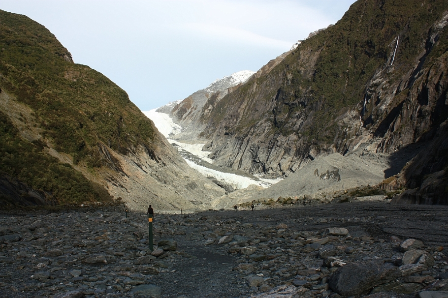
The second is the glacier walk on the valley floor of the Waiho river. As the glacier has retreated, what’s left behind is a broad plain with steep walls to the side. The walk occurs over rough exposed ground with rocks and stones of various sizes strewn on the valley floor, and involves crossing streams and stream beds. The path is clearly marked by green vertical posts the entire way with the closest view point about 500 metres from the glacier terminus. Sufficient distance is required, as recent observations show that the glacier terminus is unstable with the threat of ice- and rock-falls.
The glacier has experienced cycles of advance and retreat, and as Laura Mills wrote in the New Zealand Herald on 9 July 2012:
Between 1893 and the end of its last big retreat 90 years later, in 1983, Franz Josef Glacier receded about 3 kilometres. Between 1983 and 2008 it advanced almost 1.5 kilometres after heavy snowfalls. But in the past four years it has melted almost 500 metres.
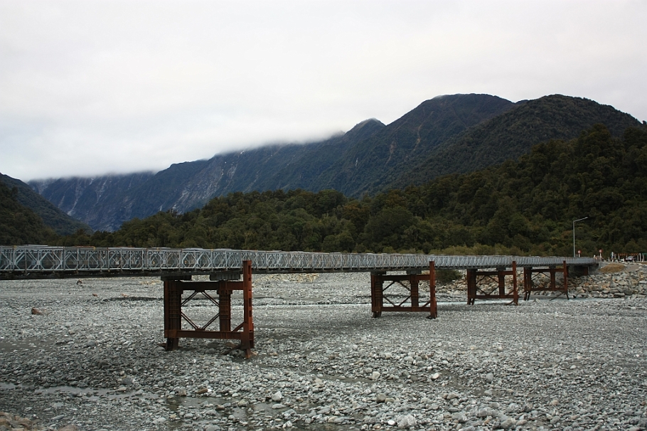
Waiho River Bailey Bridge. 26 Mar 2019: heavy rains washes away bridge (NZ Herald). 13 Apr 2019 – new bridge opens (Waka Kotahi NZ Transport).
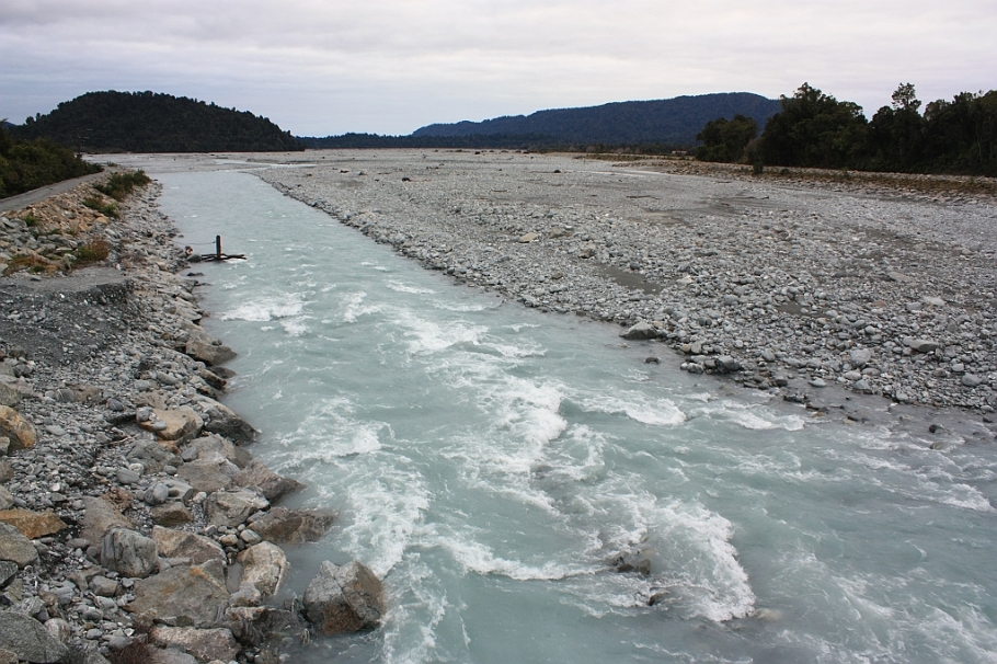
From the bailey bridge over the Waiho river, facing west to the sea.
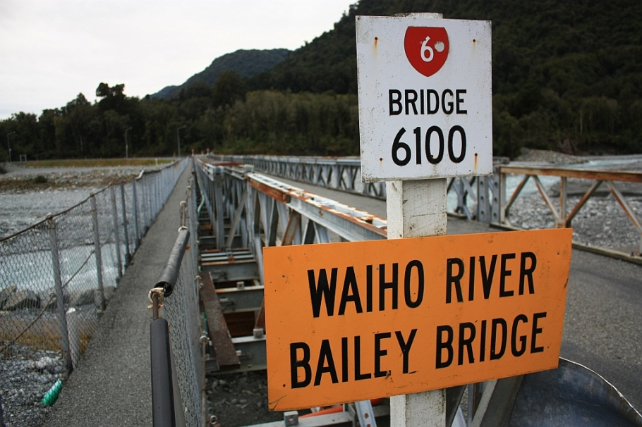
Waiho River Bailey Bridge. 26 Mar 2019: heavy rains washes away bridge (NZ Herald). 13 Apr 2019 – new bridge opens (Waka Kotahi NZ Transport).
Making a choice: I choose left.
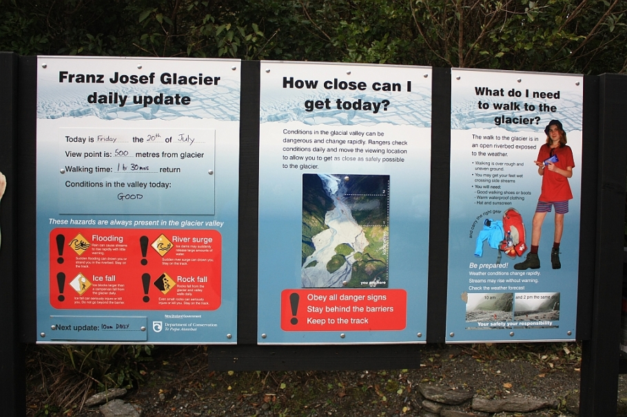
Daily update.
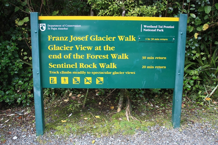
How long is the walk?
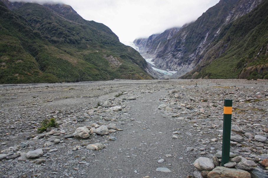
Welcome to the Waiho river valley.
Glacial debris on the valley floor.
The slow approach.
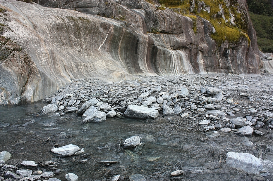
Rotational scraping and till at bottom of a corrie.
Big ground moraine near present-day glacier terminus.
Angled view up.
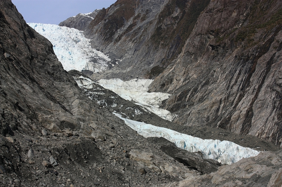
Icefall ridge.
“Safe limit” doesn’t prevent others from hopping the fence.
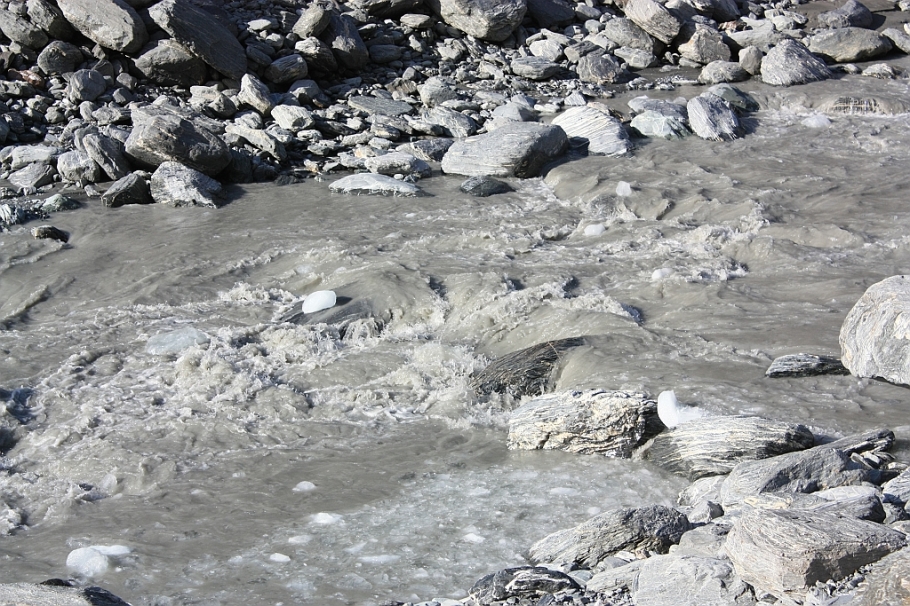
Headwaters of the Waiho: glacier melt with chunks of ice.
Stick-people, in danger!
Straight up the glacier.
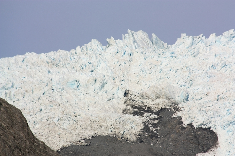
Icefall at the top.
Icefall.
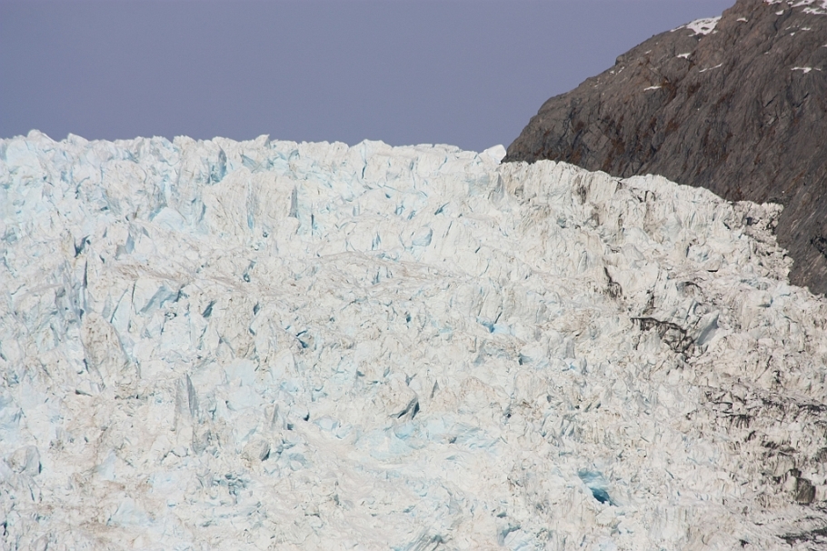
Compressed ice appears blue as air bubbles are squeezed out.
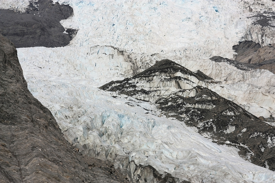
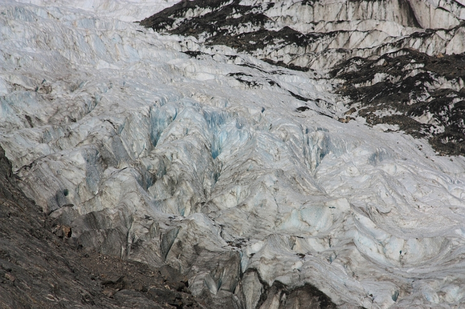
Longitudinal crevasses.
Down the stream of melted ice.

Shadows long, time to head back.
Parting view.
Here where I stand, the glacier was at least 10 metres high.

Final view along the valley to the glacier.
Time to go back.
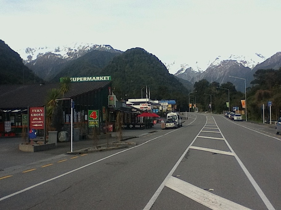
Franz Josef Glacier township, 1 of 2.
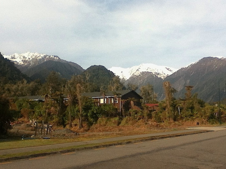
Franz Josef Glacier township, 2 of 2.
My walk from Franz Josef town to Franz Josef Glacier is indicated as a solid purple line. Nearby is a crescent-shaped feature called the Waiho Loop, a terminal moraine feature marking the farthest advance of the glacier about 12-thousand years ago.
More
Additional information from New Zealand’s Department of Conservation:
• Ka Roimata o Hinehukatere: Franz Josef Glacier | Walk to the glacier
• Tai Poutini: Westland National Park.
• Te Wahipounamu: South West New Zealand World Heritage Area.
• 2 years of the glacier’s retreat, compressed into 15 seconds.
• The frozen tears of New Zealand’s melting glaciers. DW, 30 Aug 2018.
• Swollen Waiho from heavy rains washes out bridge. NZ Herald, 26 Mar 2019.
• The slow forest walk to Fox Glacier
• The Grand Traverse over New Zealand’s Southern Alps
• Sounds of a sunset on New Zealand’s South Island
• Lake Matheson and the southern Alps at sunset
I made the photos above on 20 and 21 July 2012; the first two photos in the slideshow were made with a 4th-generation iPod Touch, and the remaining photos were made with a Canon EOS450D camera. This post appears on Fotoeins Fotografie at fotoeins DOT com as http://wp.me/p1BIdT-28I.

13 Responses to “New Zealand: slow bound to Franz Josef Glacier”
Walking through lush tropical rainforest to reach the glacier must be quite an experience. From ome extreme to the other.
Nico recently posted… The Other Inca Trail
LikeLiked by 1 person
Hi, Nico. Though the rainforest itself is a temperate one, it is still, as you rightly said, a very interesting experience to walk out of the rainforest to see a glacier at the very end. Thanks for reading and for your comment!
LikeLike
[…] With coach services, I’ve been making my way down the west coast of New Zealand’s South Island. I spend a couple of days around Franz Josef town, and I describe the walk from town to the Franz Josef Glacier. […]
LikeLike
[…] go to the patient, especially those on daytime walks through the temperate rainforest to the Franz Josef Glacier and the Fox […]
LikeLike
[…] visits to the Franz Josef Glacier and Fox Glacier, I had been contemplating whether or not I should have a look from above. It would […]
LikeLike
[…] The slow approach to Franz Josef Glacier : green path marked by pins A and B in the map above. • The slow forest walk to Fox […]
LikeLike
[…] Fox Glacier: The slow forest walk up to Fox Glacier • Franz Josef Glacier: The slow approach to Franz Josef Glacier • Interislander Ferry: On the ferry between the North and South Islands • […]
LikeLike
[…] headwaters at Franz Josef Glacier (Kā Roimata o Hine Hukatere) – 20 Jul […]
LikeLike
[…] Before retreat, there used to be many metres of ice on the valley floor […]
LikeLike
[…] from temperate rainforest. For scale, two white ovals mark the presence of other visitors. Westland Tai Poutini National Park, South Island, New Zealand – 20 July 2012 […]
LikeLike
[…] Before the glacier’s retreat, many thick metres of ice once resided on the valley floor now li…. […]
LikeLike
[…] Before the glacier’s retreat, many thick metres of ice once resided on the valley floor now li…. […]
LikeLike
[…] In the image here, I’m standing next to a massive terminal moraine just out of frame at right. This is the safe and “nearest” viewpoint, about 0.5 km from the head of the receding glacier. The glacier melt is responsible for the Waiho river, whose initial flow is marked by the diagonal line of rocks towards the lower left. Poor “stick people”! You can read more about my daytrip to the Franz Josef Glacier. […]
LikeLike