Fotoeins Fotografie

location bifurcation, place & home

Posts tagged ‘ferry’

Grouse Mountain, Vancouver, Canada, Georgia Strait, BC Ferries, Vancouver Island

Fotoeins Friday: from Island to Mainland over the Salish Sea

The Salish Sea, 2 of 5.

The Salish Sea is a body of water encompassing Georgia Strait, Howe Sound, Burrard Inlet, Puget Sound, and the Strait of Juan de Fuca. The sea is named after the Coast Salish people who are the first inhabitants of the region. The renaming without displacing the old geographic names occurred in 2010.

From the perch up on Grouse Mountain, afternoon winter sun illuminates the waters of Georgia Strait as a BC Ferries’ ship from Nanaimo on Vancouver Island is on approach to the mainland terminal at Horseshoe Bay.

I made the photo on 7 Feb 2012 with a Canon 450D, 70-300 glass, and the following settings: 1/320-sec, f/5.6, ISO100, 250mm focal length (400mm full-frame equivalent). This post appears on Fotoeins Fotografie at fotoeins.com as https://wp.me/p1BIdT-ddu.


BC Ferries, Active Pass, Salish Sea, British Columbia, fotoeins.com

Fotoeins Friday: Sunny sail across the Salish Sea

The Salish Sea, 1 of 5.

The Salish Sea is a body of water encompassing Georgia Strait, Howe Sound, Burrard Inlet, Puget Sound, and the Strait of Juan de Fuca. The sea is named after the Coast Salish people who are the first inhabitants of the region. The renaming without displacing the old geographic names occurred in 2010.

The picture above is of Active Pass where two BC Ferries’ ships navigate not only the narrow channel in the Gulf Islands of British Columbia, but also must pass each other as they traverse the route on the Salish Sea between Tsawwassen on the mainland and Swartz Bay on Vancouver Island.

I made the photo on 25 July 2007 with a Canon A510 Powershot. This post appears on Fotoeins Fotografie at fotoeins.com as http://wp.me/p1BIdT-7YU.


Interislander, Sinclair Head, Te Rimurapa, Cook Strait, Raukawa, North Island Te Ika a Maui, New Zealand, Aotearoa, myRTW, fotoeins.com

Fotoeins Friday: Crossing New Zealand’s Cook Strait (Raukawa)

14 July 2012.

It’s a cold wet winter morning in mid-July, and I’m on New Zealand’s Interislander ferry from Wellington on the North Island to Picton on the South Island. With the seasonal weather, visibility and skies are limited with low-lying stratus cloud creating some showers, mist, and fog. Fortunately, light winds create only small chop on the water, sun rays occasionally break through the grey canopy, and some geographical features begin to appear.

We bid goodbye to the North Island with this sighting of Sinclair Head, known formerly as the Māori settlement Te Rimurapa (giant bull kelp). The trailhead is faintly visible at right leading to Te Kopahou (“bent or folded feather”), whose 485-metre (1591 feet) summit is buried in cloud in this picture. The end of the ridge running as a cliff down Rimurapa is known as Taumata Patiti Pa. The strip of land jutting out to the left and into the water is Tongue Point.

Cook Strait is named after England’s famous circumnavigator Captain James Cook, but the strait’s name in Maori is “Te Moana Raukawa” (also this). This latter name may be a shortened version of “rau-kawakawa” for the leaves (rau) of the kawakawa plant used to make makeshift visors to prevent voyagers crossing the strait from unintentionally seeing islands and rocks considered too sacred to view.


More

•   “The Land of Tara …,” by Elsdon Best (1919), courtesy of Wellington City Libraries
•   NZ History
•   Rimupara – Maori sites, Te Whanganui a Tara
•   Te Ara – Encyclopedia of New Zealand
•   “History of Māori of Nelson and Marlborough“, p. 41, Hilary Mitchell and Maui John Mitchell, Huia Publishers (2004)

The Māori names for the two largest islands of New Zealand (Aotearoa) are:
•   Te Ika a Māui (Maui’s fish) for the North Island, and
•   Te Wai Pounamu (waters of greenstone) for the South Island. An alternative name is Te Waka a Aoraki (Aoraki’s canoe).

During my year-long RTW, I made this photo on 14 July 2012 with the Canon 450D, 18-55 kit-lens, and the following settings: 1/40-sec, f/8, ISO200, and 33mm focal length (53mm full-frame equivalent). This post appears on Fotoeins Fotografie at fotoeins.com as http://wp.me/p1BIdT-9VC.

New Zealand: Interislander Ferry across Cook Strait

The calendar page flips over to the 14th of July (2012).

I’ve spent a quiet week with friends in Wellington, New Zealand, and it’s time I head south to see Te Wai Pounamu or the South Island for the first time. My first destination is Christchurch, and I could fly there. But I’m in no hurry, and I want to experience the scenery route with a ferry across Raukawa Moana, otherwise known as Cook Strait.

I’ve arranged passage from Wellington on the North Island (Te Ika a Maui) to Christchurch on the South Island with ferry- and coach-service with KiwiRail. The journey begins with the Interislander ferry whose arrival is timed to match the departure time of the Coastal Pacific train leaving Picton for Christchurch.

( Click here for more )

North to Strömkajen (harbour quays), Stockholmsström, Stockholm harbour, Stockholm, Sweden, fotoeins.com

My Stockholm: daytrip to Vaxholm in the archipelago

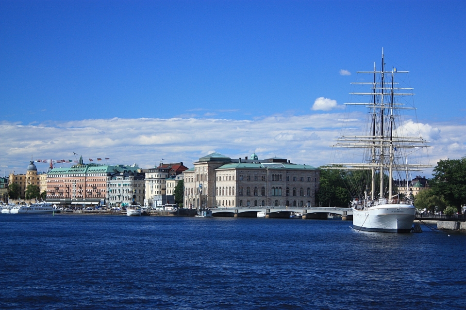
Above/featured: Stockholmsström (Stockholm harbour).

One of the great attractions in Stockholm is its archipelago (Stockholms skärgård), a network of over 20-thousand islands in the Baltic Sea. An easy get-away from the city, Vaxholm is a favorite for many, accessible by bus, by car, or by ferry.

It is with the latter, the Waxholmsbolaget ferry service, that I set off on a day trip. I boarded the boat at Stockholm Strömkajen for the hour-long ferry to Vaxholm. The return boat journey puts me back at Stockholm Strömkajen.

The Official Roslagen site describes Vaxholm as:

Vaxholm, called the archipelago’s “capital”, is the gateway to Roslagen from Stockholm. The town is a hub for boats travelling to the central and northern archipelago – Roslagen’s archipelago. Vaxholm’s municipality includes about 70 islands.

Vaxholm has lots of trees, beautiful homes and cottages, all within easy reach of the water. Because of its proximity to Stockholm, Vaxholm can also be expensive. But if you’re looking for something different in the Stockholm area, Vaxholm is an ideal daytrip for some peace and quiet by the water’s edge.


( Click here for images and more )

%d bloggers like this: