Posts from the ‘MyRTW’ category
My around the world journey: Dec 2011-Jan 2013
A trip to New Zealand’s South Island is incomplete without a visit to the Fiordland National Park. A stop at one or both of Milford Sound or Doubtful Sound is also highly recommended, as they are some of the most popular destinations in New Zealand and on the South Island. From Queenstown, I sided with Real Journeys for a daytrip out to Milford Sound: morning coach on the only road access, Milford Sound Highway (State Highway 94), from Queenstown to Milford Sound; a boat into the fiord; and the return to Queenstown by plane. The Maori Ngai Tahu name for the body of water is Piopiotahi (“one piopio bird”). The piopio resembles a thrush but is considered extinct with the last sighting in 1905.
Much of the scenery reminds me of my home province: coastal British Columbia. Carved by glacial activity, Fjords (also spelled “fiords”) are long narrow inlets with steep sides or cliffs. My time in southwest New Zealand reminds me of home along the southwest coast of British Columbia.
( Click here for images and more )
-44.668226
167.927149
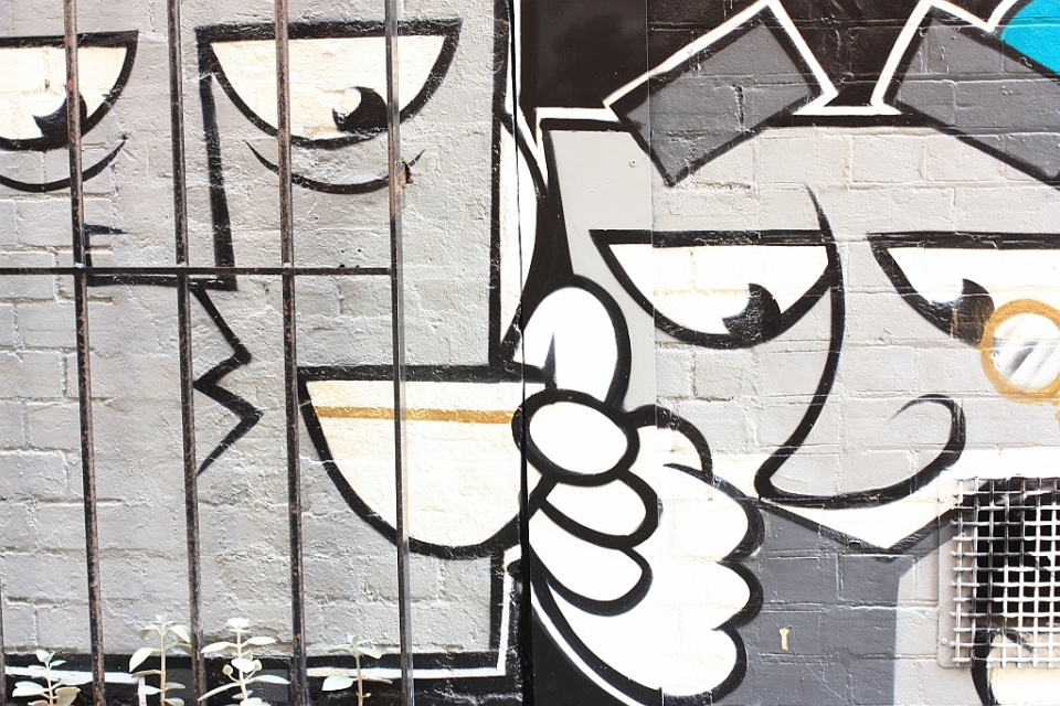
The following shows some of the street art present in and around the Central Business District in Adelaide, South Australia state’s capital city. I’m very grateful to have spent some time in South Australia as a part of my year-long RTW (around the world).
( Click here for more )
-34.928621
138.599959
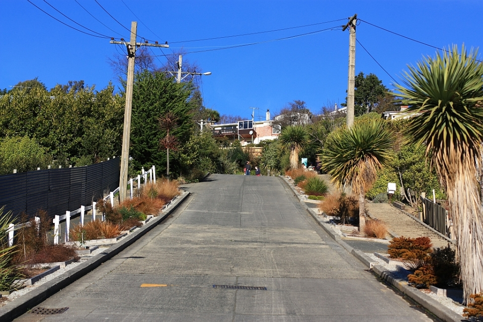
July 2019: The record for the world’s steepest road now belongs to Harlech, Wales (CBC News).
In Dunedin, New Zealand, make your way from the city centre, around the University of Otago to North Road, and onwards to Baldwin Street, where The Guinness Book of Records declared the latter street as “the steepest (street) in the world” in 1997. With this claim to fame, the street is touted as a place to visit in Dunedin. Anybody who’s spent time in San Francisco should take the challenge and find out whether the ascent grade on Baldwin Street approaches or exceeds their experience in the American city by the Bay.
( Click here for more )
-45.849322
170.534392
Chep Lap Kok airport, otherwise known as Hong Kong International Airport (HKIA), opened for service in 1998, replacing the smaller Kai Tak Airport in Kowloon. HKIA operates 24-hours, and is one of the busiest airports in the world by passenger numbers, aircraft movements, and cargo traffic.
As the airport is located over 30 kilometres (over 20 miles) from Hong Kong’s “Central” business district and city centre, transport options include taxis, buses, coaches for major hotels, or the MTR.
The MTR (Mass Transit Railway) Airport Express route is a reasonably quick and inexpensive choice with trains running every 10-12 minutes between the city of Hong Kong and the airport in a one-way trip lasting under 30 minutes. As of posting, the cost for one adult is HKD$100 (less than USD$13) for a single journey, same day return ticket, or with an Octopus card; additional information about fare-, ticket-, and travel-options with the MTR Airport Express can be accessed here (fares above as of 2013).
( Click here for more )
22.279991
114.158798
I’m pleased to present the following 12 photos from 2012, representing some special memories from the entire year’s around-the-world (RTW) travel.
( Click here for more )