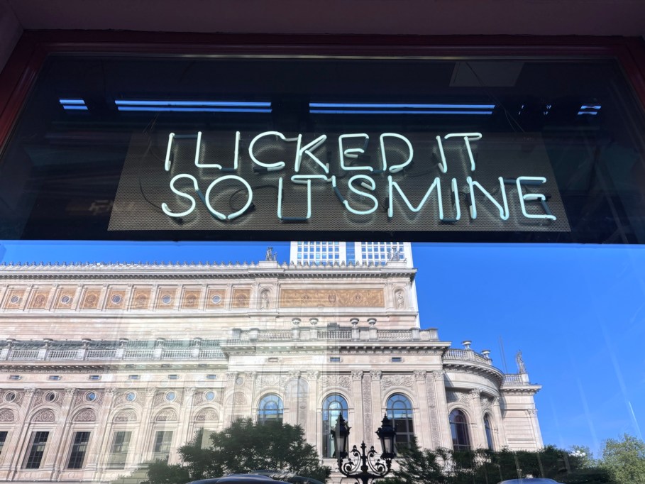
Week 1 – no comment
Erste Woche – ohne Kommentar

Above/featured: Judenplatz at night. The Holocaust memorial is in the foreground at centre. In the background are “To the little trinity” at centre and Misrachi House (Museum Judenplatz) at right. Photo, 10 Jun 2022.
At Judenplatz are clear visual reminders of the city’s first Jewish community in medieval times.
The first Jewish community in Vienna settled around present-day Judenplatz in the Middle Ages with mention in written documents dated mid- to late-13th century AD/CE. Daily Jewish life thrived around the Or-Sarua Synagogue, the Jewish School, and the Mikveh ritual bath. The community along with the surrounding Jewish neighbourhood came to an end with the Pogrom of 1421. Catholic Habsburg Duke Albrecht II rolled out a decree (Wiener Geserah, Vienna Gesera) which legitimatized the expulsion, incarceration, torture, and murder of some 800 Jewish residents; accompanied by destruction and forced takeover of buildings and property.
Below I highlight remnants and traces to the medieval Jewish community at this square in central Vienna.
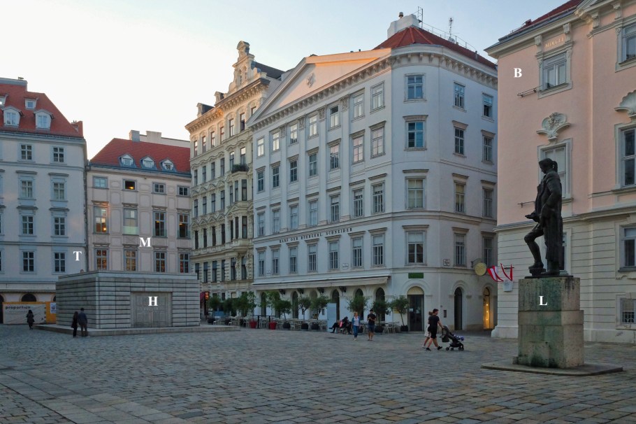
Facing northwest: B, Bohemian Chancellery; H, Holocaust Memorial; L, Lessing monument; M, Misrachi House; T, To the little Trinity. Photo, 20 May 2018.
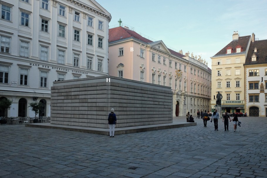
Facing southeast: B, Bohemian Chancellery; J, Jordan House; H, Holocaust memorial; L, Lessing monument. Photo, 20 May 2018.
Where: Judenplatz, in Vienna’s Altstadt.
What: Holocaust Memorial, by Rachel Whiteread (2000).
How do you commemorate or memorialize the absent or missing? How should the void be acknowledged, recognized, and remembered? Does the act of constructing a physical monument “draw a line”, creating a physical manifestation of marking an end that gathers and wipes away all subsequent future responsibility for remembering?
In Vienna’s Old Town, what was unjustly and violently removed from the city’s long historical memory and cultural identity comes into shape at Judenplatz. Under the public square are ruins of the medieval synagogue destroyed in the pogrom of 1421 with hundreds of Jews driven out, hundreds killed by burning, and the community erased. Directly above these ruins is the Holocaust Memorial which attempts to generate experiences and memories to address the void left behind after the systematic murder of 65-thousand people.
I’m looking for a “thousand-year history” in the city of Worms located in southwest Germany. This has nothing to do helminthology or nematology, as the town’s name is derived from “Warmaisa”, the former Jewish name of the city. This is about an important part of Jewish-German history and peaceful coexistence of the Judeo-Christian communities within Europe. The town’s fame and reputation is also partly derived from Martin Luther; I’ve already visited the site where Luther was on trial to answer charges of heresy, as well as the world’s largest Reformation monument.
This part of the Rhein river area is considered the “cradle of European Jewry”, known also as “little Jerusalem on the Rhine.” In medieval times, flourishing Jewish communities in the cathedral cities of Speyer, Worms, and Mainz facilitated the creation of a common Jewish league with the name ShUM (SchUM), spelled out by the first letters of the Hebrew names for the three cities. As emphasis on the influence of Jewish heritage in Europe and the ongoing process of preservation and education, the Holy Sand cemetery is one of four constituents in the newly inscribed UNESCO World Heritage Site (2021).
On a breezy late-autumn afternoon, light fades quick, casting solemn shadows on this ground. In the town’s old Jewish cemetery, I’m the only person present, and I’ve placed a small stone on top of a number of gravestones. I’m surrounded by apparitions over an millennium’s age and by the remaining physical traces in various shapes, stones, and size.

Above/featured: Guided Bauhaus tour stopping momentarily in the Georgengarten.
How times have changed: I wouldn’t have given Dessau a second thought a time ago. But after speaking with representatives from Saxony-Anhalt and after spending a few days in the city, I’ve better understood the historical and cultural significance, and those who feel strongly about culture and history should give Dessau a chance.
Dessau is a German city of about 80-thousand people in the federal state of Saxony-Anhalt, and is known as the second capital of Bauhaus in the early 20th-century movement of modernism for design and architecture which has been given inscription as World Heritage Site.
If you’re in town to check out various Bauhaus sites, there’s a 2nd heritage setting over a vast green space. East of the Bauhaus Masters’ Houses are a set of Roman ruins marking the edge of Georgengarten (George Gardens); further in the park is the Schloss Georgium (Georgium Palace). Since 2000, both Georgengarten and Schloss Georgium are part of the UNESCO World Heritage Site that’s shared with the neighbouring city of Wörlitz.
