Fotoeins Fotografie

location bifurcation, place vs. home

Posts tagged ‘San Francisco’

SF Mission: La Victoria Panadería & Pan de Muerto

Above: “La Victoria” mural painted in 2024 by Timewizard & Tressprays.

There’s something very familiar about a family-run bakery: the look, the warmth, the smell, the taste. As a product of Chinese immigrants and growing up next to (Vancouver’s) Chinatown, I have a very soft spot for their bakeries: every bite of the sweet and the savory are living memories of “home”.

On a wander through San Francisco’s Mission District on All Saints Day (2024), I find myself in front of the mural called “La Victoria” adjacent to the bakery with the same name. My eyes light up at “pan dulce” (pastries). Already aware of the “Día de Muertos” holiday, I turn the corner to see the stack of “sweet bread” in the window display, including the “pan de muerto” (bread for the dead) and the “cross of bones” on top of each “pan”. The holiday is a memorial and celebration of the dead. Small altars accompanied by golden brown pan de meurto and brilliant orange marigolds symbolize the connection between living and dead, allowing the dead to find their way back “home”.

To the amusement of the women behind the counter, I order and hold a pan de muerto in my hand, before digging into the slight crunch of the thin crust, delighting in the sugar sprinkle and orange tang in the glaze, and revelling in the soft interior of the bread. I’m grateful for a small glimpse of traditions in the Mexican-American community.

•   November 1: Día de Todos los Santos, All Saints Day.
•   November 2: Día de los Muertos, Day of the Dead.
•   I’d learn later about the bakery’s journey to its present location.
•   I enjoyed reading about pan dulce and pan de muerto from The Other Side of the Tortilla.


La Victoria PanaderĂ­a, Mission District, San Francisco, California, USA, fotoeins.com

La Victoria PanaderĂ­a.

La Victoria PanaderĂ­a, Mission District, San Francisco, California, USA, fotoeins.com

Pan dulce.

La Victoria PanaderĂ­a, Mission District, San Francisco, California, USA, fotoeins.com

Pan de muerto with the “cross-bones” on top: glorious, delicious.


Location

•   La Victoria: 3249 24th Street (at Capp), since 2019
•   BART lines Blue, Green, Red, or Yellow to station “24th Street Mission”
•   MUNI bus 14 or 14R to stop “Mission Street and 24th Street”
•   MUNI bus 48 or 67 to stop “24th Street & South Van Ness Avenue”

( View this location on OpenStreetMap )

I received neither prior support or post-visit compensation for this content. I’m happy to pay for the pan, and I’m not asking for free pan; what am I: a dum’ colonizer?! I made all images above on 1 Nov 2024 with an iPhone15. This post appears on Fotoeins Fotografie at fotoeins DOT com as https://wp.me/p1BIdT-wl3.

San Francisco: that golden bridge again

Above/featured: In San Francisco Bay on board Golden Gate Ferry westbound to Sausalito, the Golden Gate Bridge traverses over the deep narrow strait called Golden Gate, and connects San Francisco County (left) with Marin County (right). Photo, 18 Mar 2025 (X70).

It’s easy to mistake the association of the bright “international orange” colour of the Golden Gate Bridge with the Golden Gate. The name given to the deep narrow strip of water has much more to do with the Golden Horn in Istanbul. As part of his expeditions and geographic surveys in northern California in the mid-1840s, John Charles Frémont wrote the following for 27 April 1846 (Frémont 1848, pp. 31–33):

… The bay of San Francisco is separated from the sea by low mountain ranges. Looking from the peaks of the Sierra Nevada, the coast mountains present an apparently continuous line, with only a single gap, resembling a mountain pass. This is the entrance to the great bay, and is the only water communication from the coast to the interior country. Approaching from the sea, the coast presents a bold outline. On the south, the bordering mountains come down in a narrow ridge of broken hills, terminating in a precipitous point, against which the sea breaks heavily. On the northern side, the mountain presents a bold promontory, rising in a few miles to a height of two or three thousand feet. Between these points is the strait — about one mile broad, in the narrowest part, and five miles long from the sea to the bay. Passing through this gate,* the bay opens to the right and left, extending in each direction about 35 miles, having a total length of more than 70, and a coast of about 275 miles. It is divided, by straits and projecting points, into three separate bays, of which the northern two are called San Pablo and Suisoon bays.

* Called Chrysopylae (Golden gate) on the map, on the same principle that the harbor of Byzantium (Constantinople afterwards) was called Chrysoceras (golden horn). The form of the harbor, and its advantages for commerce, (and that before it became an entrepot of eastern commerce,) suggested the name to the Greek founders of Byzantium. The form of the entrance into the bay of San Francisco, and its advantages for commerce, (Asiatic inclusive,) suggest the name which is given to this entrance.

Frémont’s description in 1848 is most likely the first documented mention, as San Francisco’s Chrysopylae (golden gate) reminded him of Constantinople’s Chrysoceras (golden horn). Today, the Greek noun has been dropped, and the world recognizes the narrow water entrance into San Francisco Bay simply as “Golden Gate”.


Around the Bay & City

Over a number of months in the Bay Area, I examined many lines of sight to the Golden Gate Bridge. My favourite has to be the Bay ferry between San Francisco and Sausalito.


Crissy Field, Crissy Field Marsh, The Presidio, Golden Gate, Golden Gate Bridge, San Francisco, Bay Area, California, USA, fotoeins.com

Crissy Field Marsh – 31 Oct 2024 (P15).

Fort Mason, Golden Gate, Golden Gate Bridge, San Francisco, Bay Area, California, USA, fotoeins.com

Fort Mason, next to the Great Meadow – 2 Dec 2024 (P15).

Lands End, Golden Gate, Golden Gate Bridge, San Francisco, Bay Area, California, USA, fotoeins.com

Lands End – 3 Dec 2024 (P15).

Treasure Island, Golden Gate Bridge, San Francisco, Bay Area, California, USA, fotoeins.com

In morning light, facing west from Treasure Island – 6 Dec 2024 (P15).

China Beach, Golden Gate, Golden Gate Bridge, San Francisco, Bay Area, California, USA, fotoeins.com

Midday light at China Beach – 6 Dec 2024 (P15).

Golden Gate Bridge Welcome Center, The Presidio, Golden Gate, Golden Gate Bridge, San Francisco, Bay Area, California, USA, fotoeins.com

Dusk from the Golden Gate Bridge Welcome Center – 9 Dec 2024 (P15).

Torpedo Wharf, The Presidio, Golden Gate, Golden Gate Bridge, San Francisco, Bay Area, California, USA, fotoeins.com

Torpedo Wharf – 26 Dec 2024 (P15).

San Francisco National Cemetery, The Presidio, Golden Gate Bridge, San Francisco, Bay Area, California, USA, fotoeins.com

San Francisco National Cemetery, facing northwest – 28 Dec 2024 (P15).

Powell-Hyde cable car turntable, Maritime Park, Aquatic Cove, Golden Gate Bridge, San Francisco, Bay Area, California, USA, fotoeins.com

Powell-Hyde cable car turntable at dawn – 31 Dec 2024 (P15).

Coastal Trail, Lands End, GGNRA, Golden Gate, Golden Gate Bridge, San Francisco, Bay Area, California, USA, fotoeins.com

From the Coastal Trail, east to Lands End. Photo, 5 Jan 2025 (X70).

Hamon Tower, De Young Museum, Golden Gate Park, Golden Gate Bridge, San Francisco, Bay Area, California, USA, fotoeins.com

At upper right, the tops of the bridge towers appear over The Presidio, from de Young Museum’s Hamon Tower – 7 Jan 2025 (P15).

Battery Godfrey, The Presidio, Golden Gate, Golden Gate Bridge, San Francisco, Bay Area, California, USA, fotoeins.com

From Battery Godfrey in The Presidio. Access is from the Coastal Trail or the Golden Gate Bridge Visitor Center. Photo, 13 Jan 2025 (X70).

Twin Peaks, Christmas Tree Point, Golden Gate Bridge, San Francisco, Bay Area, California, USA, fotoeins.com

From Twin Peaks’ Christmas Tree Point, the Golden Gate bridge appears at top-centre; at right are St. Ignatius church and the University of San Francisco campus. Photo, 28 Jan 2025 (P15).

Marina Promenade, The Marina, Golden Gate Bridge, San Francisco, Bay Area, California, USA, fotoeins.com

Marina Promenade – 5 Feb 2025 (P15).

Aquatic Cove, Golden Gate Bridge, San Francisco, Bay Area, California, USA, fotoeins.com

Aquatic Cove: the bridge is almost fully covered in fog. Photo, 16 Feb 2025 (P15).

Emeryville Marina Park, Emeryville, Golden Gate Bridge, San Francisco, Bay Area, California, USA, fotoeins.com

From Emeryville Marina Park: sunset intercepts one of the bridge’s towers – 25 Feb 2025 (P15).

Fort Point, The Presidio, Golden Gate, Golden Gate Bridge, San Francisco, Bay Area, California, USA, fotoeins.com

Underneath the bridge at Fort Point – 28 Feb 2025 (P15).

Fort Point, The Presidio, Golden Gate, Golden Gate Bridge, San Francisco, Bay Area, California, USA, fotoeins.com

Next to the entrance for Fort Point and in front of Golden Gate strait – 28 Feb 2025 (P15).

Baker Beach, Golden Gate, Golden Gate Bridge, San Francisco, Bay Area, California, USA, fotoeins.com

Baker Beach – 11 Mar 2025 (P15).

Richardson Bay, Golden Gate Ferry, Golden Gate, Golden Gate Bridge, San Francisco, Bay Area, California, USA, fotoeins.com

In Richardson Bay, on Golden Gate Ferry westbound to Sausalito. The Sutro Tower also makes an appearance at left. Photo, 18 Mar 2025 (P15).

Battery Marcus Miller, The Presidio, Golden Gate, Golden Gate Bridge, San Francisco, Bay Area, California, USA, fotoeins.com

The Presidio, over Battery Marcus Miller – 26 Mar 2025 (P15).

UCSF Parnassus Heights, Parnassus Heights, Golden Gate Bridge, San Francisco, Bay Area, California, USA, fotoeins.com

From UCSF Parnassus Heights: at left-centre is The Landmark at Presidio (former military hospital), and at upper-right are the towers of the Golden Gate Bridge. Photo, 29 Mar 2025 (P15).

Presidio Tunnel Tops, The Presidio, Golden Gate, Golden Gate Bridge, San Francisco, Bay Area, California, USA, fotoeins.com

From the Tunnel Tops at the Presidio – 31 Mar 2025 (X70).


Sources

•   Fremont, J.C., “Geographical memoir upon upper California, addressed to the Senate of the United States in 1848“, 30th United States Congress, no. 148 (Philadelphia: William McCarty, 1848). Digitized in 2015 by and online access at Internet Archive, via San Francisco Public Library: https://archive.org/stream/geographicalmemo00frmo_0/geographicalmemo00frmo_0_djvu.txt [last accessed May 2025].
•   Fremont, J.C., “Map of Oregon and upper California from the surveys of John Charles FrĂ©mont and other authorities“, U.S. Library of Congress online: https://www.loc.gov/item/79692905/ [last accessed May 2025].

Golden Gate, Charles Preuss, John Charles Frémont, Northern California, San Francisco, Bay Area

Section from Charles Preuss’ 1848 map included with John Charles Frémont’s 1848 memoir of his expeditions into Northern California. Reminding him of the Golden horn in Constantinople, Frémont named the narrow strait into San Francisco Bay as Chrysopylae or “Golden Gate”.


I made all photos above between 31 October 2024 and 31 March 2025 with a Fujifilm X70 fixed-lens prime (X70) and an iPhone15 (P15). I received neither request nor compensation for the content described here. This post appears on Fotoeins Fotografie at fotoeins DOT com as https://wp.me/p1BIdT-uS3.

San Francisco: Sam Wo tradition near the close

(Chinatown)

If a place provides repeatedly good reminders of personal cultural heritage through food, my expectation is one of a long-standing nature to the point of being eternal. But human beings are temporal and ephemeral, and this fact of nature must unfortunately extend to human institutions.

At address 713 Clay (near Kearny), Sam Wo (三和)* is a restaurant in San Francisco, operating as one of the oldest restaurants in the city’s Chinatown. The present owners have retired, their adult children are moving on, and the new ownership has put the future of the restaurant in question. The final day of operations is 27 January 2025, only a handful of days before Chinese New Year. Perhaps it’ll be a pause. And perhaps it’ll be gone.

I’d done my research prior to arrival, only to discover within weeks the restaurant would soon be closed. In the remaining weeks surrounding the Christmas and New Year’s holidays, I promised myself at least one visit to Sam Wo each week until the end: that their excellent “wok6 hei3” (鑊氣) is no hindrance but an encouragement. The quality of their “stir fry essence” means every meal is delicious, with every bite and flavour pointing directly to memories of an upbringing raised by immigrant parents from China’s southern province of Canton and a big chunk of time spent walking and eating within Vancouver’s Chinatown in the 1970s and 80s.

I haven’t been here in the Bay Area very long, but in Sam Wo, I found a place a little like home, where I could also polish my rust in Cantonese (廣東話) and Toisan/Hoisan (台山語). I’ll be sad to see them go, and melt away into the annals of San Francisco’s much-storied Chinatown.

* The full name for Sam Wo is 三和粥粉麵, (read here left to right) whose first 2 characters represent “three harmonies” for congee (粥), broad flat rice noodles (粉), and thin egg noodles (麵). Historically, Chinese was written right to left.

The place, the food …

2025 postscript: there are new owners, and the new re-opening is Friday, September 5.

Read more
SFO International Terminal, Wikipedia by user Coolcaesar, CC3 license, fotoeins.com

47 hours of travel, 10600 km door-to-door

A trip from North America to Chile typically takes 24 to 30 hours door-to-door, depending upon connections at a hub airport. The following is a tale of 47 hours of travel, from San Francisco, California to La Serena, Chile.

Thursday, January 13, 2011

1030h PST (GMT-8), East Bay:

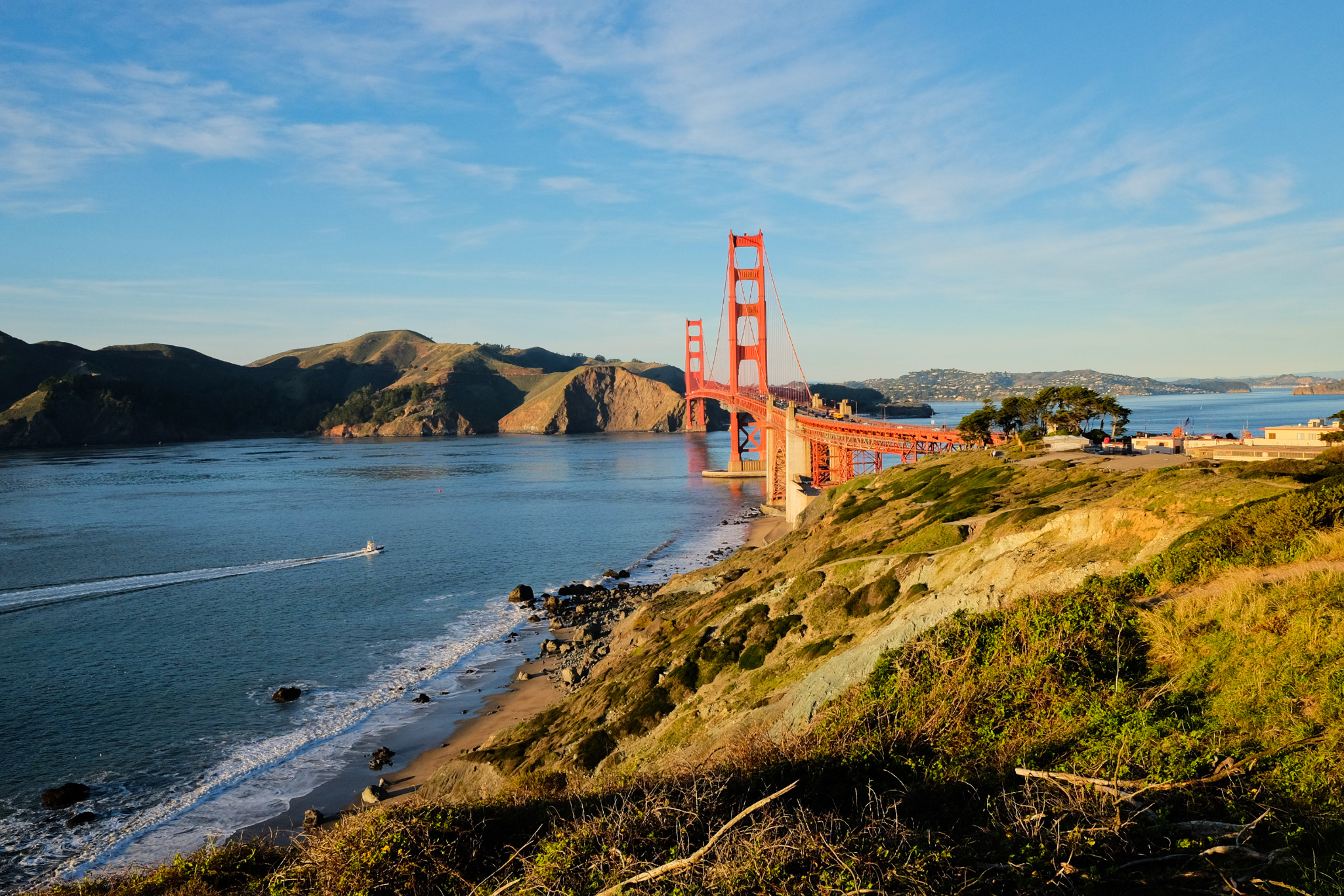
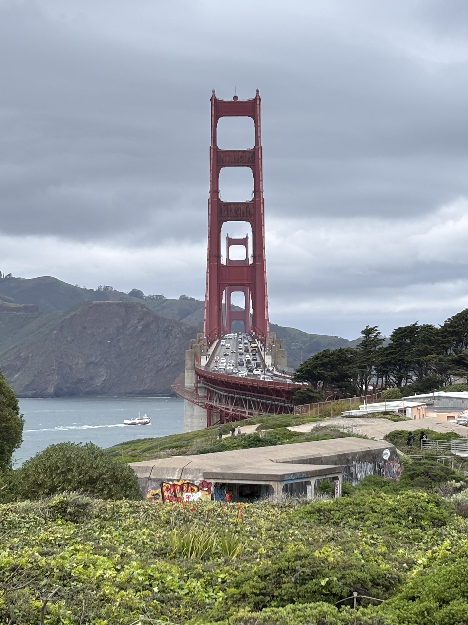
BART from El Cerrito Plaza to SFO.  There’s a lot to like about BART rapid-transit, especially when the train goes through the tunnel beyond San Bruno and comes out onto a thin cement viaduct which appears to hang gingerly over US-101/Bayshore Freeway.

1230h PST, San Francisco Airport (SFO):

plane is late; scheduled departure delayed by 30 min.  It’s raining and the ceiling or cloud-deck is low over San Francisco airport – no big surprise there.

1400h PST, SFO:

after some problems which had nothing to do with the plane itself, flight leaves 45 min late.  No problem; I’ve a scheduled 2.5-hour layover in Dallas.

1600h PST, in the air over eastern California:

plane descends below cruising altitude, we’re told we’ve got a problem with cabin pressure, and we’re landing in Las Vegas.  No oxygen masks were deployed, and everybody was calm and breathing normally.

1645h MST (GMT-8), Las Vegas McCarran Airport (LAS):

Checkmark one – plane lands safely at Las Vegas airport.  The pilot explains there was slow pressure leakage, but they couldn’t localize the origin; for safety reasons, the pilot decided to descend and land.  All pax are asked to leave the plane, as firemen/safety crew board the plane.  Checkmark two – we get to leave the plane, and everyone’s in the terminal.

1730h MST, LAS:

I call American Airlines’ call center to find out if there are other options, but since I checked luggage, the agent advises best to stay put and see what happens.  Besides, the daily AA945 DFW to SCL flight, which usually leaves at 9pm from Dallas and I thought I was going to miss, has been delayed by 11 hours to 8am the following morning.   Someone comments that it’s a holiday weekend in the U.S. about which I had completely forgotten.  Swell.

1930h MST, LAS:

after a couple of hours of increasingly cautious optimism, we’ve the green light to fly onto DFW. We’re asked to board the plane “quickly”, as the present crew is about to reach their time-limit.

2030h MST, somewhere between Arizona and Texas : … zzzzz …

2330h CST (GMT-6), Dallas-Ft. Worth Airport (DFW):

plane lands at Dallas Fort-Worth airport.  Pax are given hotel/meal vouchers, and the weary folks pile into shuttles, and pour out into the lobby of the Ramada (DFW North).  Oh look, there’s a Denny’s, but I’m too tired to even think about chicken-fried steak and a milkshake. I’ll be up at 0530h to catch the 0615h morning shuttle back to DFW to see if I can catch my delayed morning-flight to SCL …

Friday, January 14

0630h CST, DFW:

Time to check in.  The nice agent says my DFW-SCL portion was canceled when I called American Airlines call center from Las Vegas last night.  Yikes.  “No worry”, she says.  She calls a couple of people to get the proper seating codes, and she calmly types away, trying to insert my two final flight segments ‘back’ into the itinerary.  After about 15 minutes, there’s an “aha!” from her side of the counter, and I sigh with relief.

0830h CST, DFW:

Flight AA945 is on its way to Santiago de Chile.  It’s just another step forward, even if the “step” is 7800 kilometres in distance. Completely uneventful flight, and zzzzz …

2015h CLST (GMT-3), Aeropuerto Santiago de Chile (SCL):

Usually, flight AA945 is an overnight flight which arrives in Santiago after sunrise. The 11.5-hour delay has flipped the script. With a beautiful orange-hue to the early-evening summer sky, the plane lands safely in Santiago airport. Border control is a breeze (with my Chilean work visa), and my luggage is already on the carousel. So far, so good. My work-colleague P was also on the Dallas-Santiago flight, and thanks to his vastly superior Spanish, we try to get the attention of an AA agent to see if we can get our hotel/meal vouchers, because there’s no way we’re flying to La Serena tonight.  An agent tells us his colleague will be on their way shortly.  We head on over to the AA counter near the luggage carousels.  Another agent comes by about 15 minutes later, and asks us to wait in the terminal land-side, outside customs control.  Customs is a breeze, because I declared my one jar of strawberry jam : no granola, seeds, or turtle-shells.  And then we wait, and we wait some more …

2145h CLST, SCL:

The second AA agent finally appears with our hotel/meal/travel vouchers, and we find out we’re staying at the Sheraton San Cristobal on the southeastern flank of the hill at the edge of Bellavista in Santiago.  We get our shuttle-vouchers verified, and we get multiple slips of paper for our shuttles to and from the hotel.

2230h CLST, SCL:

After the usual wait about what shuttle we’re taking and about how full our shuttle is going to be, our vehicle finally leaves the airport.  As there are three other pax in the shuttle, I tell P we’re probably going to be last.   I was so happy to be wrong as …

2250h CLST, Providencia, Santiago:

… we’re dropped off first, and we arrive in the hotel to check-in.  I ask the gentleman at the hotel counter if we can use our meal voucher at one of the hotel restaurants. No, unfortunately, the restaurants are closing in 5 minutes, but the bar is available. OK, whatever : dump stuff in room, head to the bar, please give me a burger, fries, beer. Eat, drink, be merry … zzzzzz …

Saturday, January 15

1030h CLST, Providencia, Santiago:

Up at 10am, pack what little I unpacked.  After check-out, I finally get to see how the hotel appears in daylight – not bad, very fancy – nice pool, too, and are … those … Argentinian/Brazilian pool-bunnies? Sadly, before I learn the answer to this very important question, the shuttle arrives to take me back to SCL airport.

1200h CLST, SCL:

At Starbuck’s in the airport’s national terminal for their free WiFi, I’ve begun collecting notes to write this story of hilarity.

1400h CLST, LSC (La Serena Airport):

Flight LA312 arrives in LSC early. At the 47th hour of travel, I’m in the apartment at long last: unwrapping, unpacking. I head outside to my green front-lawn, looking up into that bright glowing ball high in the sky. The sky is clear and blue, there’s a slight breeze off the Pacific, and the air temperature on this summer afternoon is a very usable +22C/72F. With a beer in hand, I finally begin to unwind, over 48 hours after leaving my friends’ home in the East Bay.

Great Circle Mapper

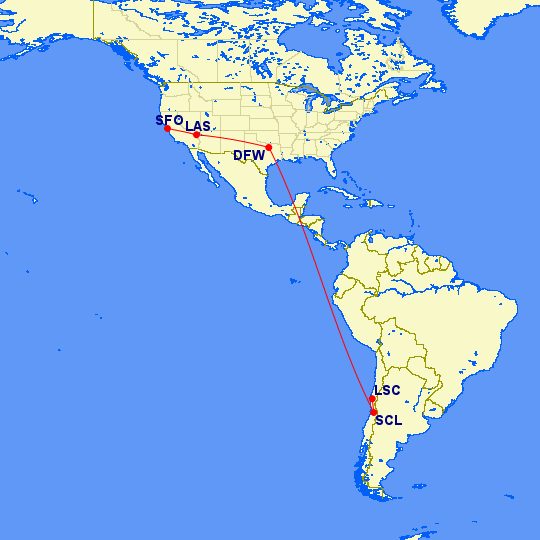
SFO-LAS, LAS-DFW, DFW-SCL, SCL-LSC.

LAN plane on tarmac, LSC airport, fotoeins.com

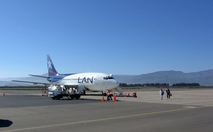
LAN plane on tarmac, at La Serena airport (LSC).

Less than 24 hours after my return to La Serena, I’ve hopped onto a shuttle, heading up to Cerro Pachon. The mountain is at an elevation of 2800 metres (9000 feet) in the lower Andes, and I’m at the telescope to begin my nighttime duty-function shift for a number of nights. Them’s the breaks, and time to get right back to work, and tackle the 500+ messages in my work mailbox …


This post was originally posted 17 January 2011, and appears on Fotoeins Fotopress at fotoeins DOT com as http://wp.me/p1BIdT-T.