Fotoeins Fotografie

location bifurcation, place & home

Posts tagged ‘Deutsche Teilung’

Festival of Lights, Potsdamer Platz, Mauerfall, Berliner Mauer, Berlin Wall, Fall of the Wall, Berlin, Germany, Deutschland, fotoeins.com

Fotoeins Friday: 30 years after the fall of the Wall, 5 of 5

November 2019 marks the 30th anniversary of the fall of the Berlin- and inner-German wall.

With the annual Festival of Lights casting colour and patterns, I’m standing next to the first ever traffic signal in Germany (1924), just out of view to the left. What’s highlighted is a stripe on the pavement through the centre of the frame, with the camera view south to the south entrance to Potsdamer Platz train station. The imbedded brick stripe marks the former location of the “Vorderlandmauer“, the forward or boundary wall immediately next to West Berlin). Left of the stripe would have been East Berlin; to the right, West Berlin.

I made the image above on 14 October 2017 with a Canon 6D mark 1 and the following settings: 1/50-sec, f/4, ISO10000, and 24mm focal length. This post appears on Fotoeins Fotografie at fotoeins DOT com as https://wp.me/p1BIdT-fdf.


Location

The first map section from berlin.de shows my location and image perspective with a black asterisk and black arrow, respectively, with additional parts labeled: Vorderlandmauer (boundary or outer wall) which was often but not always coincident with the “politische Grenze” (political border) between West and East Berlin, Grenzstreifen (border control zone), and Hinterlandmauer (hinterland or inner wall). West Berlin is to the left of the red line, and East Berlin is to the right of the blue line. The second map section below is clickable via Google Maps.

Berliner Mauer, Potsdamer Platz, Berlin.de

Berliner Mauer, Potsdamer Platz: berlin.de.

Nordbahnhof, Bernauer Strasse, Mauerfall, Berliner Mauer, Berlin Wall, Fall of the Wall, Berlin, Germany, Deutschland, fotoeins.com

Fotoeins Friday: 30 years after the fall of the Wall, 4 of 5

November 2019 marks the 30th anniversary of the fall of the Berlin- and inner-German wall.

Facing south, corner of Julie-Wolfthorn-Strasse and Gartenstrasse:

The brick and metal stripe in the pavement lies between S-Bahn station Nordbahnhof (green “S”) and the Visitor Centre for the Berlin Wall Memorial at Bernauer Strasse (beyond the image frame). East- and West-Berlin would have been on the left and right of the stripe, respectively. The stripe delineates the path of the former Berlin Wall which divided the city and represented a sort of “landmark” and “status quo” for the Cold War over a 28-year period between 1961 and 1989. Construction of the Berlin Wall began quietly and without warning just after midnight on 13 August 1961. The Wall fell 28 years later on 9 November 1989.

I made the image above on 6 December 2014 with a Canon 6D mark1 and the following settings: 1/200-sec, f/9, ISO2000, and 28mm focal length. This post appears on Fotoeins Fotografie at fotoeins DOT com as https://wp.me/p1BIdT-fdE.


Location

The first map section from berlin.de shows my location and image perspective with a black asterisk and black arrow, respectively, with additional parts labeled: Vorderlandmauer (boundary or outer wall) which was often but not always coincident with the “politische Grenze” (political border) between West and East Berlin, Grenzstreifen (border control zone), and Hinterlandmauer (hinterland or inner wall). West Berlin is above the red line, and East Berlin is below the blue line. The second map section below is clickable via Google Maps.

Berliner Mauer, Nordbahnhof, Berlin.de

Berliner Mauer, Nordbahnhof: berlin.de.

Gedenkstätte Berliner Mauer, Berlin Wall Memorial, Bernauer Strasse, Berlin, Hauptstadt, Mauerfall, Fall of the Wall, Berlin Wall, Berliner Mauer, Germany, Deutschland, fotoeins.com

Fotoeins Friday: 30 years after the fall of the Wall, 3 of 5

November 2019 marks the 30th anniversary of the fall of the Berlin- and inner-German wall.

This green space at the Berlin Wall Memorial looks harmless through a present-day perspective, but this so-called “security wall” was meant to prevent people from leaving. Not only was there a wall at the boundary between East Berlin and West Berlin, there was a 2nd inner wall on the East Berlin side, because East Berlin and East German authorities really meant to keep their citizens contained. I’m standing in what would’ve been the “Grenzstreifen” (border strip) or “Todesstreifen” (death strip).

I made the image above on 19 October 2012 with a Canon 450D and the following settings: 1/320-sec, f/8, ISO200, and 18mm focal length (29mm full-frame equivalent). This post appears on Fotoeins Fotografie at fotoeins DOT com as https://wp.me/p1BIdT-f9R.


Location

The first map section from berlin.de shows my location and image perspective with a black asterisk and black arrow, respectively, with additional parts labeled: Vorderlandmauer (boundary or outer wall) which was often but not always coincident with the “politische Grenze” (political border) between West and East Berlin, Grenzstreifen (border control zone), and Hinterlandmauer (hinterland or inner wall). West Berlin is to the left of the red line, and East Berlin is to the right of the blue line. The second map section below is clickable via Google Maps.

Berliner Mauer, Bernauer Strasse, Berlin.de


Gedenkstätte Berliner Mauer, Berlin Wall Memorial, Bernauer Strasse, Berlin, Hauptstadt, Mauerfall, Fall of the Wall, Berlin Wall, Berliner Mauer, Germany, Deutschland, fotoeins.com

Fotoeins Friday: 30 years after the fall of the Wall, 2 of 5

November 2019 marks the 30th anniversary of the fall of the Berlin- and inner-German wall.

At Bernauer Strasse, the former death strip at the Berlin Wall Memorial has been converted to a green space for remembrance and contemplation. In the days of separation, unauthorized entry into this space was met with gunfire without warning by border guards who had “shoot to kill” orders. A row of red bars highlights the former course of the Wall, and I’m standing what would’ve been “no man’s land” or the “death strip”. The cylindrical structure at right-centre is the Versöhnungskapelle or Reconciliation Chapel to mark the former location of the former Church of Reconciliation which was demolished in 1985 because the structure was in the “death strip” area for the Berlin Wall.

I made the image above on 19 October 2012 with a Canon 450D and the following settings: 1/400-sec, f/8, ISO200, 18mm focal length (29mm full-frame equivalent). This post appears on Fotoeins Fotografie at fotoeins DOT com as https://wp.me/p1BIdT-f9J.


Location

The first map section from berlin.de shows my location and image perspective with a black asterisk and black arrow, respectively, with additional parts labeled: Vorderlandmauer (boundary or outer wall) which was often but not always coincident with the “politische Grenze” (political border) between West and East Berlin, Grenzstreifen (border control zone), and Hinterlandmauer (hinterland or inner wall). West Berlin is above the red line, and East Berlin is below the blue line. The second map section below is clickable via Google Maps.

Berliner Mauer, Bernauer Strasse, Versöhnungskapelle, Berlin.de


Platz des 9. November 1989, Boesebruecke, Bornholmer Strasse, S Bornholmer Strasse, S-Bahn Berlin, Berliner Mauer, Berlin Wall, Berlin, Hauptstadt, Germany, fotoeins.com

Fotoeins Friday: 30 years after the fall of the Wall, 1 of 5

November 2019 marks the 30th anniversary of the fall of the Berlin- and inner-German wall.

One of the first places where people broke through the Wall was at Berlin’s Bornholmer Strasse crossing. On the former East Berlin side is the Platz des 9. November 1989 (9th of November 1989 Plaza or Square) with former sections of the wall and information panels and displays describing the timeline and events of the historic evening.

I made the image above on 8 May 2015 with a Canon 6D mark1 and the following settings: 1/1000-sec, f/11, ISO1000, 32mm focal length. This post appears on Fotoeins Fotografie at fotoeins DOT com as https://wp.me/p1BIdT-f9A.


Location

The first map section from berlin.de shows my location and image perspective with a black asterisk and black arrow, respectively, with additional parts labeled: Vorderlandmauer (boundary or outer wall) which was often but not always coincident with the “politische Grenze” (political border) between West and East Berlin, Grenzstreifen (border control zone), and Hinterlandmauer (hinterland or inner wall). West Berlin is to the left of the red line, and East Berlin is to the right of the blue line. The second map section below is clickable via Google Maps.

Berliner Mauer, Bornholmer Strasse, Berlin.de

Berliner Mauer, Bornholmer Strasse: berlin.de.

My Berlin: Bornholmer Strasse, first through the Wall

By today’s appearance, it’s easy to overlook the bridge at Bornholmer Strasse (also known as Bösebrücke) as an historic landmark. On the night of 9 November 1989, the Berlin Wall opened here first, at the Bornholmer Strasse bridge border-crossing between East Berlin and West Berlin.


( Click here for images and more )

Berlin Wall fragment, Niederkirchnerstrasse, fotoeins.com

Fotoeins Friday: downfall, the Berlin Wall

Here along Niederkirchnerstrasse is a 200-metre stretch of the Berlin Wall (Berliner Mauer), marking the former border between Berlin-Mitte (East Berlin) and Kreuzberg (West Berlin). In the foreground is the Topography of Terror museum. The neo-Renaissance building behind the wall is the Abgeordnetenhaus or the State Parliament building for the city-state of Berlin. Rising in the background at Potsdamer Platz are two skyscrapers: Kohlhoff Tower on the left, and the Deutsche Bahn headquarters on the right.

9 November 2014 marks the 25th anniversary of the fall of the Berlin Wall. In the second map below, the thick red border marks the extent for West Berlin, which from 1961 to 1989, was an island in the sea of East Germany.

I made the photo above of the Wall section on Niederkirchnerstrasse on 18 March 2011 with the Canon EOS450D (XSi) camera, 50-prime, and the following settings: 1/80s, f/5, ISO100, 50mm focal length (80mm full-frame equivalent). This post appears on fotoeins DOT com as http://wp.me/p1BIdT-5wc.

Pavement marker Niederkirchnerstrasse, between Martin-Gropius Bau & Topographie des Terrors, Berlin, Germany - 2. Okt. 2009

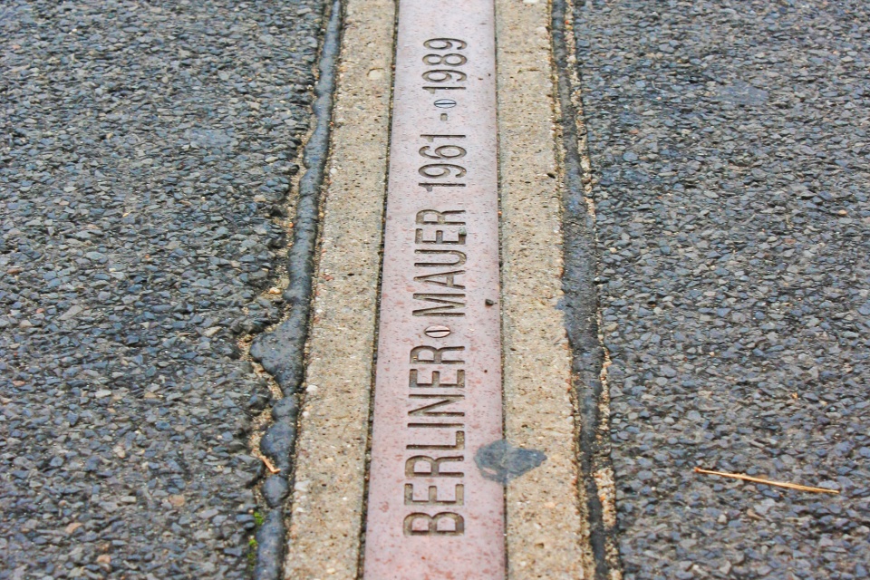
The Berlin Wall, 1961-1989

Some view East Germany (GDR/DDR) with great fondness, if it’s a comparison made between today with the “good old days.” I’m not interested in the “Ostalgie” (nostalgia for the former east). I’m interested in learning how a system in place does a gradual creep, takes over a country and her people. Before they realize what’s happening, their own government has locked them inside the borders to prevent them from leaving; get caught trying to escape near the border, and you’ll be shot for your trouble.

“No intention to build a wall …”

On 15 June 1961, when asked at a press conference if a wall would be erected between west and east Berlin, Walter Ulbricht, leader of the GDR’s only recognized political party, the Socialist Unity Party of Germany (Sozialistische Einheitspartei Deutschlands), answered:

“Die Bauarbeiter unserer Hauptstadt beschäftigen sich hauptsächlich mit Wohnungsbau, und ihre Arbeitskraft wird dafür voll eingesetzt. Niemand hat die Absicht, eine Mauer zu errichten.”

“Construction workers in our capital city are fully engaged in residential construction, and the labour force is deployed for that purpose. No one has any intention of putting up a wall.”

(Chronik der Mauer | YouTube )

Privately, Ulbricht had already been pushing hard to build a wall to stop the increasing number of people leaving East Germany for the West. Building a wall would also strengthen the (buffer) position of East Germany within the developing Soviet satellite-empire.

Two months later at midnight on August 13, work began quietly on a wall, and orders were given for additional troops to guard and “protect” the border. Berliners awoke at daybreak to a divided city.

( Click here for more )

%d bloggers like this: