Fotoeins Fotografie

location bifurcation, place vs. home

Posts tagged ‘Area de la Bahia de San Francisco’

25 for 25: fotoeins fotos in 2025

Above/featured: “Göttin” (goddess), by AlfAlfA, also known as Nicolás Sánchez, for One Wall 2017. Photo, 17 Jun 2025 (P15).

In continuation of high spirits and enthusiastic support of leading choices, I’m very grateful to significant time spent:

  • in the Bay Area, to visit mum’s family in Sacramento and long-time friends in the South Bay;
  • in Vienna for the 4th consecutive summer; and
  • in Berlin for the 1st time in 4 years, as set up for a repeat in the new year.


( Click here for images and more )

SF Mission: La Victoria Panadería & Pan de Muerto

Above: “La Victoria” mural painted in 2024 by Timewizard & Tressprays.

There’s something very familiar about a family-run bakery: the look, the warmth, the smell, the taste. As a product of Chinese immigrants and growing up next to (Vancouver’s) Chinatown, I have a very soft spot for their bakeries: every bite of the sweet and the savory are living memories of “home”.

On a wander through San Francisco’s Mission District on All Saints Day (2024), I find myself in front of the mural called “La Victoria” adjacent to the bakery with the same name. My eyes light up at “pan dulce” (pastries). Already aware of the “Día de Muertos” holiday, I turn the corner to see the stack of “sweet bread” in the window display, including the “pan de muerto” (bread for the dead) and the “cross of bones” on top of each “pan”. The holiday is a memorial and celebration of the dead. Small altars accompanied by golden brown pan de meurto and brilliant orange marigolds symbolize the connection between living and dead, allowing the dead to find their way back “home”.

To the amusement of the women behind the counter, I order and hold a pan de muerto in my hand, before digging into the slight crunch of the thin crust, delighting in the sugar sprinkle and orange tang in the glaze, and revelling in the soft interior of the bread. I’m grateful for a small glimpse of traditions in the Mexican-American community.

•   November 1: Día de Todos los Santos, All Saints Day.
•   November 2: Día de los Muertos, Day of the Dead.
•   I’d learn later about the bakery’s journey to its present location.
•   I enjoyed reading about pan dulce and pan de muerto from The Other Side of the Tortilla.


La Victoria Panadería, Mission District, San Francisco, California, USA, fotoeins.com

La Victoria Panadería.

La Victoria Panadería, Mission District, San Francisco, California, USA, fotoeins.com

Pan dulce.

La Victoria Panadería, Mission District, San Francisco, California, USA, fotoeins.com

Pan de muerto with the “cross-bones” on top: glorious, delicious.


Location

•   La Victoria: 3249 24th Street (at Capp), since 2019
•   BART lines Blue, Green, Red, or Yellow to station “24th Street Mission”
•   MUNI bus 14 or 14R to stop “Mission Street and 24th Street”
•   MUNI bus 48 or 67 to stop “24th Street & South Van Ness Avenue”

( View this location on OpenStreetMap )

I received neither prior support or post-visit compensation for this content. I’m happy to pay for the pan, and I’m not asking for free pan; what am I: a dum’ colonizer?! I made all images above on 1 Nov 2024 with an iPhone15. This post appears on Fotoeins Fotografie at fotoeins DOT com as https://wp.me/p1BIdT-wl3.

San Francisco: that golden bridge again

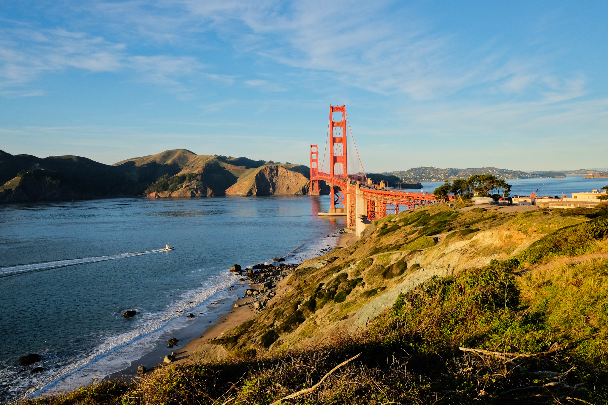
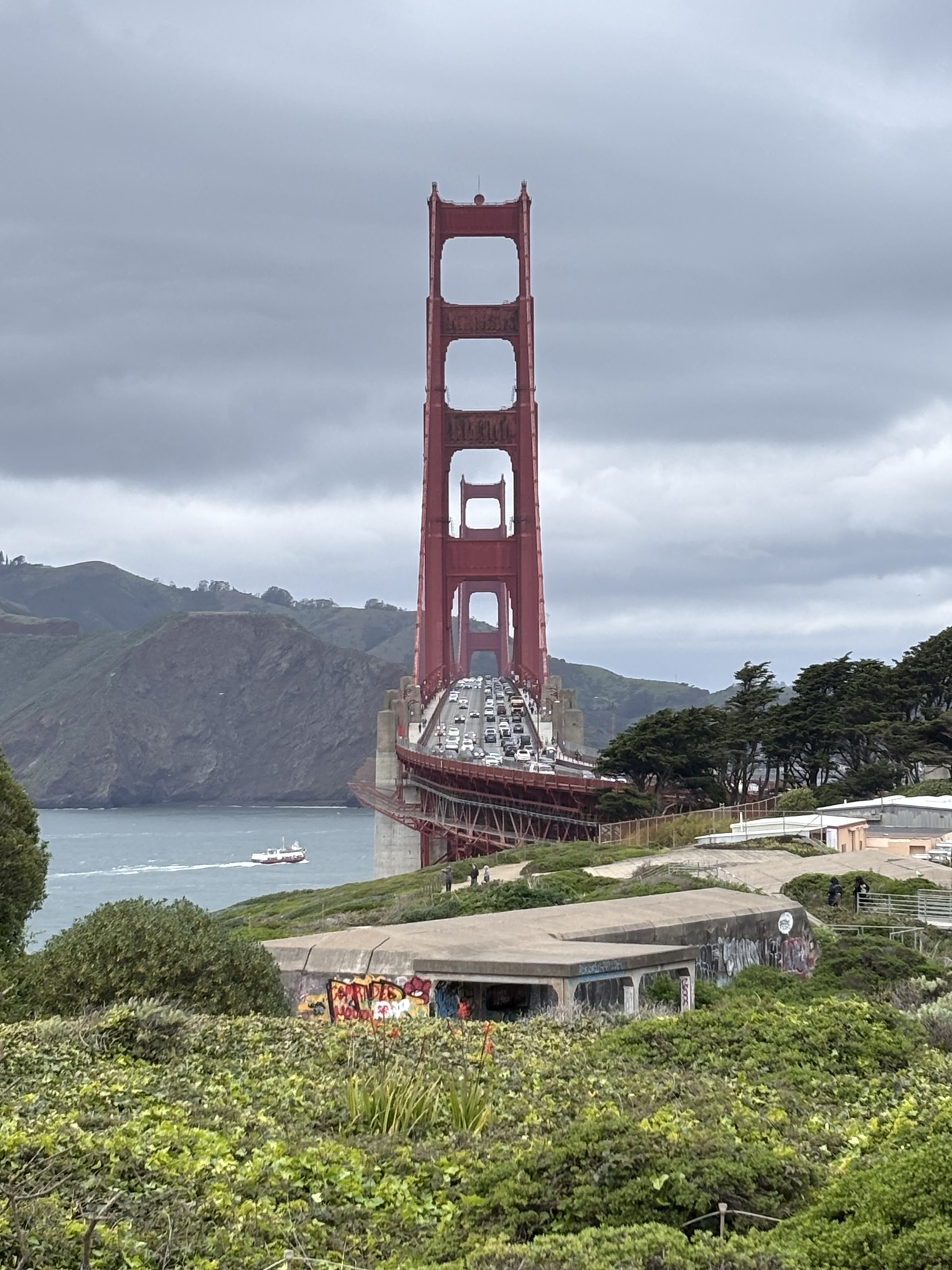
Above/featured: In San Francisco Bay on board Golden Gate Ferry westbound to Sausalito, the Golden Gate Bridge traverses over the deep narrow strait called Golden Gate, and connects San Francisco County (left) with Marin County (right). Photo, 18 Mar 2025 (X70).

It’s easy to mistake the association of the bright “international orange” colour of the Golden Gate Bridge with the Golden Gate. The name given to the deep narrow strip of water has much more to do with the Golden Horn in Istanbul. As part of his expeditions and geographic surveys in northern California in the mid-1840s, John Charles Frémont wrote the following for 27 April 1846 (Frémont 1848, pp. 31–33):

… The bay of San Francisco is separated from the sea by low mountain ranges. Looking from the peaks of the Sierra Nevada, the coast mountains present an apparently continuous line, with only a single gap, resembling a mountain pass. This is the entrance to the great bay, and is the only water communication from the coast to the interior country. Approaching from the sea, the coast presents a bold outline. On the south, the bordering mountains come down in a narrow ridge of broken hills, terminating in a precipitous point, against which the sea breaks heavily. On the northern side, the mountain presents a bold promontory, rising in a few miles to a height of two or three thousand feet. Between these points is the strait — about one mile broad, in the narrowest part, and five miles long from the sea to the bay. Passing through this gate,* the bay opens to the right and left, extending in each direction about 35 miles, having a total length of more than 70, and a coast of about 275 miles. It is divided, by straits and projecting points, into three separate bays, of which the northern two are called San Pablo and Suisoon bays.

* Called Chrysopylae (Golden gate) on the map, on the same principle that the harbor of Byzantium (Constantinople afterwards) was called Chrysoceras (golden horn). The form of the harbor, and its advantages for commerce, (and that before it became an entrepot of eastern commerce,) suggested the name to the Greek founders of Byzantium. The form of the entrance into the bay of San Francisco, and its advantages for commerce, (Asiatic inclusive,) suggest the name which is given to this entrance.

Frémont’s description in 1848 is most likely the first documented mention, as San Francisco’s Chrysopylae (golden gate) reminded him of Constantinople’s Chrysoceras (golden horn). Today, the Greek noun has been dropped, and the world recognizes the narrow water entrance into San Francisco Bay simply as “Golden Gate”.


Around the Bay & City

Over a number of months in the Bay Area, I examined many lines of sight to the Golden Gate Bridge. My favourite has to be the Bay ferry between San Francisco and Sausalito.


Crissy Field, Crissy Field Marsh, The Presidio, Golden Gate, Golden Gate Bridge, San Francisco, Bay Area, California, USA, fotoeins.com

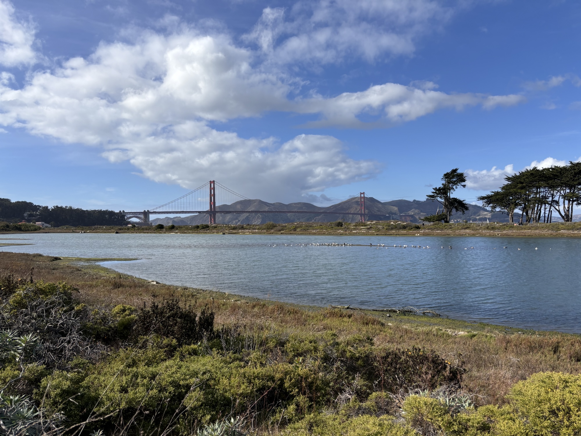
Crissy Field Marsh – 31 Oct 2024 (P15).

Fort Mason, Golden Gate, Golden Gate Bridge, San Francisco, Bay Area, California, USA, fotoeins.com

Fort Mason, next to the Great Meadow – 2 Dec 2024 (P15).

Lands End, Golden Gate, Golden Gate Bridge, San Francisco, Bay Area, California, USA, fotoeins.com

Lands End – 3 Dec 2024 (P15).

Treasure Island, Golden Gate Bridge, San Francisco, Bay Area, California, USA, fotoeins.com

In morning light, facing west from Treasure Island – 6 Dec 2024 (P15).

China Beach, Golden Gate, Golden Gate Bridge, San Francisco, Bay Area, California, USA, fotoeins.com

Midday light at China Beach – 6 Dec 2024 (P15).

Golden Gate Bridge Welcome Center, The Presidio, Golden Gate, Golden Gate Bridge, San Francisco, Bay Area, California, USA, fotoeins.com

Dusk from the Golden Gate Bridge Welcome Center – 9 Dec 2024 (P15).

Torpedo Wharf, The Presidio, Golden Gate, Golden Gate Bridge, San Francisco, Bay Area, California, USA, fotoeins.com

Torpedo Wharf – 26 Dec 2024 (P15).

San Francisco National Cemetery, The Presidio, Golden Gate Bridge, San Francisco, Bay Area, California, USA, fotoeins.com

San Francisco National Cemetery, facing northwest – 28 Dec 2024 (P15).

Powell-Hyde cable car turntable, Maritime Park, Aquatic Cove, Golden Gate Bridge, San Francisco, Bay Area, California, USA, fotoeins.com

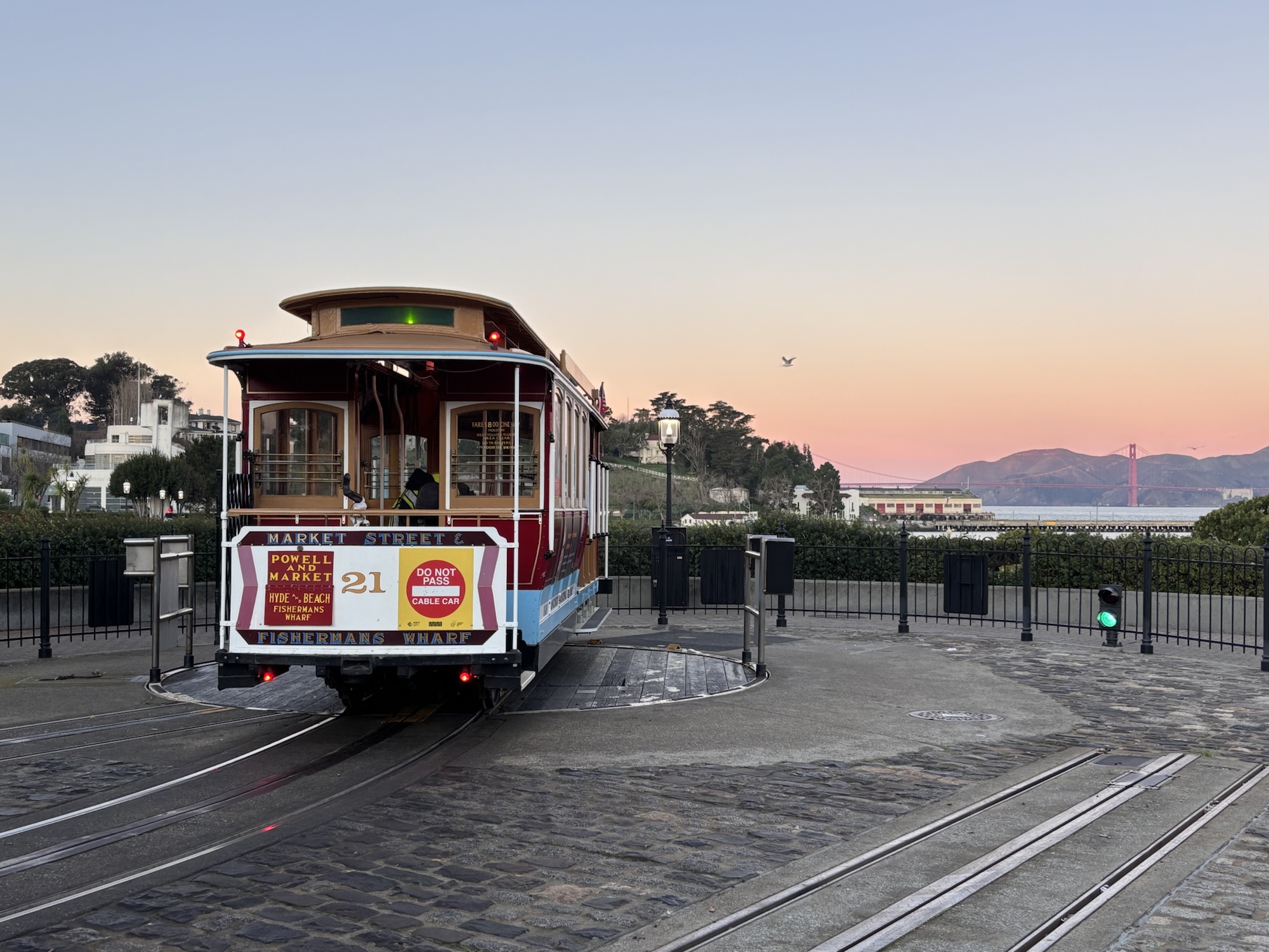
Powell-Hyde cable car turntable at dawn – 31 Dec 2024 (P15).

Coastal Trail, Lands End, GGNRA, Golden Gate, Golden Gate Bridge, San Francisco, Bay Area, California, USA, fotoeins.com

From the Coastal Trail, east to Lands End. Photo, 5 Jan 2025 (X70).

Hamon Tower, De Young Museum, Golden Gate Park, Golden Gate Bridge, San Francisco, Bay Area, California, USA, fotoeins.com

At upper right, the tops of the bridge towers appear over The Presidio, from de Young Museum’s Hamon Tower – 7 Jan 2025 (P15).

Battery Godfrey, The Presidio, Golden Gate, Golden Gate Bridge, San Francisco, Bay Area, California, USA, fotoeins.com

From Battery Godfrey in The Presidio. Access is from the Coastal Trail or the Golden Gate Bridge Visitor Center. Photo, 13 Jan 2025 (X70).

Twin Peaks, Christmas Tree Point, Golden Gate Bridge, San Francisco, Bay Area, California, USA, fotoeins.com

From Twin Peaks’ Christmas Tree Point, the Golden Gate bridge appears at top-centre; at right are St. Ignatius church and the University of San Francisco campus. Photo, 28 Jan 2025 (P15).

Marina Promenade, The Marina, Golden Gate Bridge, San Francisco, Bay Area, California, USA, fotoeins.com

Marina Promenade – 5 Feb 2025 (P15).

Aquatic Cove, Golden Gate Bridge, San Francisco, Bay Area, California, USA, fotoeins.com

Aquatic Cove: the bridge is almost fully covered in fog. Photo, 16 Feb 2025 (P15).

Emeryville Marina Park, Emeryville, Golden Gate Bridge, San Francisco, Bay Area, California, USA, fotoeins.com

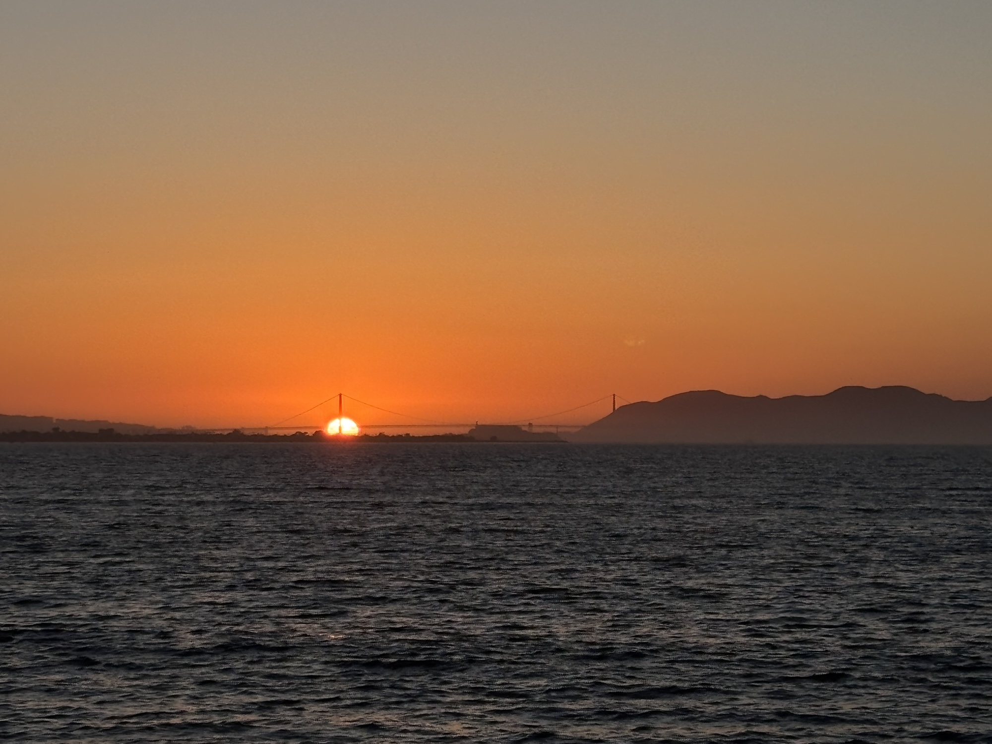
From Emeryville Marina Park: sunset intercepts one of the bridge’s towers – 25 Feb 2025 (P15).

Fort Point, The Presidio, Golden Gate, Golden Gate Bridge, San Francisco, Bay Area, California, USA, fotoeins.com

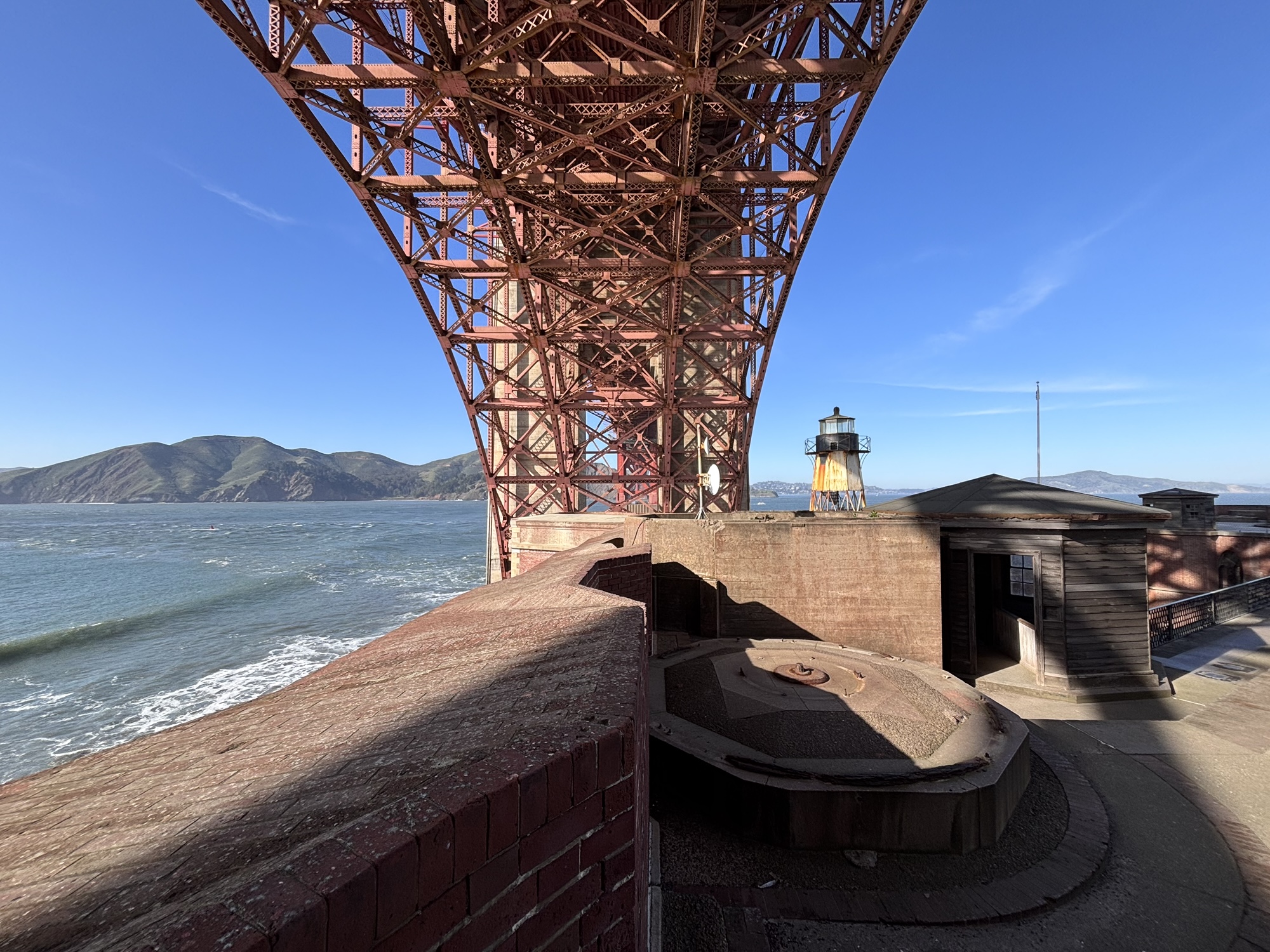
Underneath the bridge at Fort Point – 28 Feb 2025 (P15).

Fort Point, The Presidio, Golden Gate, Golden Gate Bridge, San Francisco, Bay Area, California, USA, fotoeins.com

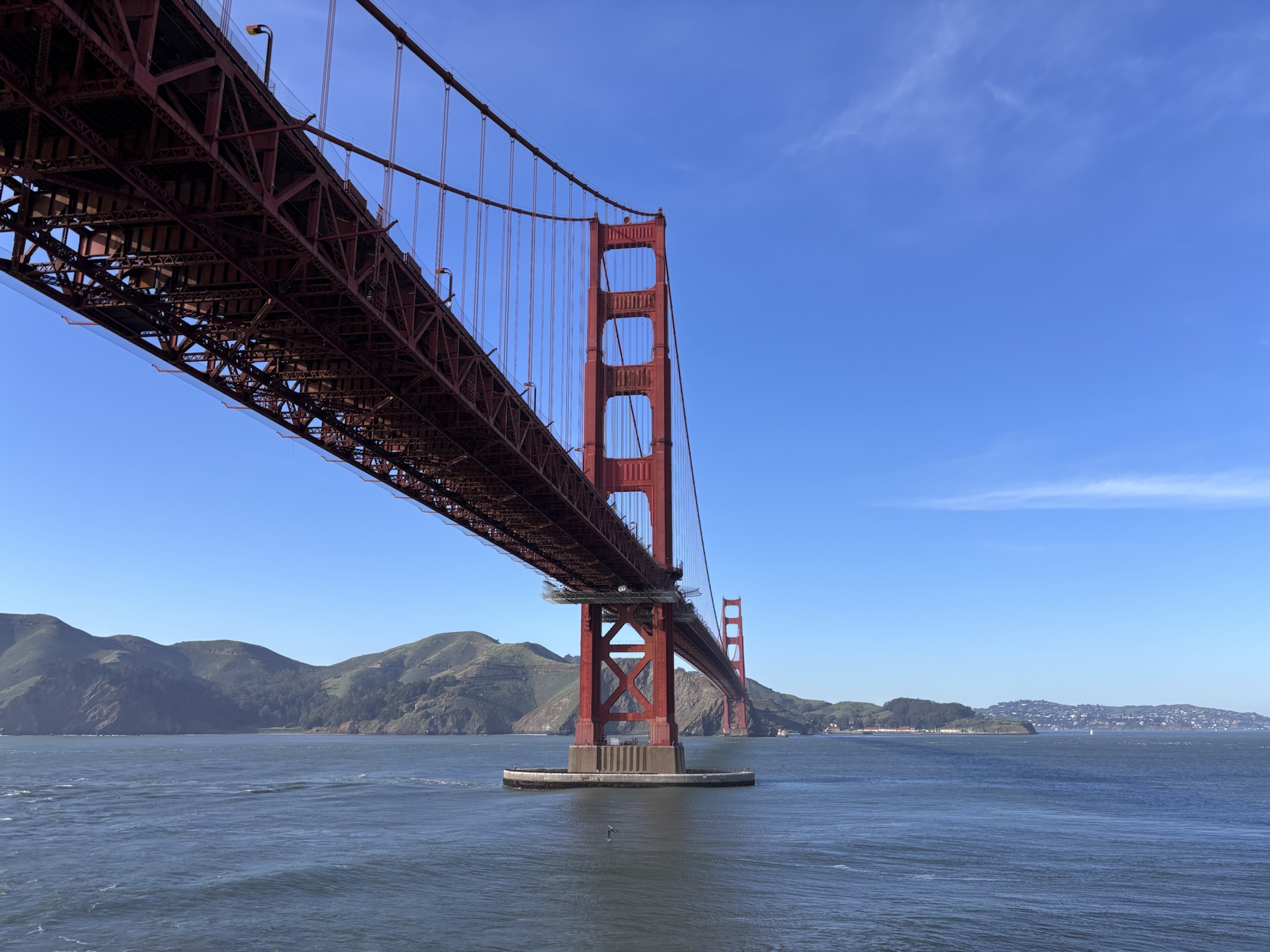
Next to the entrance for Fort Point and in front of Golden Gate strait – 28 Feb 2025 (P15).

Baker Beach, Golden Gate, Golden Gate Bridge, San Francisco, Bay Area, California, USA, fotoeins.com

Baker Beach – 11 Mar 2025 (P15).

Richardson Bay, Golden Gate Ferry, Golden Gate, Golden Gate Bridge, San Francisco, Bay Area, California, USA, fotoeins.com

In Richardson Bay, on Golden Gate Ferry westbound to Sausalito. The Sutro Tower also makes an appearance at left. Photo, 18 Mar 2025 (P15).

Battery Marcus Miller, The Presidio, Golden Gate, Golden Gate Bridge, San Francisco, Bay Area, California, USA, fotoeins.com

The Presidio, over Battery Marcus Miller – 26 Mar 2025 (P15).

UCSF Parnassus Heights, Parnassus Heights, Golden Gate Bridge, San Francisco, Bay Area, California, USA, fotoeins.com

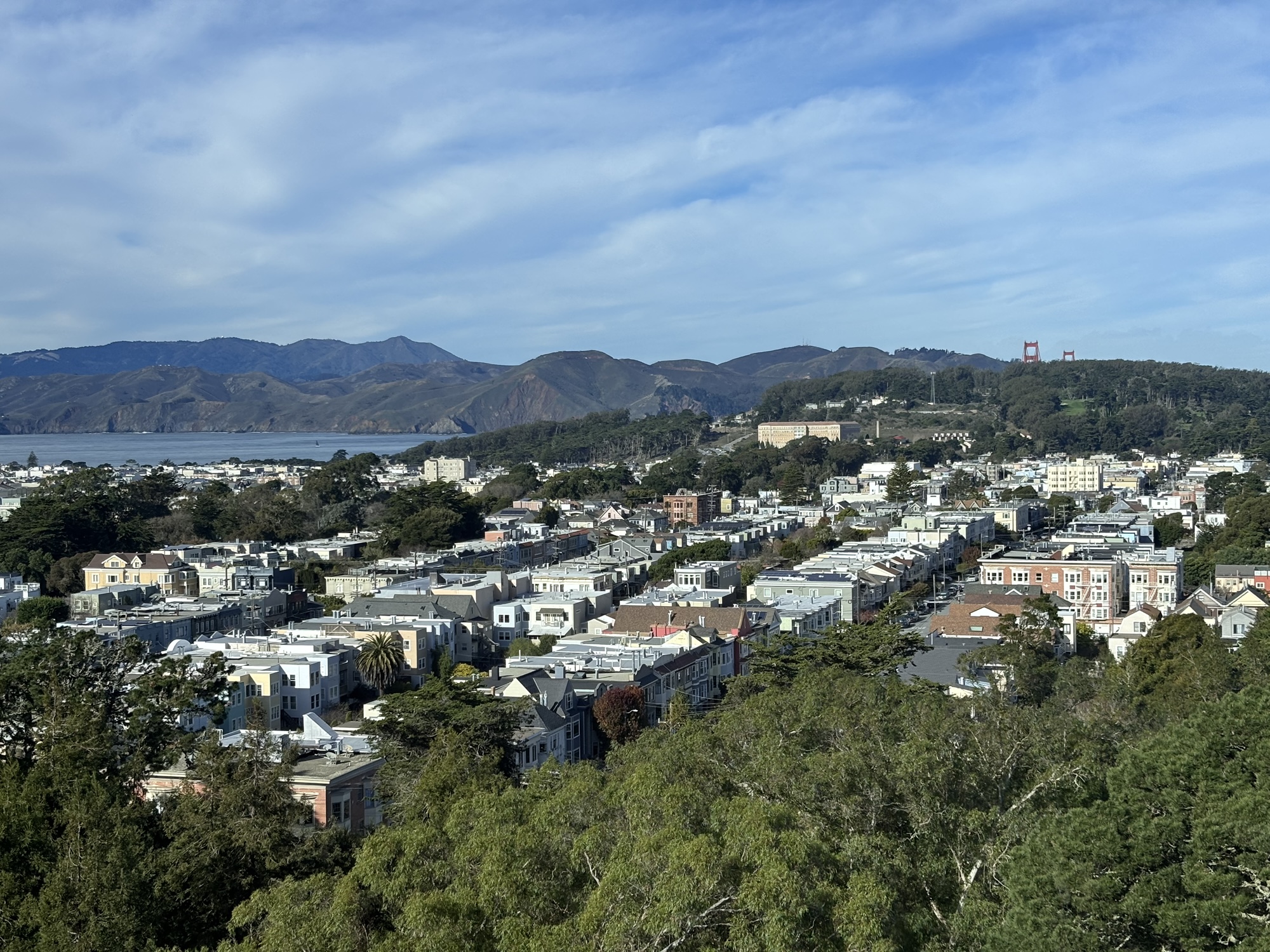
From UCSF Parnassus Heights: at left-centre is The Landmark at Presidio (former military hospital), and at upper-right are the towers of the Golden Gate Bridge. Photo, 29 Mar 2025 (P15).

Presidio Tunnel Tops, The Presidio, Golden Gate, Golden Gate Bridge, San Francisco, Bay Area, California, USA, fotoeins.com

From the Tunnel Tops at the Presidio – 31 Mar 2025 (X70).


Sources

•   Fremont, J.C., “Geographical memoir upon upper California, addressed to the Senate of the United States in 1848“, 30th United States Congress, no. 148 (Philadelphia: William McCarty, 1848). Digitized in 2015 by and online access at Internet Archive, via San Francisco Public Library: https://archive.org/stream/geographicalmemo00frmo_0/geographicalmemo00frmo_0_djvu.txt [last accessed May 2025].
•   Fremont, J.C., “Map of Oregon and upper California from the surveys of John Charles Frémont and other authorities“, U.S. Library of Congress online: https://www.loc.gov/item/79692905/ [last accessed May 2025].

Golden Gate, Charles Preuss, John Charles Frémont, Northern California, San Francisco, Bay Area

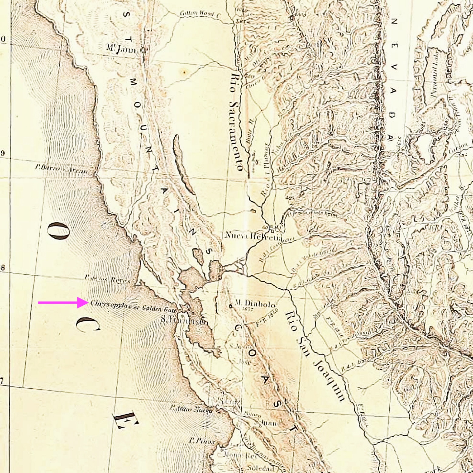
Section from Charles Preuss’ 1848 map included with John Charles Frémont’s 1848 memoir of his expeditions into Northern California. Reminding him of the Golden horn in Constantinople, Frémont named the narrow strait into San Francisco Bay as Chrysopylae or “Golden Gate”.


I made all photos above between 31 October 2024 and 31 March 2025 with a Fujifilm X70 fixed-lens prime (X70) and an iPhone15 (P15). I received neither request nor compensation for the content described here. This post appears on Fotoeins Fotografie at fotoeins DOT com as https://wp.me/p1BIdT-uS3.