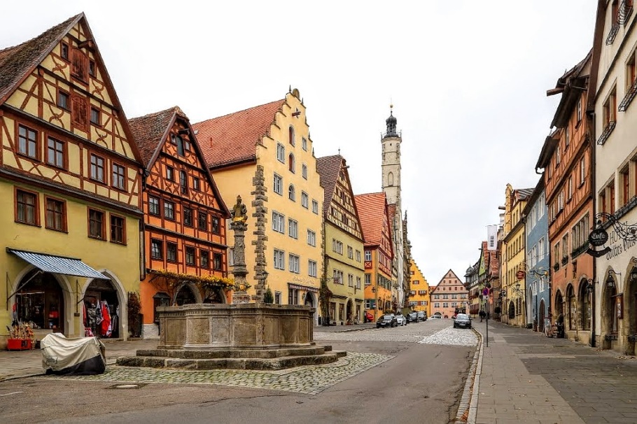
Rothenburg ob der Tauber: medieval city by day
I’ve been hearing about this place for years. “Ya gotta come; the beautiful magical city is a dream come true.” At some point, hype bleeds into “white noise”, and attention turns elsewhere.
The day arrives when the timing is a great fit, when the city becomes the first stop on a four-week long tour of the country. I’m hitting a seasonal “sweet spot” in between the summer surge and the Christmas crush. There are far fewer tour buses and day-trippers, but even in mid-November, plenty of visitors are spellbound by the visual beauty. Freed by the weight of the crowds, the feeling collectively from Rothenburg ob der Tauber and her residents feels a lot like a big exhalation of relief.
Directly translated as “red castle over the Tauber (river)”, Rothenburg ob der Tauber is located in the Middle Franconia (Mittelfranken) region of Bavaria. The city lies at the junction of the Romantische Strasse (Romantic Road) and the Burgenstrasse (Castle Road).
From the first community established in nearby Detwang in 960 AD/CE, the Hohenstaufen “Castrum Imperiale” (Imperial Castle) in 1142, a new settlement adjacent to the castle recognized as “Civitas” in 1241, the young city’s Free Imperial City status claimed in 1274, the Reformation’s arrival in 1544, the Thirty Years’ War siege and forced occupation in the early 17th-century, an independent imperial city forced to join the Bavarian Kingdom in 1802, Allied bombing destroyed a large chunk of the old town in World War Two, to subsequent post-war reconstruction and repair, the rich and tumultuous history together with the half-timbered red-roofed houses, cobblestone streets, and the stone wall perimeter make Rothenburg ob der Tauber one of the most beautiful medieval cities in Europe.
Walking tour through town
What follows is a photographic and walking tour of the city with 20 spots indicated in the map below; click on the “arrow-window” icon in the upper left corner of the map for additional details. Each numbered spot is accompanied by corresponding photographs below.
- Marktplatz: Rathaus, Ratstrinkstube (Market Square: Town Hall, Councillors’ Tavern)
- Herrngasse (Nobles’ Lane)
- Burgtor (Castle Gate)
- Burggarten: Taubertalblick (Castle Garden: Tauber valley view)
- Burggarten: Stadtblick (Castle Garden: city view)
- Plönlein (Little Square)
- Siebersturm (Siebers Tower)
- Spitalbastei (Spital Bastion)
- Spitaltor (Spital Gate)
- Auf der Stadtmauer (On the city wall)
- Gerlachschmiede, Rödertor (Old Forge, Röder Gate)
- Paradeisgasse (Paradise Alley)
- Am Platzl (At the little square)
- Pulverturm, Schrannenplatz (Powder Tower, Grain Trade Square)
- St. Wolfgangskirche (St. Wolfgang Church)
- Klingentor (Klingen Gate)
- Klingengasse 9 (Klingen Alley 9)
- Reichsstadtmuseum (Imperial City Museum)
- Klostergarten (Convent Garden)
- Jakobskirche (St. James Church)
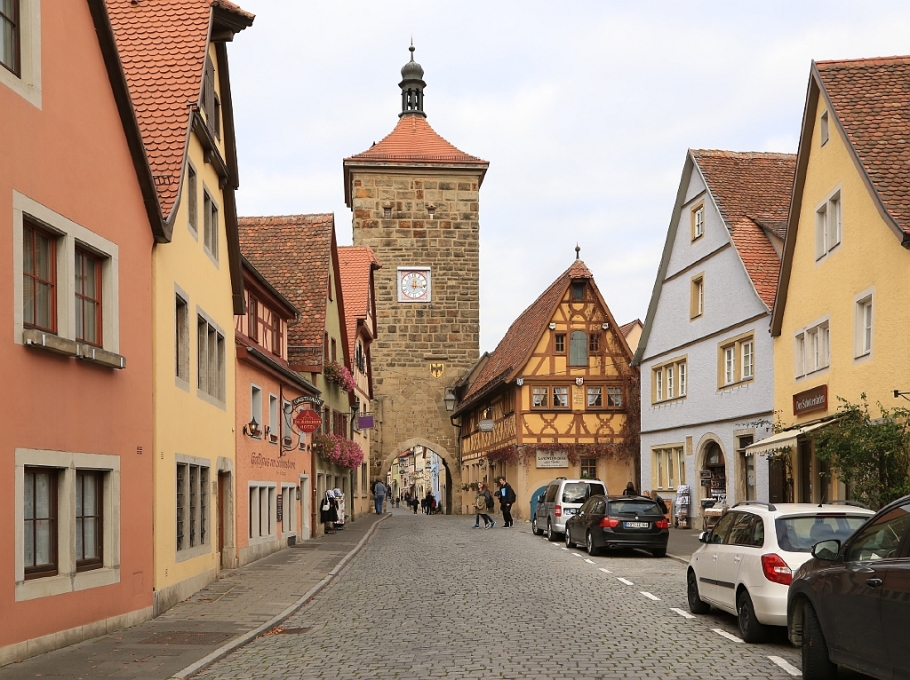
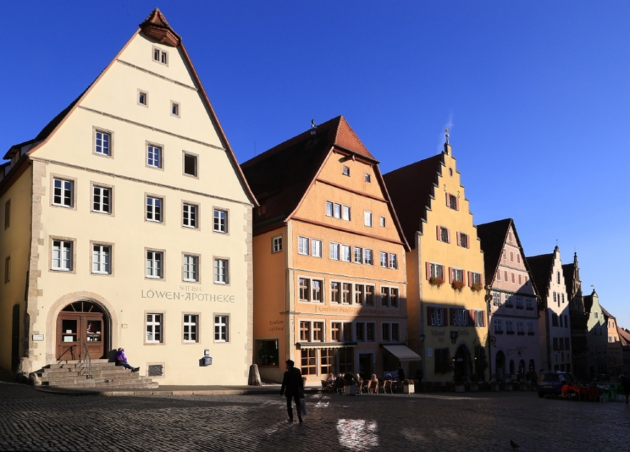
1. Market Square: Town Hall, Councillors’ Tavern
Anchoring the west side of Marktplatz (Market Square), the city’s Rathaus (Town Hall) consists of two parts: the west Gothic part goes back to the 14th-century and the east Renaissance construction goes back to 1572. The gallery arcade facing Market Square was added in 1681. At the north side of the square is the Ratstrinkstube (Councillors’ Tavern) built around 1466, with the astronomical clock added in 1683, and figures for the legendary “Meistertrunk” (Master Draught) scene added in 1910. The city’s Tourist Information Office resides in this building.
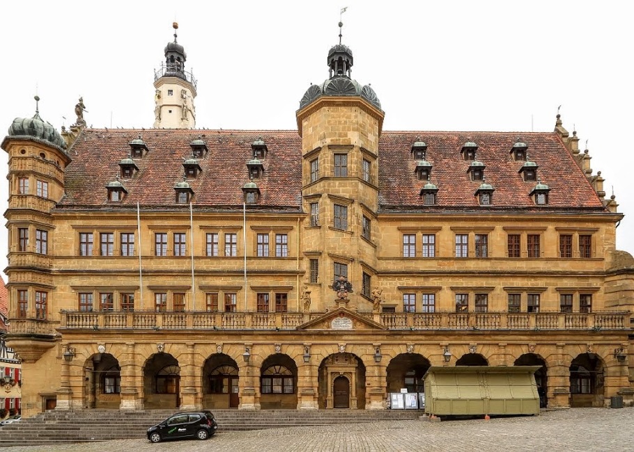
Rathaus. The arcade seen here added in 1681.
Ratstrinkstube at left; nearby red and yellow buildings at Markt 4 and 2, respectively. At right, yellow gable building at Marktplatz 6 dates back to 1415.
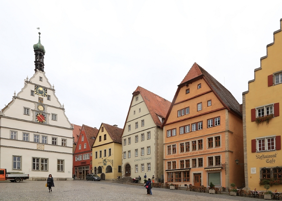
2. Nobles’ Lane
Over centuries, the street was once the preferred area where wealthy families resided in their big patrician houses. Constructed in 1615, the Herrnbrunnen (Nobles’ Fountain) was the former market fountain where livestock markets once stood in proximity. The Franziskanerkirche (Franciscan Church) is the one of the city’s oldest churches, inaugurated in 1309 and built in the early Gothic style. Near Marktplatz, the Deutsches Weihnachtsmuseum (German Christmas Museum) is inside the Käthe Wohlfahrt Weihnachtsdorf (Christmas Village).
Looking east to Marktplatz, the green, orange, & yellow houses (from left) at 12, 10, & 8 Herrngasse go back to the 15th-, 15th-, & 12th-centuries.
West on Herrngasse to Castle Gate (Burgtor). Left: Franziskanerkirche (Franciscan Church, 1309). Centre-right: Herrnbrunnen (Nobles’ Fountain, 1615).
3. Castle Gate
The tower leading to the former castle was completed around 1470 with adjacent guard houses added at the end of the 16th-century. An earthquake in 1356 destroyed the Hohenstaufen Castle which was never rebuilt; the rubble was used as subsequent building material. All that’s left are the castle gate and the castle gardens.
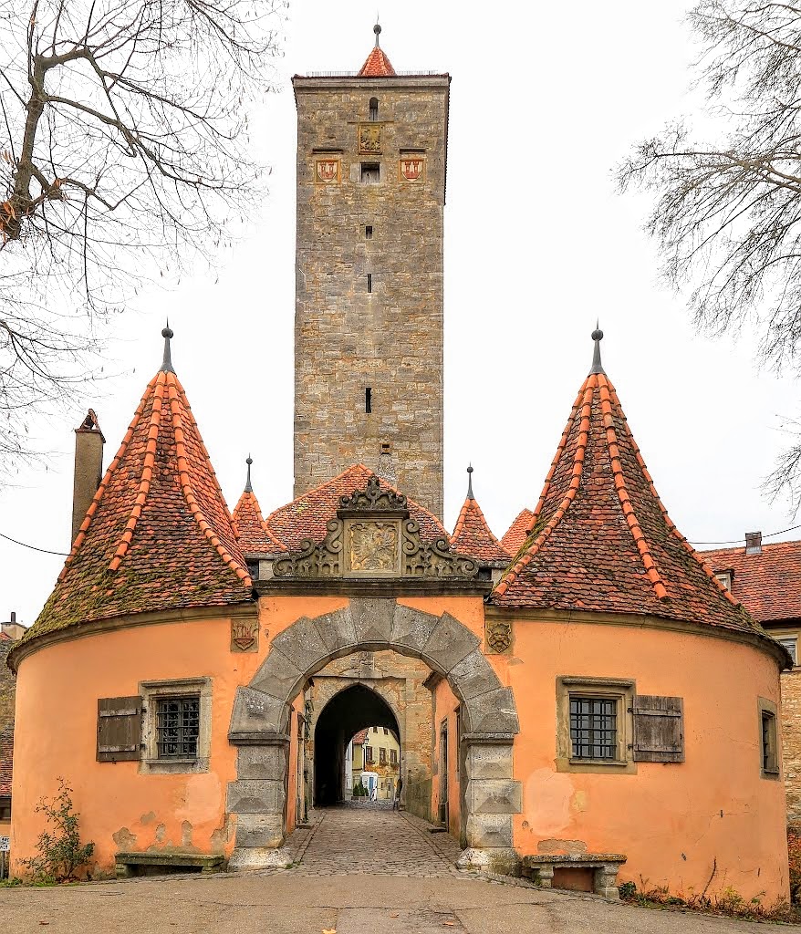
East from the castle garden: Burgtor (Castle Gate)
4. Castle Garden: Tauber valley view
The castle garden is a beautiful park which looks over the Tauber river valley. The garden is at the site of the former Hohenstaufen Castle built in 1142 and destroyed in 1356. At the west end of the garden is a view below of the Topplerschlösschen (Toppler’s Manor House, 1388) owned by Lord Mayor Heinrich Toppler and put into use as Toppler’s weekend house and defensive tower to repel possible invaders. The building now houses furniture collection from the 16th to the 19th-century.
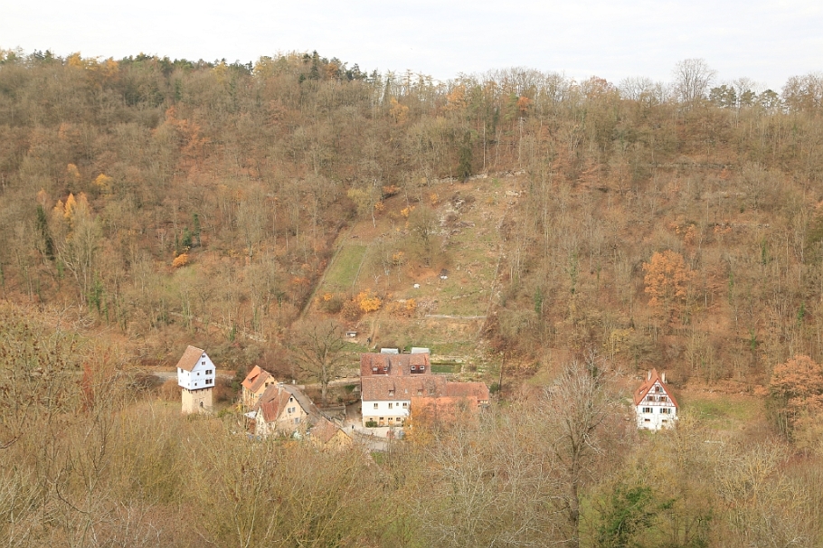
West to the Topplerschlösschen (Toppler’s Manor House, far-left), sitting snug in the Tauber river valley below.
5. Castle Garden: city view
At the south end of the garden, the view is south-southeast to the city. At centre-right next to the Tauber river are the Herrnmühle and Kobolzellerkirche (Nobles’ Mill, Kobolzeller Church). The Herrenmühle site first began as a grain mill in 1340; over centuries functionality expanded to oil press and timber mill. Buildings in use now as guesthouse for visitors were built in 1760. First construction of the Kobozeller Church dates back to 1472. Along the way to the next location, you’ll come across the Mittelalterliches Kriminalmuseum (Medieval Crime Museum).
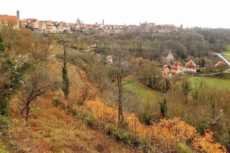
Southeast to the city; at right-centre in the valley below, Herrnmühle and Kobozeller Kirche
6. Little Square
The name for this small flat square, Plönlein, is derived from the Latin word “plānum” or “level ground”. The south facing shot (below) at Plönlein generally makes for one of the best known settings and photographs for Rothenburg ob der Tauber. But this photo is a north facing shot with the late-autumn afternoon sun behind me to the south, and is equally representative of half-timbered houses and cobblestone streets in a medieval setting which gives the city its “romantic” description.
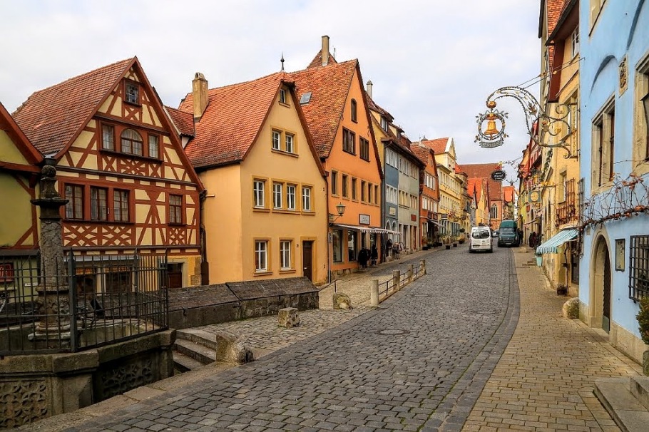
North from Plönlein to Untere Schmiedgasse. The fountain at left was once used to store fish from the Tauber river.
7. Siebers Tower
Siebers Tower was built in 1385 as part of the “new” defenses (second or outer wall) to fortify the southern entry into the city. From here south along Spitalgasse is the hospital (“Spital”) quarter which began in 1280 and was subsequently included with the fortifications when Spitaltor and Spitalbastei were built. The main hospital in the hospital quarter was built in the late 16th-century.
North on Spitalgasse, to Siebersturm.
8. Spital Bastion
The Spitalbastei (Infimary/hospital bastion) is one of the largest and most extensive fortifications to the city wall. Construction began in 1542, with the outer gate built in 1586, and additional defense structures added in 1616. The two inner courtyard fortifications are in the form of a figure-eight. The outer gate built in 1586 bears the Latin inscription: “Pax intrantibus, salus exeuntibus” (peace to all who enter, fare well to all who leave).

North from Nördlinger Strasse, to the outer gate into Spital Bastion
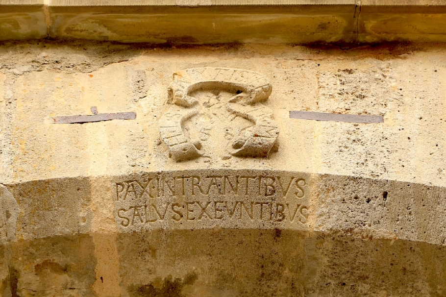
“Pax intrantibus, salus exeuntibus”, Latin inscription over Spital bastion outer gate (1586)
9. Spital Gate
The Spital Gate is one of my gates from which the city wall can be accessed, climbed, and walked, up high along its perimeter. The south perimeter is particularly vulnerable to the flat terrain along the right/east flank of the Tauber, which goes some way to explain the extent of the defensive measures built here.
Spitaltor, from inside the Spital Bastion.
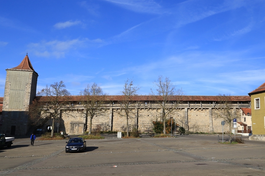
10. On the city wall
As the medieval city expanded, a second wall was built as the outer defensive perimeter beginning in the middle of the 14th-century. Walking along this city wall provides extensive views of the red roofs, timbered houses, sheltered side streets and alleys, and the prominent skyline with St. James Church in the distance; quiet contemplation is highly recommended at daybreak and dawn.
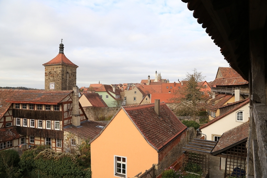
On the city wall, northwest to Siebersturm.
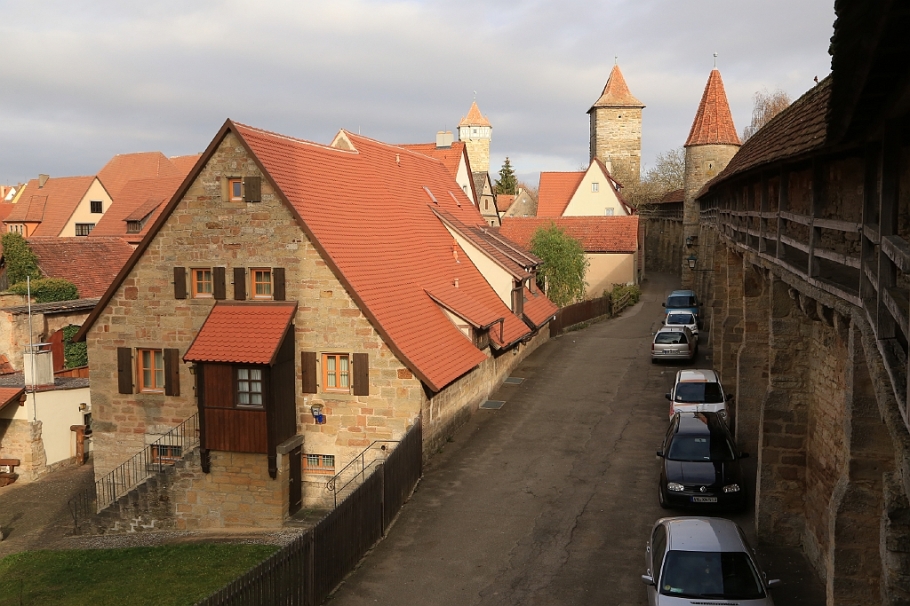
On the city wall, north to Rödertor.
11. Old Forge, Röder Gate
The pretty triangular half-timbered house with the gable, windows, and the crowned serpent coat-of-arms once belonged to the blacksmith Georg Gerlach. Destroyed in the Second World War, the building was reconstructed in 1951 to resume function as a forge until 1967. The Röder Gate goes back to the 14th-century and includes one of the few lookout towers on the medieval wall.
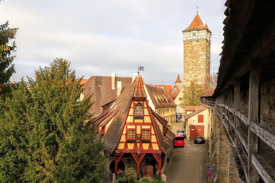
Lower-centre: Gerlachschmiede (Old Forge). Right: Medieval city wall to the tower at Rödertor (Röder Gate).
12. Paradise Alley
“Geniesse, was Dir Gott beschieden,
Entbehre gern, was Du nicht hast,
Ein jeder Stand hat seinen Frieden,
Ein jeder Stand auch seine Last.”
From the poem “Zufriedenheit mit seinem Zustande”, in the book “Geistliche Oden und Lieder”, Leipzig (Weidmann) 1757, written by Christian Fürchtegott Gellert (*1715-1769+).
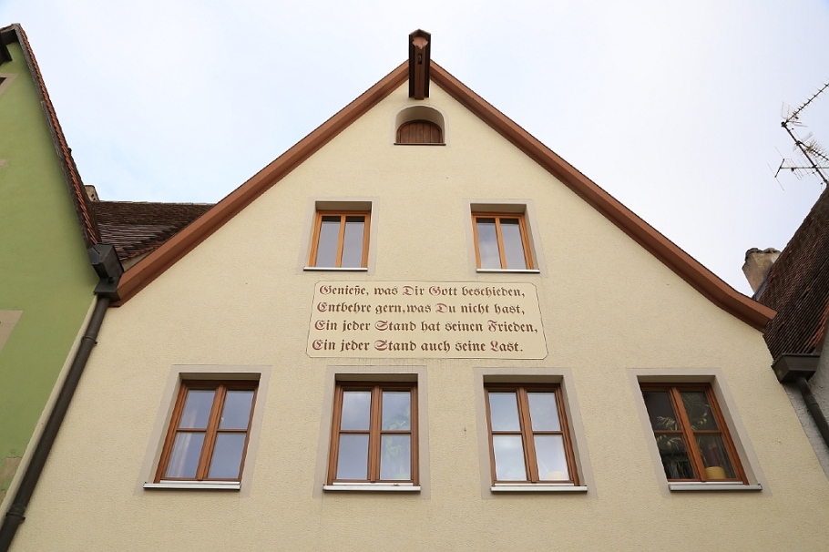
Excerpt from 1757 poem by Christian Fürchtegott Gellert.
13. At the little square
This tiny square marks the former boundary to the Jewish community: to the left is Judengasse, and the road to the right leads to Schrannenplatz (grain storage and animal farms) which itself was also the site of the former Jewish cemetery.
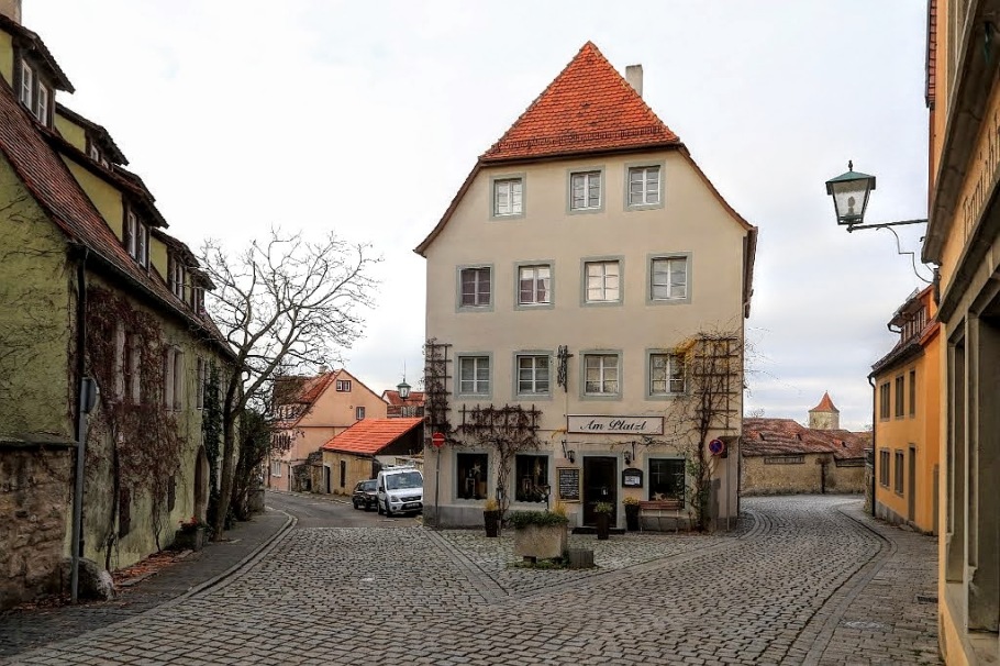
Left: Judengasse. Right: To Schrannenplatz.
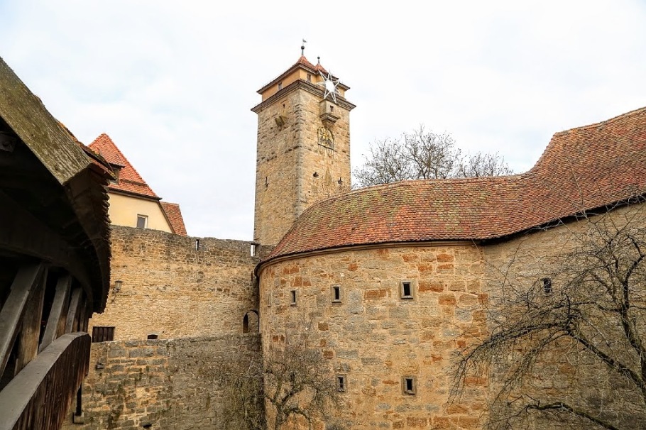
14. Powder Tower, Grain Trade Square
At the northern perimeter to the Old Town, the “outer” medieval wall runs east-west. Shown at left is the Pulverturm (Powder Tower) which was used to store the town’s supply of gunpowder. Built around 1408, the tower was originally known as Fürbringer Tower, but the name was eventually transferred to a smaller 16th-century tower to the west near Klingentor.
Pulverturm (Powder Tower), north perimeter of the outer medieval city wall.
15. St. Wolfgang Church
Also called the Shepherds’ Church to honour its patron saint, St. Wolfgang Church was built in the late 15th-century in late-Gothic style. Constructed behind the Klingen Tower, the church is also known as the Wehrkirche (defense church) by its inclusion within the city’s fortifications, complete with cannon platforms and underground caverns for storing ammunition.
St. Wolfgangskirche
16. Klingen Gate
To bolster the northern flank, the 30-meter high Klingen Gate formed part of the extra defence built in the late 16th-century. With the installation of a copper tank, the tower was converted to water storage to serve the fresh water needs of the city’s populace.
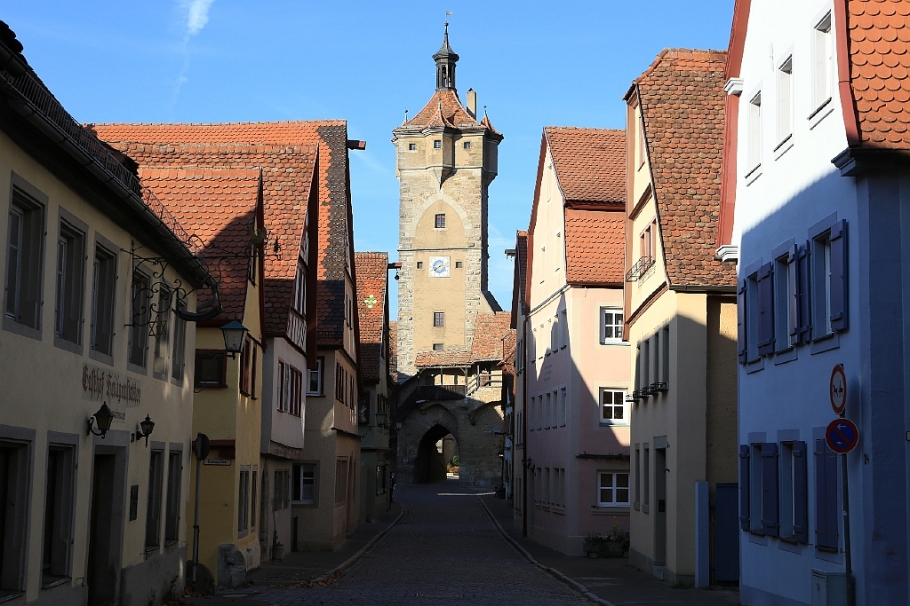
North to Klingentor (Klingen Gate), on Klingengasse
17. Klingen Alley 9
“Du findest für den Leib,
das Brot in diesem Haus.
Das Brot für deine Seele,
teilt Gottes Wort dir aus.”
Built around 1501 and housing a bakery until 1966, the Feuerleinserker (“Feuerleins Oriel”) building is particularly well photographed at the corner of Klingengasse and Küblersgässchen, particularly in spring and summer with flowers in full bloom. I’ve chosen to photograph the Klingengasse side of the building with the inscription.
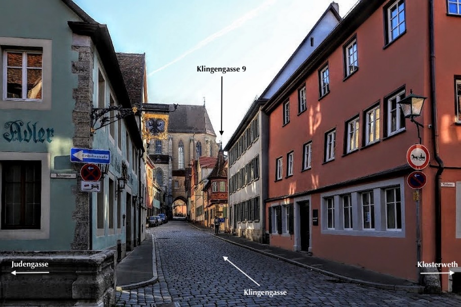
South on Klingengasse
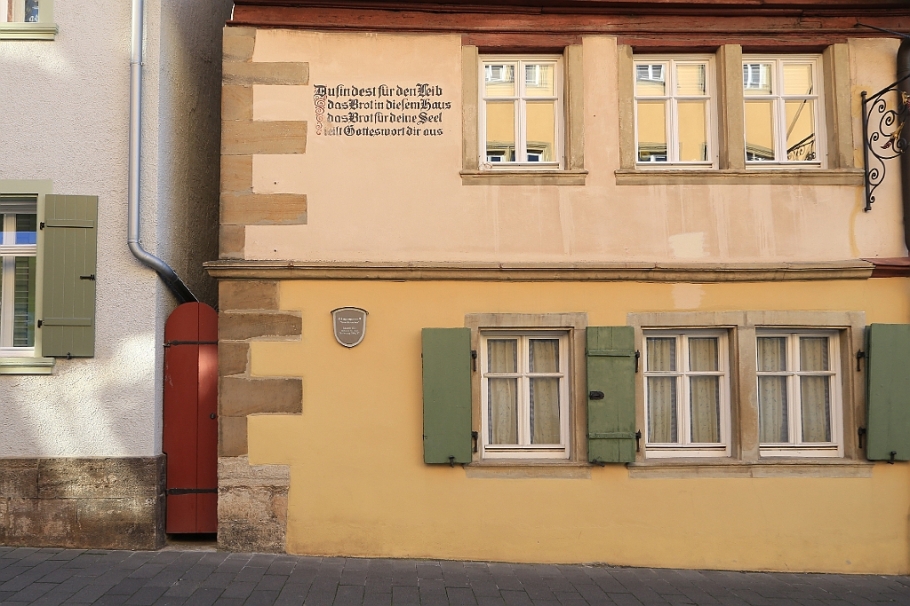
Feuerleinserker (Feuerleins Oriel), at Klingengasse 9
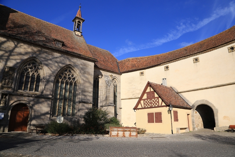
18. Imperial City Museum
The Imperial City Museum is housed in a former Dominican convent founded in 1258. With the 14th-century nunnery kitchen left almost intact, the museum also contains exhibits about the art and culture for the former imperial city, including the Rothenburg Passion (1494), archaeological finds, medieval and post-medieval artifacts, as well as an important “Judaica” collection of Jewish historical artifacts.
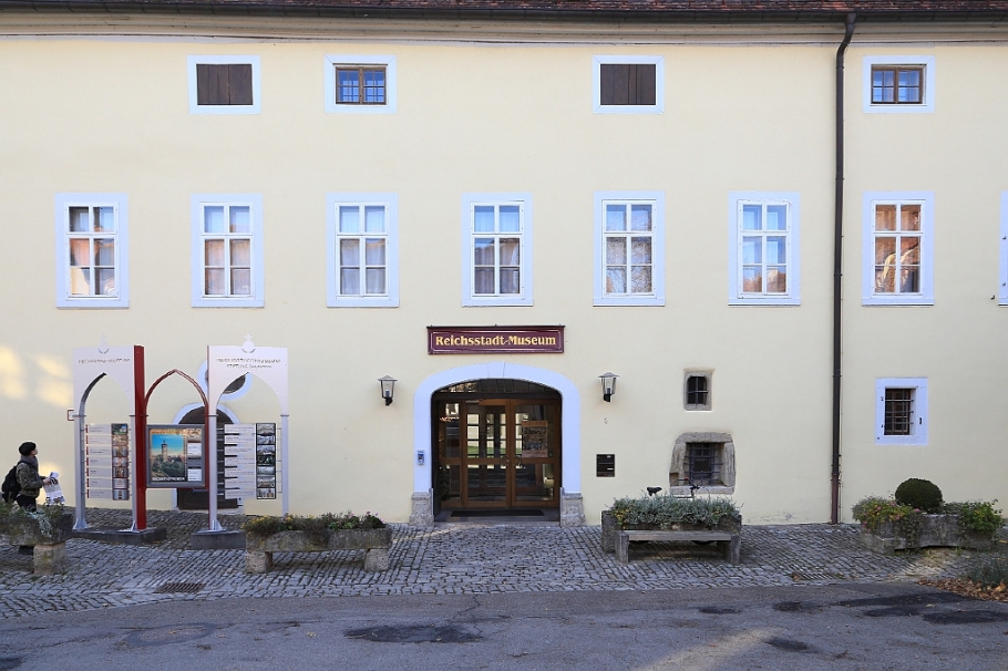
Reichsstadtmuseum
19. Convent Garden
The garden was once a part of the neighbouring former Dominican convent which is now the Imperial City Museum.
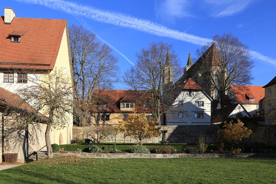
Garden with St. James Church in background. A herb garden likely owes its origins to the nuns who once occupied the convent.
20. St. James Church
With construction of the east end beginning in 1311, this Lutheran church is dedicated to St. James (St. Jakob, in German) and is included on the pilgrim road to the St. James shrine in the Cathedral of Santiago de Compostela in Galicia in northwestern Spain. Outside the entrance to Jakobskirche is the statue of the saint dressed in a pilgrim’s hat with staff in one hand and the scallop shell in the other; he is the patron saint of pilgrims and merchants. The name “Santiago” (Diego) is the Galician version of the Vulgar Latin “Sanctu Iacobu” or “Saint James”.
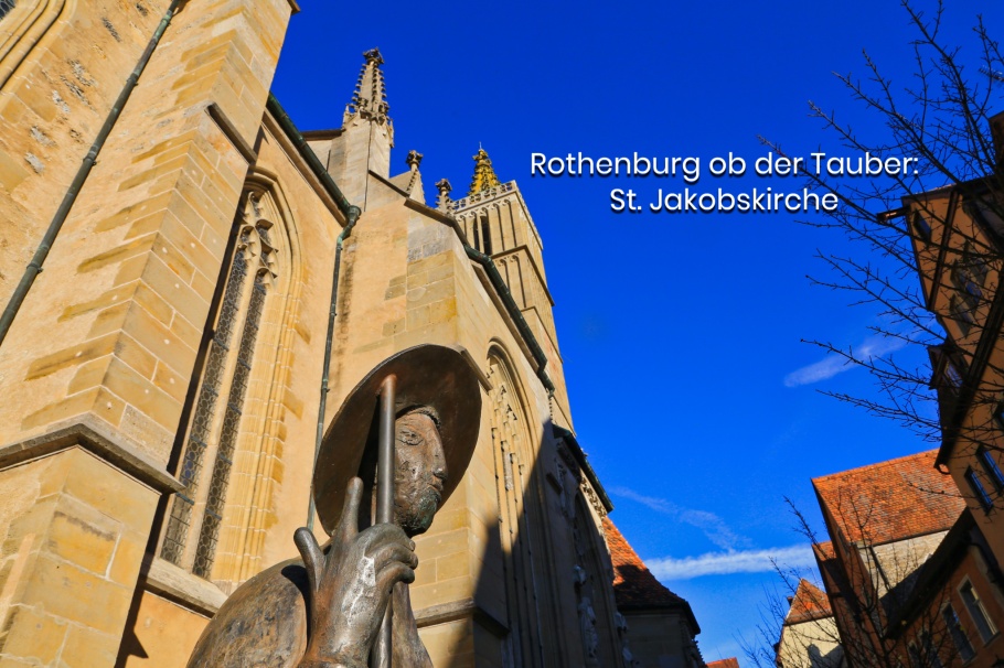
Jakobskirche
After leaving St. James church you can head back to Marktplatz, where this walking tour began. Alternatively, you can go to the restaurant or tavern of your choice where food and drink you’ve been eyeing all day wait for you.
• Exploration on foot of city’s Jewish history
Marktplatz in afternoon light
More
• City tourism, in English
• Bavaria, in English
• Germany Travel, in English
• Castle Road (Burgenstrasse), in English
• Franconia’s Cities (Fränkische Städte), in English
• Romantic Road (Romantische Strasse), in English
• List of city’s heritage and historical buildings, in German.
• Bayerisches Landesamt für Denkmalpflege (BLfD), Bavarian State Conservation Office.
• ( Bundesland: Bayern, Regierungsbezirk: Mittelfranken, Landkreis: Ansbach )
Thanks to Rothenburg ob der Tauber Tourism Service for providing access to services and facilities, and thanks to (Akzent) Hotel-Gasthaus Schranne for a warm welcome and a comfortable convenient stay. I made all photos above on 11 and 12 Nov 2015 with a Canon EOS6D mark1. This post appears on Fotoeins Fotografie at fotoeins DOT com as http://wp.me/p1BIdT-7xB.

13 Responses to “Rothenburg ob der Tauber: medieval city by day”
Such a picturesque city. I’ve heard so much about it and would love to visit it one day for myself. Even with all the hype 🙂
LikeLiked by 1 person
Hi and thank you, Adelina. There is still tremendous hype about this fair town, and sometimes I get that nerve-jangling nausea-inducing feeling when the “overrave” about a place turns into “overrun”. But like most things to keep things on the fair, I am very fortunate to have visited at a time between peak seasons with a decent spell of good weather, too. I like to think that this post will give the impression that it’s very much worth at least a day-trip, but I recommend at least one night in town, too. And the night shots? That’s another upcoming post. 🙂 Thanks for your comment and for stopping by!
LikeLike
What a well-researched and composed article, Henry. From Christmas Market season to casual spring and autumn visits, I’m fortunate to have tiptoed through Rothenburg a few times. I’m happy you were finally able to do the same, particularly during the low-travel season! My earliest memory of the town was when I was in elementary school. I remember thinking Rothenburg felt so large and formidable then. When I returned to Germany as an adult, my perception had evolved, as I later regarded Rothenburg as a charming, rather diminutive place. My parents live a bit farther away now, but I do look forward to returning to Franken someday soon.
LikeLiked by 1 person
Hi and thanks, Tricia! I liked and enjoyed the relative compactness of Rothenburg, and I can definitely credit living in Heidelberg for that comfort level. I’m sure you agree that there’s something to be said about the familiarity of having lived in a relatively smaller place: not just any small town, but a small German town. To that end, getting around Rothenburg’s Altstadt is very easy, although the city is obviously much more beyond the medieval city wall. I would love to see Rothenburg (1) in the middle of summer with clear skies and a lot more people, and (2) with snow on the ground and on the roofs in the month of December. Thanks again for your comment!
LikeLike
it’s beautiful! Like from a fairy tale!:) and where are all the people? you got photos without the crowds, splendid!
LikeLiked by 1 person
Hi, Tanja. After what I read, I thought similarly: where are all the people? It is a beautiful place to be sure, and I’m lucky to have visited during “low/shoulder season.” Thanks for stopping by and for your comment!
LikeLiked by 1 person
[…] The medieval city by day • A trip through the city’s Jewish […]
LikeLike
I visited Rothenburg in the early 70’s I can still find my way around the city, wonderful pictures.
LikeLiked by 1 person
Hello, Harvey. Thank you for your kind comment, and I’m very glad I provided “updated memories” to add to your very own memories from the 1970s. Thanks again!
LikeLike
[…] ob der Tauber: Gerlachschmiede (Old Forge) at centre and Rödertor (Röder Gate) at right. Number 11 of 20 on a pictorial tour; photo: 12 Nov 2015 […]
LikeLike
Hi,
I’m looking for information on my great grandmother Rosa Heinlein. She lived in the guard /gate house in the southern end of Rothenburgs Spital Bastion around 1955-1960’s where she used a broom to help direct traffic. I also heard she was a former Catholic nun who left the church, married and had 3 children. One was my grandfather Leo. I don’t have her maiden name and trying to find how to find out more about her.
Thanks so very much,
Cindy Buda
LikeLike
Hi, Cindy.
Thank you for your message. As a Google search for “Rosa Heinlein Rothenburg” doesn’t reveal fruitful results, I think someone will have to go to Rothenburg and search their archives in person as described at the city website below (in German). I’m sorry I can’t be of more help.
Sincerely,
Henry.
https://www.rothenburg.de/stadtportrait/stadtarchiv/personen-familien-forschung/
LikeLike
[…] Gerlachschmiede, Rödertor (Gerlach’s Old Forge, Röder Gate) – 12 November 2015 with 6D1 (more here). […]
LikeLike