Allgäu winter: Fellhorn in the German-Austrian Alps
Above: A group of skiers gather before their run near the Fellhorn summit.
As a product of the Canadian southwest, I’ve maintained a fascination with mountains. I don’t necessarily need to climb the mountains, but I’ve always been curious about the names of mountains, the reasons for their names, and the people who named them. I’m not always going to get answers, but if there’s a lift to take me to a view, I’m always game.
With an easy bus from Oberstdorf in the southwest corner of Germany, I’m headed 10 km south to Faistenoy for the gondola up to the summit of Fellhorn (2038 metres) among the Allgäu Alps. There’s a lot of snow up top with a depth of about 1.5 metres; skiing and snowboarding conditions look good in the Skigebiet Fellhorn-Kanzelwand (Fellhorn-Kanzelwand Ski Area). But what do I know? I don’t ski or snowboard, but the winter-afternoon light is decent on the smooth snowy landscape. I’m drawn to the information displays to learn more about Fellhorn and the mountains I’m seeing in the near 360-degree panorama. In the distance the flat-topped Hoher Ifen mountain looks like a multiple-layer cream-filled cake. I arrive quickly at a couple of conclusions: one, it’s fun to stand on a border between two countries at altitude, even if an international frontier is set somewhat arbitrarily; and two, I promise to return in the summertime to do a loop: return to Fellhorn, hike along the relatively flat ridge-line west, take the Kanzelwandbahn gondola down into Austria’s Kleinwalsertal valley, have a sip and nosh in one of the alpine towns, and return to Germany’s Oberstdorf on a local bus.
Up to the frontier at 2037 metres

On the bus south from Oberstdorf, at the Zweistapfenweg bus stop, facing west with Höchster Kackenkopf (1560 metres) at upper-left.
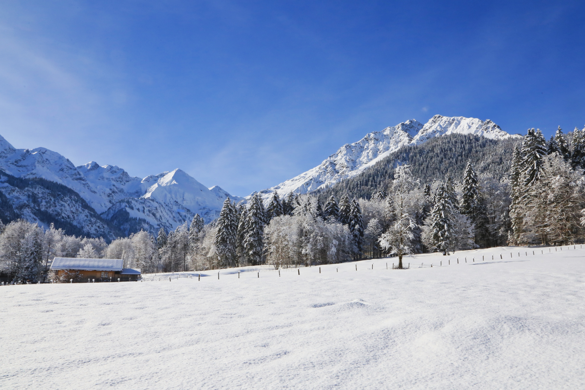
Morning light in Faistenoy, near the Fellhorn gondola lower- or valley-station.
1m12s video, ending with “Fellhorn-Gipfel Bergschau 2037 (Fellhorn summit, mountain view 2037-metres) at the upper-/mountain-station.
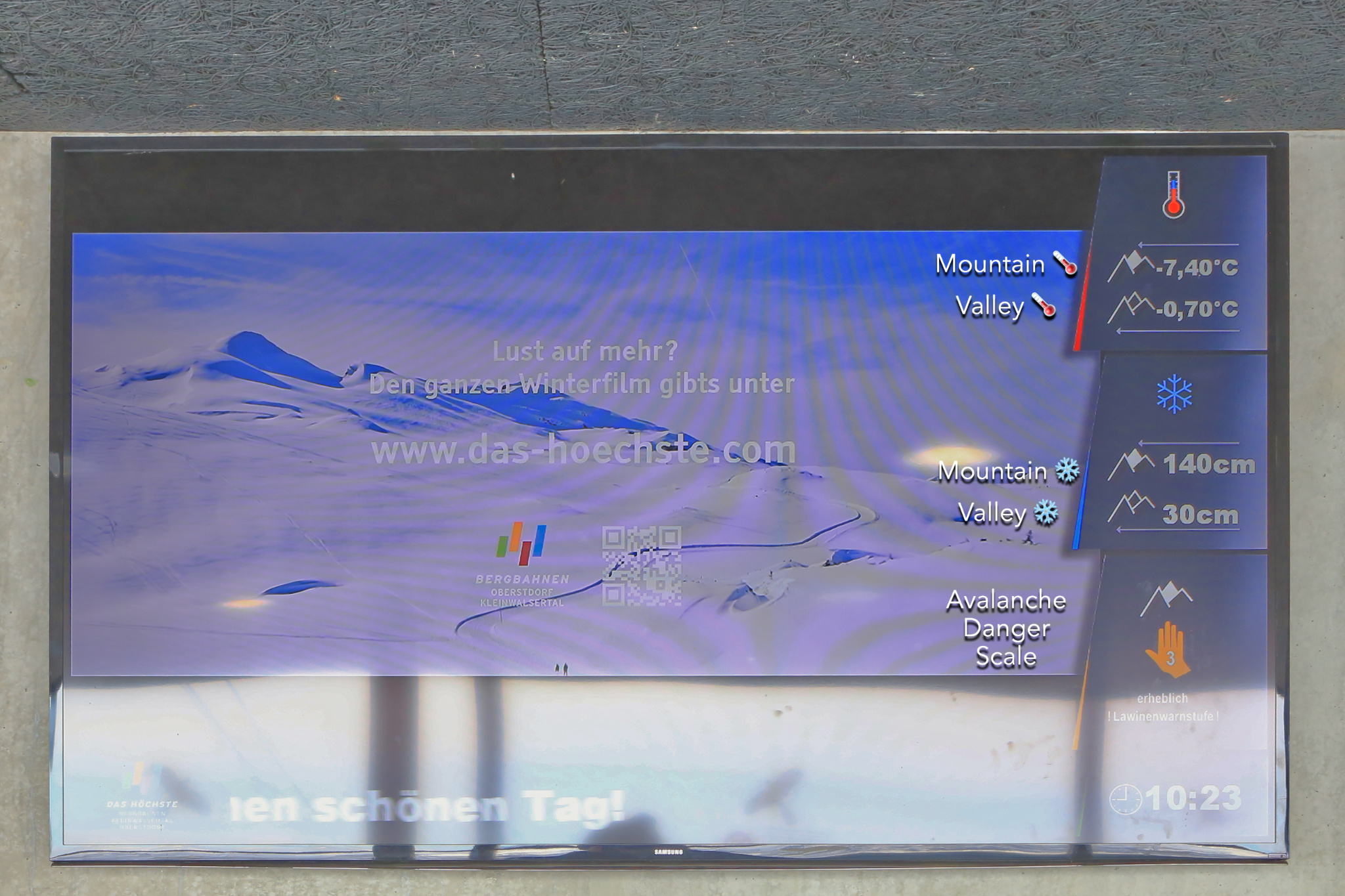
Morning information display inside the mountain station. In the video above, the gondola attendant mentioned their avalanche warning was raised from level 3 (significant risk) to level 4 (high risk) to better account for local conditions.

From the mountain-station of the Fellhorn gondola: facing east, with Nebelhorn summit at upper-left.

Fellhorn, facing east.

Fellhorn and the German-Austrian frontier. The orange out-of-bounds fence straddling the ridge also marks the border between Germany and Austria. This southwest facing view includes the Möserbahn at lower-left; and the Kanzelwandbahn’s upper station at the upper right, above which is the peak Grosse Widderstein (2533 metres).

Facing southwest: Möserbahn Bergstation (centre-right), Kanzelwandbahn Bergstation (upper right). Grosse Widderstein is the prominent peak in the background at upper right.

Inside the arrows: the orange out-of-bounds fence straddling the ridge marks the border between Germany and Austria. This southwest-facing view includes the Möserbahn at lower-left; and the Kanzelwandbahn upper station at the upper-right, above which is the peak Grosse Widderstein (2533 metres).

Southwest view along the German-Austrian frontier. Germany: G1, Obere-Geren-Piste, from the Fellhorn mountain station (from lower-right); G2, Möse chair-lift; G3, Zweiländer chair-lift. Austria: A1, Kanzelwandbahn cable-car mountain station at a line-of-sight distance 1.6 km (1 mi); A2, Zwerenalpe chair-lift; A3, Grosser Widderstein, summit 2533 metres (8310 feet); A4, Elferkopf, summit 2387 metres (7831 feet).

At upper-left are Grosse Widderstein and the Kanzelwandbahn gondola with Hochkünzelspitze at upper-right. Also visible in the scene is a sprinkling of skiers.
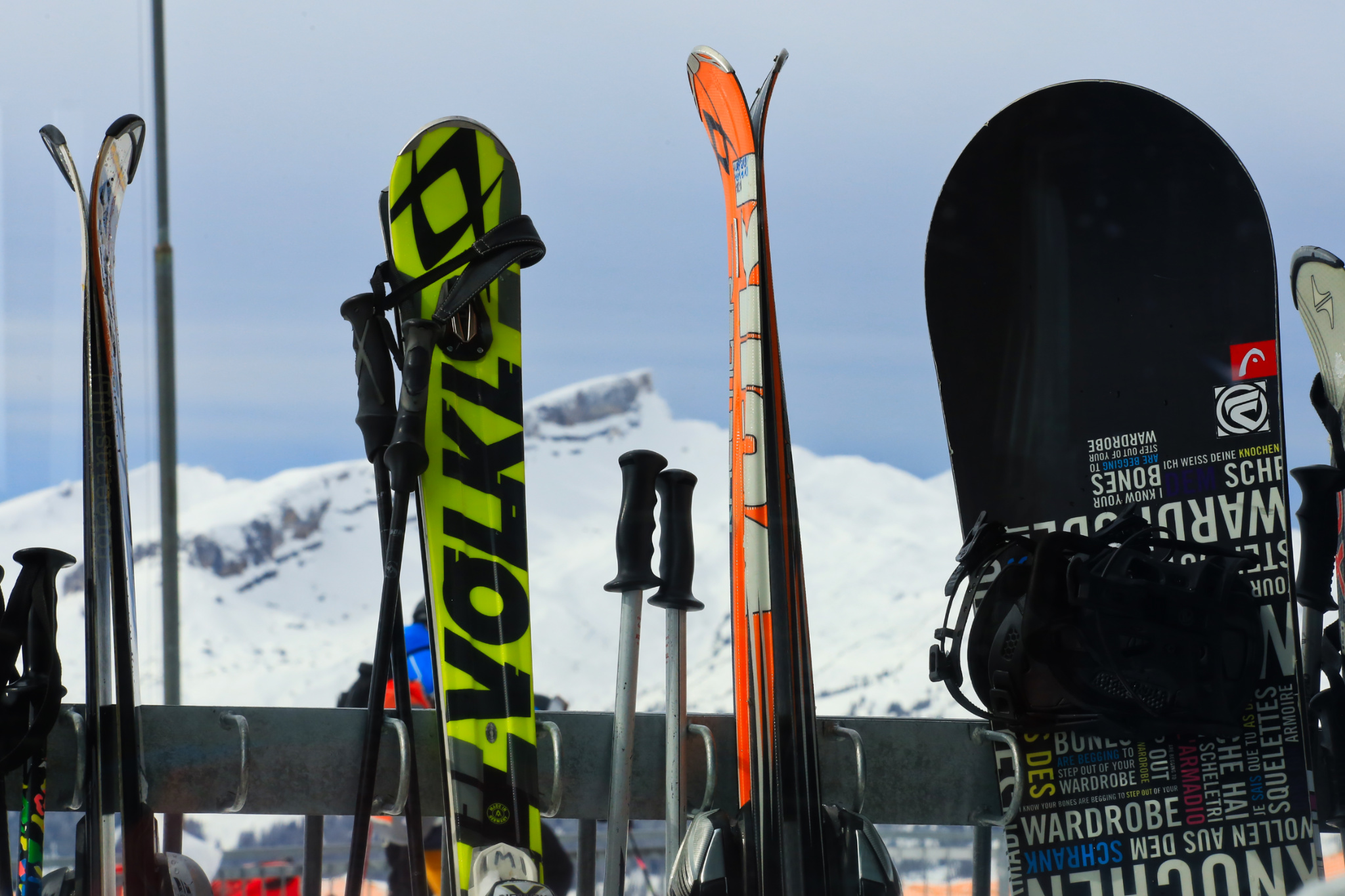
“I know your bones are begging to step out of your wardrobe.”

On the snowbank resting on the German-Austrian border (deutsche-österreichische Staatsgrenze) is this view northwest over Austria’s Kleinwalsertal, a mountain valley with alpine villages whose road access is solely through Germany.
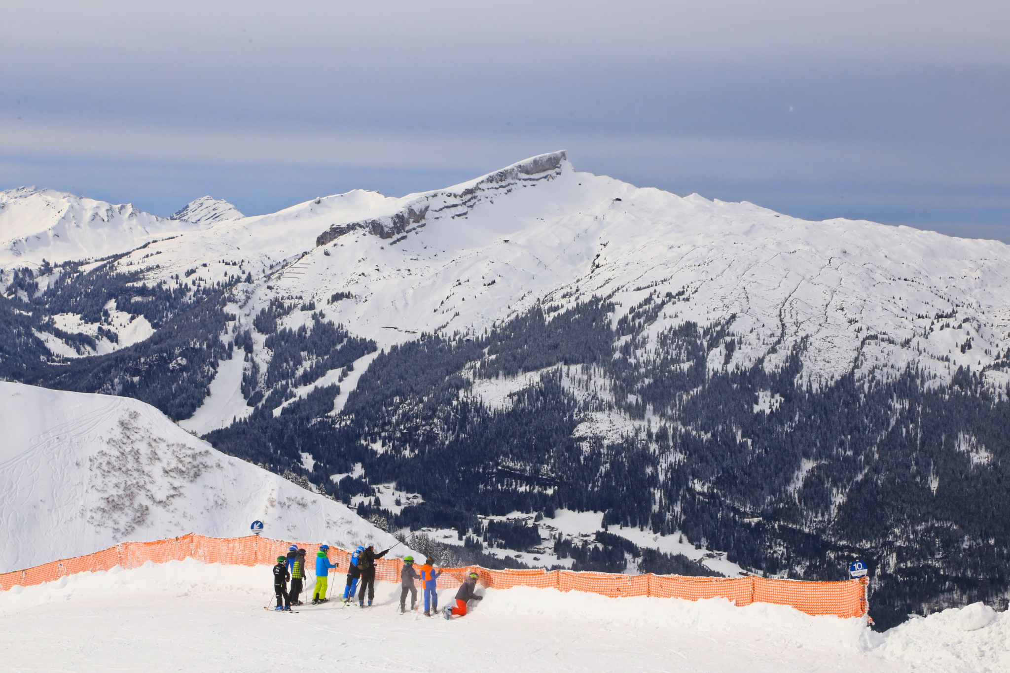
With Hoher Ifen in the centre-background, a group of skiers gather before their run. The orange safety-fence prevents wayward skiers or snowboarders from going over the steep ridge.
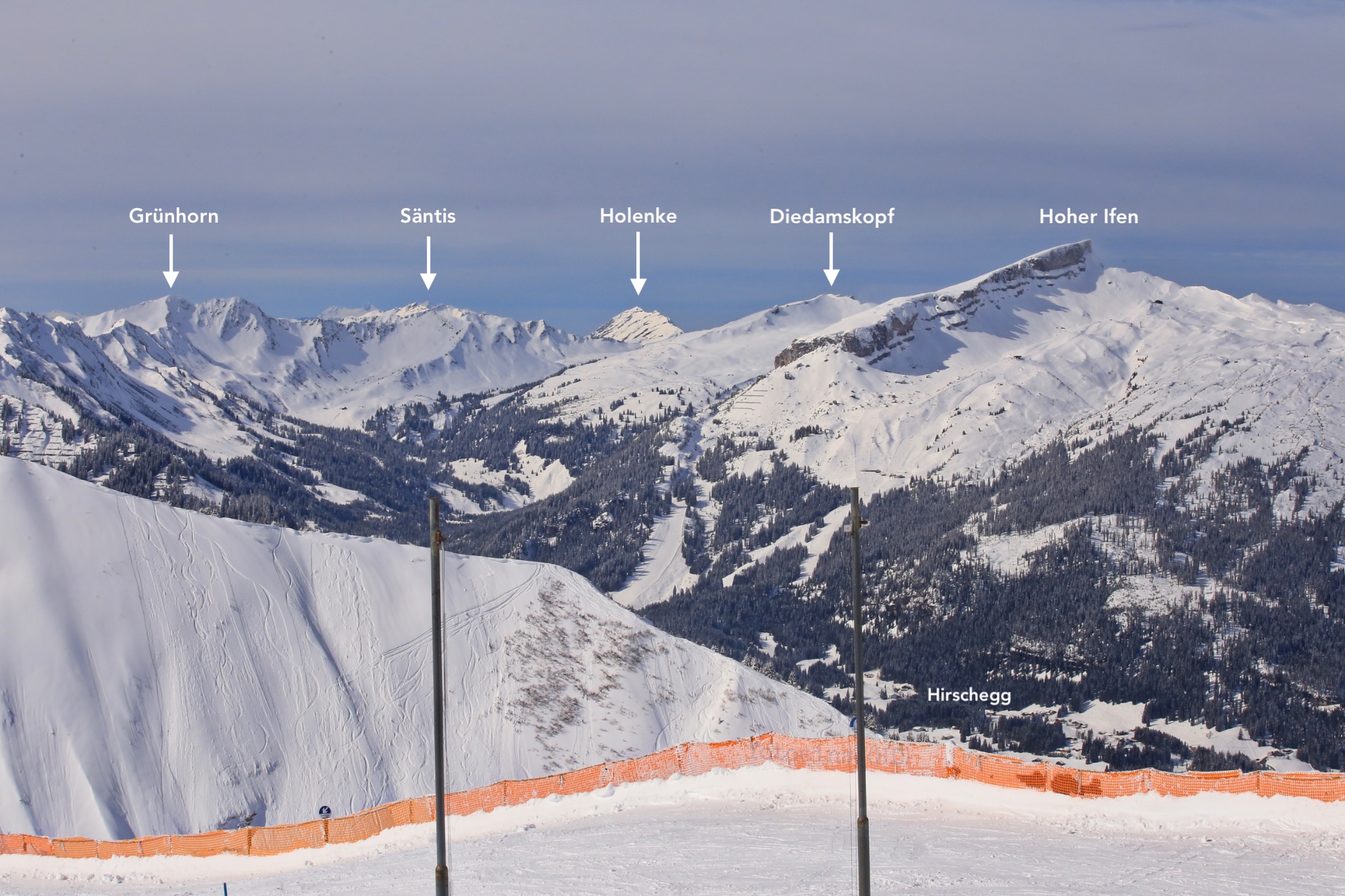
Facing west towards Hoher Ifen. The orange safety-fence marks approximately the German-Austria border along the ridgeline.
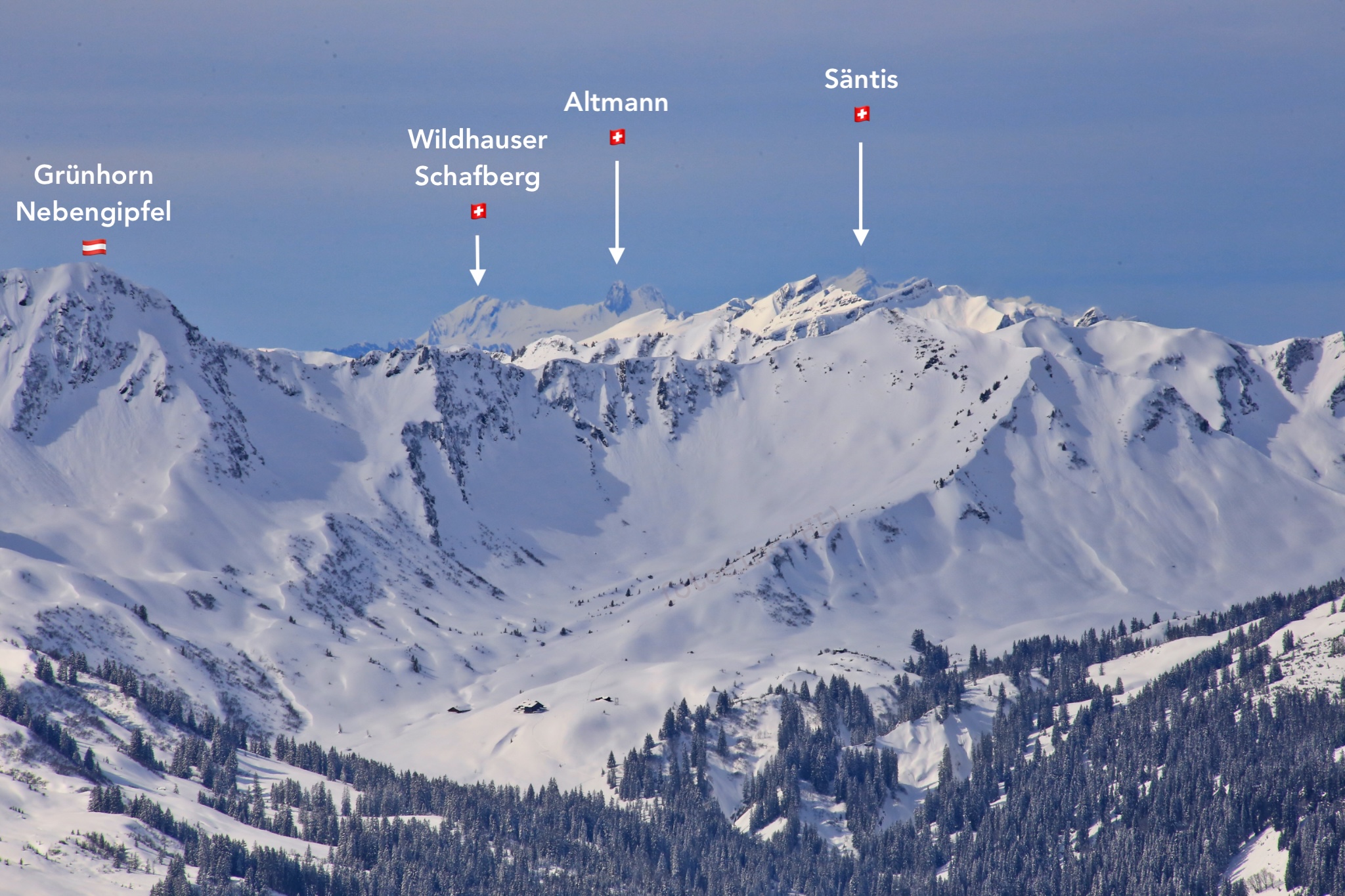
Visible peaks in the Swiss Alps, including Säntis (2502 m), visible at a line-of-sight distance of 65 km.
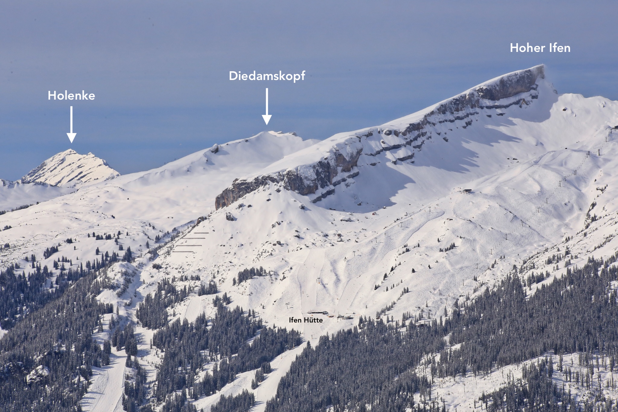
Facing west across the Kleinwalsertal valley. Holenke: 2044 metres elevation, 22 km line-of-sight; Diedamskopf: 2090 metres elevation, 15 km line-of-sight, and the elevated plateau that is Hoher Ifen: 2230 metres elevation, 9 km line-of-sight.
Hoher Ifen: one of the displays as translated:
The Schratten limestone slab, up to 100 metres in thickness, is folded over like a tablecloth. The original rock layer above has been eroded away over geologic time. The Schratten slab is fractured in a number of places, revealing the underlying older layers, as seen on Hoher Ifen.
Directions
From Oberstdorf Busbahnhof, I hopped on DB Regio Bus Bayern route 7 for the 15-minute ride to stop “Fellhornbahn Talstation”. The gondola up to Fellhorn is operated by Oberstdorf-Kleinwalsertal Bergbahnen.
( View this location on OpenStreetMap )
I received neither pre-visit support nor post-visit compensation for this post. I made all media above on 8 March 2017 with a Canon EOS6D mark1. This post appears on Fotoeins Fotografie at fotoeins DOT com as https://wp.me/p1BIdT-f6u. Last edit: 12 Jan 2026.

Please leave your comments below