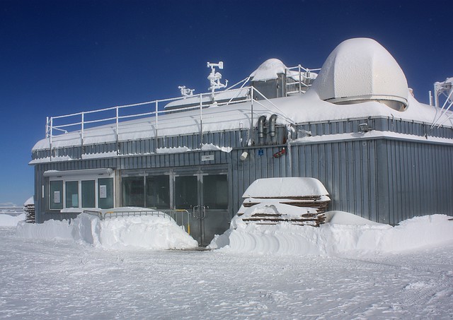
Hanging out at the top of Germany, 1 of 4
I wrote previously about my ascent to Zugspitze, the highest point in Germany.
I rode the Bayerische Zugspitzbahn railway from Garmisch to Eibsee, followed by the steep Eibseeseilbahn cable-car/aerial tramway directly to the summit. Although the mid-level clouds earlier in the morning looked like a no-go, I “broke through” the clouds into clear blue skies at the Zugspitze summit. As clouds continue to roll in and out, up and over the summit, I stayed at the summit for a number of hours in the glorious sun to snap away at the scenery around and below.
There is a truckload of photos to fill many posts and pages, but I’ve selected plenty for the following series of four posts to describe and show the view at the Zugspitze summit:
• part 1 (the post you’re reading now) is on the German side of Zugspitze,
• parts 2 and 3 are over on the Austrian side of the summit,
• and part 4 is a final set of photos from the German side, after much of the cloud below cleared.
Walking from one side of the summit to the other only takes ten minutes, even with the ever-present crowds in the way! Besides, with the pointy craggy summit at 2960 metres (9710 feet) above sea level, it’s not very far where one can wander off.


The Munich House at the summit even has a mailbox; I wrote about the “mailbox with a view” here.
The series:
• Ascent to Zugspitze, the top of Germany
• Zugspitze summit : part 1, German side (this post)
• Zugspitze summit : part 2, Austrian side
• Zugspitze summit : part 3, Austrian side, after the clouds cleared
• Zugspitze : part 4, the summit and the plateau below
The windchill estimate above was obtained from the U.S. NWS Wind Chill Index and from the Environment Canada Windchill Calculator. I made the photos above on 9 October 2011. This post is originally published on Fotoeins Fotopress at fotoeins.com.
7 Responses to “Hanging out at the top of Germany, 1 of 4”
Very chilly looking (the good kind of chilly, anyway 🙂 I love the sign with the summit temps – and of course, the map!
LikeLike
Thanks! It’s always interesting to see how readers respond to specific choices or selections in photos. Some photos work in a “documentary”-like fashion, and some photos work better to evoke a mood. However, I view the map as a given for someone else to use in the future, but I think the map works even better when you zoom “out” to get all the map markers. 🙂
LikeLike
[…] Post navigation ← Previous […]
LikeLike
[…] Zugspitze summit : part 1, German side […]
LikeLike
[…] Zugspitze summit : part 1, German side […]
LikeLike
[…] Zugspitze summit : part 1, German side […]
LikeLike
[…] Zugspitze summit : part 1, German side […]
LikeLike